Enable Location

We need your location to show you interesting places around you

Discover nearby places

Find interesting locations and hidden gems around you

Precise directions

Get accurate directions and distances to places

Your location is never shared with other users. It's only used when you tap the location button.

Anastasia State Park

Log in to your account

Start exploring — it's free

Trusted by 62,529 travelers worldwide

Continue with Google
Continue with Apple
or

We will send you a code to connect

By continuing, you accept our Terms and Conditions and our Privacy Policy

Check your inbox

We've sent a pincode in your inbox. Please enter the code below.

Anastasia State Park

Anastasia State Park, State park in Saint Augustine, United States

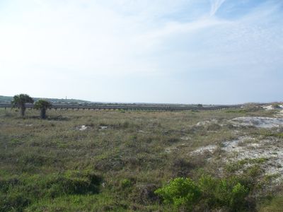
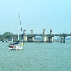
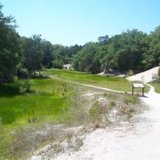
Anastasia State Park is a coastal park south of Saint Augustine that spans roughly 1600 acres with diverse habitats including sandy beaches, salt marshes, and forests with sand dunes. The park has a significant shoreline and is crossed by trails that lead visitors through its varied landscapes.

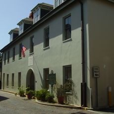
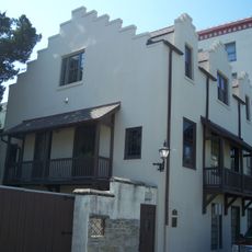
The park was established in 1949 as part of Florida's state conservation system, which developed to protect coastal habitats. Beneath the sand and within the forests lie traces of early Spanish settlement, closely tied to Saint Augustine's colonial past.

The park is a place where visitors experience coastal Florida directly, noticing how locals and tourists move through the beaches and trails at different times of the day. The landscape itself shows the layering of natural environments, from sand dunes to salt marshes, reflecting how people here live alongside dynamic natural systems.

The park has marked trails of varying lengths, camping areas for overnight stays, and direct access to beaches and waterways. Visitors should bring plenty of water in hot, humid weather and protect themselves from insects, especially during early morning and evening hours.

The park contains an old archaeological zone where artifacts from centuries of human settlement remain visible today. Hikers can encounter traces ranging from fire pits to shell deposits that tell the story of early use of this coastline.

The community of curious travelers

AroundUs brings together thousands of curated places, local tips, and hidden gems, enriched daily by 60,000 contributors worldwide.

Start exploring
Location
Inception
1949
GPS coordinates
29.86194,-81.27306
Latest update
December 7, 2025 20:43
Around this place
St. Augustine Light
United States of America

St. Augustine Light

3 km
Ponce de León Hotel
United States of America

Ponce de León Hotel

5.3 km
Lightner Museum
United States of America

Lightner Museum

5.1 km
St. Augustine Alligator Farm Zoological Park
United States of America

St. Augustine Alligator Farm Zoological Park

2.7 km
Bridge of Lions
United States of America

Bridge of Lions

4.8 km
St. Augustine Amphitheatre
United States of America

St. Augustine Amphitheatre

1.8 km
Villa Zorayda
United States of America

Villa Zorayda

5.2 km
González-Alvarez House
United States of America

González-Alvarez House

4.6 km
Lincolnville Historic District
United States of America

Lincolnville Historic District

4.7 km
Ximenez-Fatio House
United States of America

Ximenez-Fatio House

5 km
Government House
United States of America

Government House

5.1 km
St. Augustine Town Plan Historic District
United States of America

St. Augustine Town Plan Historic District

5.2 km
Grace United Methodist Church
United States of America

Grace United Methodist Church

4.4 km
Llambias House
United States of America

Llambias House

4.6 km
Spanish Military Hospital Museum
United States of America

Spanish Military Hospital Museum

5 km
Potter's Wax Museum
United States of America

Potter's Wax Museum

5 km
St. Benedict the Moor School
United States of America

St. Benedict the Moor School

4.9 km
Segui-Kirby Smith House
United States of America

Segui-Kirby Smith House

5 km
Lindsley House
United States of America

Lindsley House

5.1 km
O'Reilly House
United States of America

O'Reilly House

4.8 km
Spanish Coquina Quarries
United States of America

Spanish Coquina Quarries

982 m
Sanchez Powder House Site
United States of America

Sanchez Powder House Site

4 km
Clapp Octagon House
United States of America

Clapp Octagon House

3.2 km
Lincolnville Museum and Cultural Center
United States of America

Lincolnville Museum and Cultural Center

4.8 km
Record Building
United States of America

Record Building

4.9 km
Stanbury Cottage
United States of America

Stanbury Cottage

5 km
Villa Zorayda Museum
United States of America

Villa Zorayda Museum

5.2 km
First Colony: Our Spanish Origins Exhibit at Government House Museum
United States of America

First Colony: Our Spanish Origins Exhibit at Government House Museum

5.1 km
Show the full map
« Anastasia State Park - State park in Saint Augustine, United States » is provided by Around Us (aroundus.com). Images and texts are derived from Wikimedia project under a Creative Commons license. You are allowed to copy, distribute, and modify copies of this page, under the conditions set by the license, as long as this note is clearly visible.

Discover hidden gems everywhere you go!

From secret cafés to breathtaking viewpoints, skip the crowded tourist spots and find places that match your style. Our app makes it easy with voice search, smart filtering, route optimization, and insider tips from travelers worldwide. Download now for the complete mobile experience.

Around Us App Screenshot

A unique approach to discovering new places

Le Figaro

All the places worth exploring

France Info

A tailor-made excursion in just a few clicks

20 Minutes

Around Us
Travel Guide & Maps
Download

Send to your phone

QR Code
1

Open the camera app on your mobile.

2

Point at the QR code with your camera. A notification will appear.

3

Tap the notification to open the link.