Enable Location

We need your location to show you interesting places around you

Discover nearby places

Find interesting locations and hidden gems around you

Precise directions

Get accurate directions and distances to places

Your location is never shared with other users. It's only used when you tap the location button.

Gwinnett County

Log in to your account

Start exploring — it's free

Trusted by 62,058 travelers worldwide

Continue with Google
Continue with Apple
or

We will send you a code to connect

By continuing, you accept our Terms and Conditions and our Privacy Policy

Check your inbox

We've sent a pincode in your inbox. Please enter the code below.

Gwinnett County, Administrative county in Atlanta metropolitan area, United States

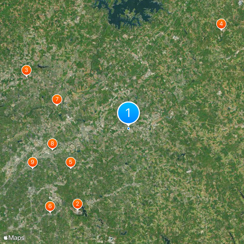
Gwinnett County is an administrative area in the north central part of Georgia, bordering eight other counties in the state. The territory covers forested hills, suburban neighborhoods and commercial zones between river courses and road networks.

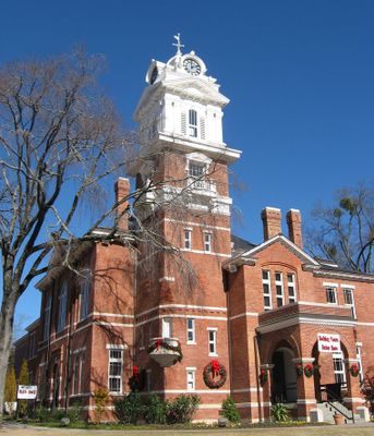
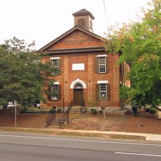
The Georgia General Assembly created the county on December 15, 1818, naming it after a signer of the Declaration of Independence. Gold mining and textile mills shaped the economy in the 19th century before technology companies transformed the region in the 20th century.

The name honors Button Gwinnett, a signatory of the Declaration of Independence whose traces remain visible in street names and public buildings across the area. Communities maintain parks, libraries and schools used daily by families from diverse backgrounds.

Roads connect residential areas, business districts and protected nature sites spread across several incorporated cities. Public facilities and services are located in different municipal centers and administrative buildings.

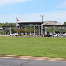
Nearly a million residents form a population with no single ethnic majority, making this one of the most diverse counties in the Southeast. Technology firms have settled in former agricultural landscapes and built corporate headquarters among green spaces.

The community of curious travelers

AroundUs brings together thousands of curated places, local tips, and hidden gems, enriched daily by 60,000 contributors worldwide.

Start exploring
Location
Inception
December 15, 1818
Capital city
Lawrenceville
Shares border with
Forsyth County, DeKalb County, Fulton County, Rockdale County, Walton County, Barrow County, Jackson County, Hall County
GPS coordinates
33.96000,-84.03000
Latest update
December 14, 2025 23:44
Around this place
Stone Mountain
United States of America

Stone Mountain

20.2 km
North Point Community Church
United States of America

North Point Community Church

24.1 km
Road Atlanta
United States of America

Road Atlanta

28.5 km
BAPS Shri Swaminarayan Mandir Atlanta
United States of America

BAPS Shri Swaminarayan Mandir Atlanta

14.8 km
Tupac Amaru Shakur Center for the Arts
United States of America

Tupac Amaru Shakur Center for the Arts

24.1 km
Atlanta Athletic Club
United States of America

Atlanta Athletic Club

15.8 km
Victory World Church
United States of America

Victory World Church

16.6 km
Atlanta Silverbacks Park
United States of America

Atlanta Silverbacks Park

21.8 km
Netherworld Haunted House
United States of America

Netherworld Haunted House

17.7 km
Southeastern Railway Museum
United States of America

Southeastern Railway Museum

11.9 km
United States of America

Lanier National Speedway

29.4 km
Elisha Winn House
United States of America

Elisha Winn House

13.3 km
James R. Hallford Stadium
United States of America

James R. Hallford Stadium

26.2 km
Autrey Mill Nature Preserve & Heritage Center
United States of America

Autrey Mill Nature Preserve & Heritage Center

19.8 km
Holy Cross Cathedral
United States of America

Holy Cross Cathedral

16 km
Gwinnett County Courthouse
United States of America

Gwinnett County Courthouse

3.8 km
Summit Skyride
United States of America

Summit Skyride

19.9 km
United States of America

Vines Botanical Gardens

14.7 km
Superb
United States of America

Superb

12 km
United States of America

Gwinnett Environmental & Heritage Center

11.8 km
United States of America

Northwoods Historic District

24 km
Spalding Drive
United States of America

Spalding Drive

21.1 km
Old Seminary Building
United States of America

Old Seminary Building

3.9 km
Bowman-Pirkle House
United States of America

Bowman-Pirkle House

21.5 km
Newtown Elementary School
United States of America

Newtown Elementary School

23.1 km
John Quincy Allen House
United States of America

John Quincy Allen House

18.3 km
United States of America

William Terrell Homeplace

5.9 km
Bona Allen Shoe and Horse Collar Factory
United States of America

Bona Allen Shoe and Horse Collar Factory

17.2 km
Show the full map
Administrative divisions
« Gwinnett County - Administrative county in Atlanta metropolitan area, United States » is provided by Around Us (aroundus.com). Images and texts are derived from Wikimedia project under a Creative Commons license. You are allowed to copy, distribute, and modify copies of this page, under the conditions set by the license, as long as this note is clearly visible.

Discover hidden gems everywhere you go!

From secret cafés to breathtaking viewpoints, skip the crowded tourist spots and find places that match your style. Our app makes it easy with voice search, smart filtering, route optimization, and insider tips from travelers worldwide. Download now for the complete mobile experience.

Around Us App Screenshot

A unique approach to discovering new places

Le Figaro

All the places worth exploring

France Info

A tailor-made excursion in just a few clicks

20 Minutes

Around Us
Travel Guide & Maps
Download

Send to your phone

QR Code
1

Open the camera app on your mobile.

2

Point at the QR code with your camera. A notification will appear.

3

Tap the notification to open the link.