Chest opened
+${chestReward.xp} XP
Explorer
NOUVEAU ×${chestReward.collectible.quantity}
tapez pour fermer

See the monuments around you in AR Open chests in the app

Around Us is built for your phone — point your camera at the streets and discover the monuments and places around you in augmented reality. Around Us is built for your phone — chests unlock when you walk, explore and capture nearby places.

•

Enable Location

We need your location to show you interesting places around you

Discover nearby places

Find interesting locations and hidden gems around you

Precise directions

Get accurate directions and distances to places

Your location is never shared with other users. It's only used when you tap the location button.

Sweat Mountain

Log in to your account

Start exploring — it's free

Trusted by 92,731 travelers worldwide

Continue with Google
Continue with Apple
or

We will send you a code to connect

By continuing, you accept our Terms and Conditions and our Privacy Policy

Check your inbox

We've sent a pincode in your inbox. Please enter the code below.

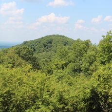
Sweat Mountain, Mountain summit in Cobb County, Georgia, US.

Sweat Mountain is a summit in far northeastern Cobb County, Georgia, reaching 1,688 feet (515 m) above sea level, the second-highest point in the county after Kennesaw Mountain. Its top carries an antenna farm of radio and television transmitters, towers and amateur repeaters, and its northern side holds natural rock formations, including a rock shelter that could hold one or two campers.

The whole mountain was once owned by the Wigley family, and Henry Clay Wigley lived for decades at its base, across from a gravel road that led to the summit. A U.S. Forest Service ranger climbed a fire tower there daily to give smoke coordinates for fire control until satellites took over; the tower is gone, but a benchmark remains in concrete where one of its feet rested. Wigley Road once ran from Sandy Plains Road through to Georgia 92 but was closed in the 1970s after poor maintenance and a spring-fed mudbog.

The mountain's name comes from the Sweat family, early settlers of the area, and nearby roads and schools carry the name too. A lake off Sandy Plains Road at the base hosted a large music festival in the early 1970s. Wigley Road, once a through route to Georgia 92, was closed in the 1970s after a spring-fed mudbog made it impassable.

There is no maintained hiking trail to the summit; the old gravel road up from Wigley Road is closed and barricaded. The summit holds an antenna farm and a benchmark set in concrete where a fire tower foot once rested. Natural rock formations, including a small rock shelter, lie on the northern side.

The summit holds a concrete benchmark marking where one foot of a U.S. Forest Service fire tower once stood; a ranger climbed the tower daily to give smoke coordinates for fire control before satellites took over. The tower was removed as suburbs spread, but the benchmark remains.

The community of curious travelers

AroundUs brings together thousands of curated places, local tips, and hidden gems, enriched daily by 92,731 contributors worldwide.


Start exploring
Location
GPS coordinates
34.06704,-84.45548
Latest update
October 25, 2026 12:14
Around this place
Western and Atlantic 3 “General”
United States of America

Western and Atlantic 3 “General”

9.6 mi
Six Flags White Water
United States of America

Six Flags White Water

8.4 mi
Bulloch Hall
United States of America

Bulloch Hall

6.2 mi
Chattahoochee River National Recreation Area
United States of America

Chattahoochee River National Recreation Area

11.5 mi
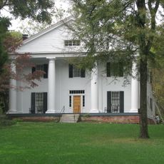
Barrington Hall
United States of America

Barrington Hall

6.4 mi
Blessed Trinity Catholic High School
United States of America

Blessed Trinity Catholic High School

3.8 mi
First Baptist Church
United States of America

First Baptist Church

2.6 mi
Southern Museum of Civil War and Locomotive History
United States of America

Southern Museum of Civil War and Locomotive History

9.6 mi
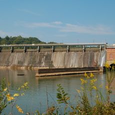
Morgan Falls Dam
United States of America

Morgan Falls Dam

8 mi
KSU Convocation Center
United States of America

KSU Convocation Center

7.5 mi
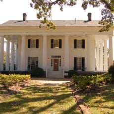
Archibald Smith Plantation Home
United States of America

Archibald Smith Plantation Home

6.2 mi
Sope Creek Ruins
United States of America

Sope Creek Ruins

8.8 mi
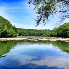
Chattahoochee Nature Center
United States of America

Chattahoochee Nature Center

6.1 mi
Strand Theatre
United States of America

Strand Theatre

9.5 mi
Computer Museum of America
United States of America

Computer Museum of America

6.9 mi
Little Kennesaw Mountain
United States of America

Little Kennesaw Mountain

10.1 mi
Primrose Cottage
United States of America

Primrose Cottage

6.3 mi
Teaching Museum North
United States of America

Teaching Museum North

6.2 mi
Zion Baptist Church
United States of America

Zion Baptist Church

9.4 mi
Roswell Historic District
United States of America

Roswell Historic District

6.5 mi
Northwest Marietta Historic District
United States of America

Northwest Marietta Historic District

9.4 mi
Isaac Roberts House
United States of America

Isaac Roberts House

7.5 mi
Roswall
United States of America

Roswall

6.4 mi
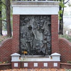
Faces of War Memorial
United States of America

Faces of War Memorial

6.2 mi
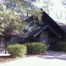
Island Ford Lodge
United States of America

Island Ford Lodge

9.3 mi
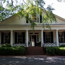
Arnoldus Brumby House
United States of America

Arnoldus Brumby House

10.2 mi
Computer Museum of America
United States of America

Computer Museum of America

6.9 mi
Kennesaw Mountain National Battlefield Park Visitor Center
United States of America

Kennesaw Mountain National Battlefield Park Visitor Center

9.1 mi
Show the full map
Reviews
Share your experience

No review yet

Discussions
Start a discussion...

No discussion yet

« Sweat Mountain - Mountain summit in Cobb County, Georgia, US » is provided by Around Us (aroundus.com). Images and texts are derived from Wikimedia project under a Creative Commons license. You are allowed to copy, distribute, and modify copies of this page, under the conditions set by the license, as long as this note is clearly visible.

Discover hidden gems everywhere you go!

From secret cafés to breathtaking viewpoints, skip the crowded tourist spots and find places that match your style. Our app makes it easy with voice search, smart filtering, route optimization, and insider tips from travelers worldwide. Download now for the complete mobile experience.
Around Us App Screenshot
❝

A unique approach to discovering new places❞

— Le Figaro

❝

All the places worth exploring❞

— France Info

❝

A tailor-made excursion in just a few clicks❞

— 20 Minutes

Around Us
Travel Guide & Maps
Download

Send to your phone

QR Code
1

Open the camera app on your mobile.

2

Point at the QR code with your camera. A notification will appear.

3

Tap the notification to open the link.