Chest opened
+${chestReward.xp} XP
Explorer
NOUVEAU ×${chestReward.collectible.quantity}
tapez pour fermer
Chest locked

Open chests in the app

Around Us is built for your phone — chests unlock when you walk, explore and capture nearby places.

Enable Location

We need your location to show you interesting places around you

Discover nearby places

Find interesting locations and hidden gems around you

Precise directions

Get accurate directions and distances to places

Your location is never shared with other users. It's only used when you tap the location button.

Log in to your account

Start exploring — it's free

Trusted by 72,932 travelers worldwide

Continue with Google
Continue with Apple
or

We will send you a code to connect

By continuing, you accept our Terms and Conditions and our Privacy Policy

Check your inbox

We've sent a pincode in your inbox. Please enter the code below.

Wadmalaw Island
Discussion Reviews Photo
16.6k Popularity

Wadmalaw Island, Sea island near Charleston, United States

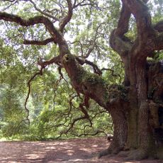
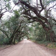
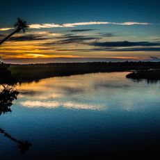
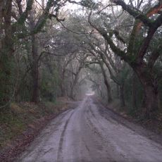
Wadmalaw Island is a sea island off the coast of South Carolina covering approximately 41 square miles (106 square kilometers). Its flat terrain features open fields, wooded areas, and tidal waterways that shape the landscape throughout.

The island was claimed for England in 1666 and developed over centuries into an agricultural settlement. The surrounding waters and natural resources shaped its economy and way of life for generations afterward.

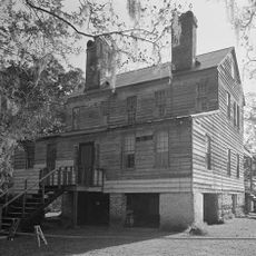
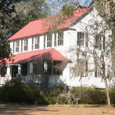
The island maintains a rural character rooted in agriculture and fishing, with small farms and traditional practices still visible across the landscape. This way of life gives the place a distinct identity separate from nearby urban areas.

The island is accessible from Charleston and best visited by those with time to explore at a slower pace. Tours and tastings are available at the local tea operation, which provides insight into the island's agricultural focus.

The island is home to North America's only commercial tea plantation, where tea leaves are harvested using mechanical equipment. This unusual operation reveals an unexpected agricultural focus in an area better known for other crops.

The community of curious travelers

AroundUs brings together thousands of curated places, local tips, and hidden gems, enriched daily by 60,000 contributors worldwide.

Start exploring
Location
GPS coordinates
32.67351,-80.17843
Latest update
December 7, 2025 19:26
Around this place
Angel Oak
United States of America

Angel Oak

10.4 km
Brookland Plantation
United States of America

Brookland Plantation

20.3 km
Botany Bay Plantation Wildlife Management Area
United States of America

Botany Bay Plantation Wildlife Management Area

14.4 km
Edisto Beach State Park
United States of America

Edisto Beach State Park

21.2 km
Fenwick Hall
United States of America

Fenwick Hall

15.6 km
William Seabrook House
United States of America

William Seabrook House

12.5 km
Hutchinson House
United States of America

Hutchinson House

13.7 km
Brick House Ruins
United States of America

Brick House Ruins

15.9 km
Oak Island
United States of America

Oak Island

11.2 km
Cassina Point
United States of America

Cassina Point

11.4 km
Grove Plantation
United States of America

Grove Plantation

20.2 km
Charleston Tea Garden
United States of America

Charleston Tea Garden

6.2 km
Seaside Plantation House
United States of America

Seaside Plantation House

20 km
John's Island Presbyterian Church
United States of America

John's Island Presbyterian Church

9.1 km
Edisto Island Presbyterian Church
United States of America

Edisto Island Presbyterian Church

15.3 km
The Progressive Club
United States of America

The Progressive Club

12.8 km
Summit Plantation House
United States of America

Summit Plantation House

10.3 km
Sunnyside
United States of America

Sunnyside

16.4 km
Edisto Island Baptist Church
United States of America

Edisto Island Baptist Church

15 km
Stono River Slave Rebellion Site
United States of America

Stono River Slave Rebellion Site

13 km
Trinity Episcopal Church
United States of America

Trinity Episcopal Church

15.2 km
Wescott Road
United States of America

Wescott Road

15.7 km
Seashore Farmers' Lodge No. 767
United States of America

Seashore Farmers' Lodge No. 767

19.8 km
Wilkinson-Boineau House
United States of America

Wilkinson-Boineau House

16.8 km
Splash Zone
United States of America

Splash Zone

19 km
Seabrook Beach
United States of America

Seabrook Beach

11.8 km
Edingsville Beach
United States of America

Edingsville Beach

18.5 km
Bleak Hall Plantation Outbuildings
United States of America

Bleak Hall Plantation Outbuildings

14.4 km
Show the full map
Reviews
Share your experience

No review yet

Discussions
Start a discussion...

No discussion yet

« Wadmalaw Island - Sea island near Charleston, United States » is provided by Around Us (aroundus.com). Images and texts are derived from Wikimedia project under a Creative Commons license. You are allowed to copy, distribute, and modify copies of this page, under the conditions set by the license, as long as this note is clearly visible.

Discover hidden gems everywhere you go!

From secret cafés to breathtaking viewpoints, skip the crowded tourist spots and find places that match your style. Our app makes it easy with voice search, smart filtering, route optimization, and insider tips from travelers worldwide. Download now for the complete mobile experience.

Around Us App Screenshot

A unique approach to discovering new places

Le Figaro

All the places worth exploring

France Info

A tailor-made excursion in just a few clicks

20 Minutes

Around Us
Travel Guide & Maps
Download

Send to your phone

QR Code
1

Open the camera app on your mobile.

2

Point at the QR code with your camera. A notification will appear.

3

Tap the notification to open the link.