·

Enable Location

We need your location to show you interesting places around you

Discover nearby places

Find interesting locations and hidden gems around you

Precise directions

Get accurate directions and distances to places

Your location is never shared with other users. It's only used when you tap the location button.

Botany Bay Plantation Wildlife Management Area

Log in to your account

Start exploring — it's free

Trusted by 62,653 travelers worldwide

Continue with Google
Continue with Apple
or

We will send you a code to connect

By continuing, you accept our Terms and Conditions and our Privacy Policy

Check your inbox

We've sent a pincode in your inbox. Please enter the code below.

Botany Bay Plantation Wildlife Management Area

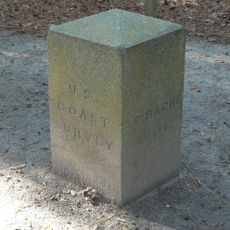
Botany Bay Plantation Wildlife Management Area, state preserve on Edisto Island, South Carolina, United States

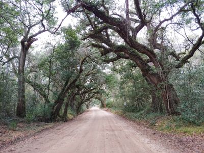
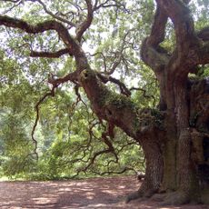
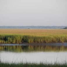
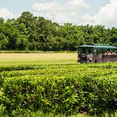
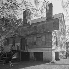
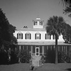
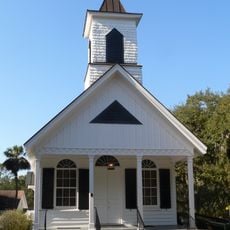
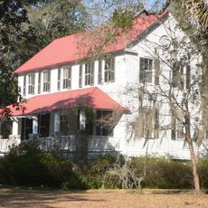
Botany Bay Plantation Wildlife Management Area is a 4,600-acre protected site on South Carolina's coast that combines coastal forest, beaches, freshwater ponds, and historic structures. Towering pines, live oaks, and palms draped in Spanish moss cover the land, while marshes and ponds provide habitat for deer, alligators, and numerous bird species.

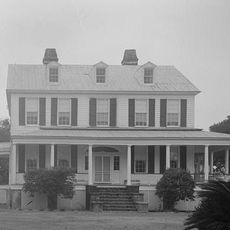
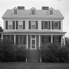
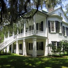
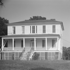
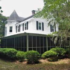
The area grew from two plantations, Sea Cloud and Bleak Hall, known for Sea Island cotton production from the 1700s onward. After the Civil War and damage from boll weevils in the early 1900s, the land changed owners several times until John Meyer bequeathed it to South Carolina in the 1960s with the request that it remain protected for wildlife and public enjoyment.

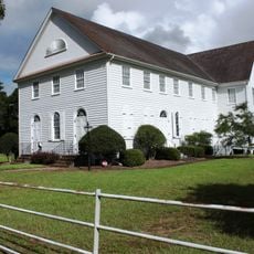
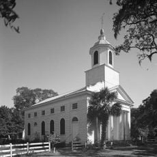
The name Botany Bay reflects the area's historical connection to plant study and botanical work. Today, visitors can see how the land serves as a meeting point between the work of earlier residents and the natural world that now surrounds those old structures.

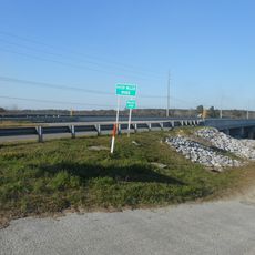
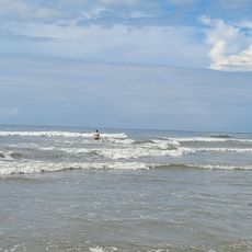
The causeway to the beach is wheelchair accessible and takes about half a mile to walk from the parking area. Check tide charts before heading to the shore, and bring water, sturdy shoes, and sunscreen, as facilities are limited throughout the property.

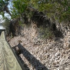
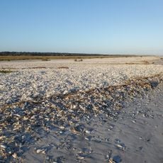
The beach is called Boneyard Beach because of the bleached white fallen trees scattered across the sand and water like natural sculptures. These tree remains, shaped by sun and waves, create an otherworldly appearance found nowhere else in the region.

The community of curious travelers

AroundUs brings together thousands of curated places, local tips, and hidden gems, enriched daily by 60,000 contributors worldwide.

Start exploring
Location
Address
Botany Bay Road
GPS coordinates
32.55250,-80.23361
Latest update
February 7, 2026 11:01
Around this place
Angel Oak
United States of America

Angel Oak

23.3 km
Hunting Island State Park
United States of America

Hunting Island State Park

28.7 km
Edisto Beach State Park
United States of America

Edisto Beach State Park

7.6 km
William Seabrook House
United States of America

William Seabrook House

7.1 km
Hutchinson House
United States of America

Hutchinson House

2.9 km
Brick House Ruins
United States of America

Brick House Ruins

10.2 km
Coffin Point Plantation
United States of America

Coffin Point Plantation

26.3 km
Oak Island
United States of America

Oak Island

4.9 km
Cassina Point
United States of America

Cassina Point

4.6 km
Grove Plantation
United States of America

Grove Plantation

19.5 km
Charleston Tea Garden
United States of America

Charleston Tea Garden

8.6 km
Prospect Hill
United States of America

Prospect Hill

14.5 km
Seaside Plantation House
United States of America

Seaside Plantation House

6.4 km
John's Island Presbyterian Church
United States of America

John's Island Presbyterian Church

20.6 km
Edisto Island Presbyterian Church
United States of America

Edisto Island Presbyterian Church

6.6 km
The Progressive Club
United States of America

The Progressive Club

22.6 km
Summit Plantation House
United States of America

Summit Plantation House

16.5 km
Sunnyside
United States of America

Sunnyside

6.1 km
Hunting Island Light
United States of America

Hunting Island Light

27.6 km
Edisto Island Baptist Church
United States of America

Edisto Island Baptist Church

5.3 km
Alexander Bache U.S. Coast Survey Line
United States of America

Alexander Bache U.S. Coast Survey Line

8.9 km
Spanish Mount Point
United States of America

Spanish Mount Point

10.1 km
Stono River Slave Rebellion Site
United States of America

Stono River Slave Rebellion Site

27.4 km
Coffin Point Plantation Caretaker's House
United States of America

Coffin Point Plantation Caretaker's House

26 km
Trinity Episcopal Church
United States of America

Trinity Episcopal Church

5.1 km
Wilkinson-Boineau House
United States of America

Wilkinson-Boineau House

21.5 km
Seabrook Beach
United States of America

Seabrook Beach

7.2 km
Edingsville Beach
United States of America

Edingsville Beach

4.3 km
Show the full map
« Botany Bay Plantation Wildlife Management Area - state preserve on Edisto Island, South Carolina, United States » is provided by Around Us (aroundus.com). Images and texts are derived from Wikimedia project under a Creative Commons license. You are allowed to copy, distribute, and modify copies of this page, under the conditions set by the license, as long as this note is clearly visible.

Discover hidden gems everywhere you go!

From secret cafés to breathtaking viewpoints, skip the crowded tourist spots and find places that match your style. Our app makes it easy with voice search, smart filtering, route optimization, and insider tips from travelers worldwide. Download now for the complete mobile experience.

Around Us App Screenshot

A unique approach to discovering new places

Le Figaro

All the places worth exploring

France Info

A tailor-made excursion in just a few clicks

20 Minutes

Around Us
Travel Guide & Maps
Download

Send to your phone

QR Code
1

Open the camera app on your mobile.

2

Point at the QR code with your camera. A notification will appear.

3

Tap the notification to open the link.