Chest opened
+${chestReward.xp} XP
Explorer
NOUVEAU ×${chestReward.collectible.quantity}
tapez pour fermer
Chest locked

Open chests in the app

Around Us is built for your phone — chests unlock when you walk, explore and capture nearby places.

Enable Location

We need your location to show you interesting places around you

Discover nearby places

Find interesting locations and hidden gems around you

Precise directions

Get accurate directions and distances to places

Your location is never shared with other users. It's only used when you tap the location button.

Orcutt

Log in to your account

Start exploring — it's free

Trusted by 72,891 travelers worldwide

Continue with Google
Continue with Apple
or

We will send you a code to connect

By continuing, you accept our Terms and Conditions and our Privacy Policy

Check your inbox

We've sent a pincode in your inbox. Please enter the code below.

Discussion Reviews 1 Photos
18.6k Popularity

Orcutt, Census-designated place in Santa Barbara County, United States.

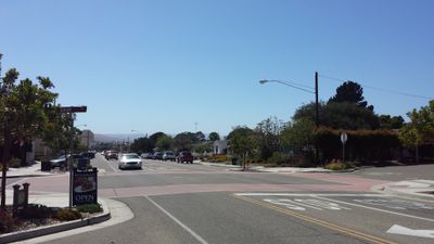
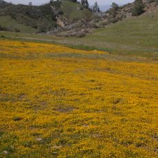
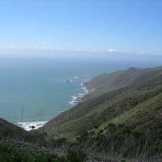
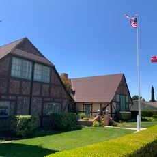
Orcutt is a residential community in Santa Barbara County situated in the Santa Maria Valley with suburban neighborhoods and local services. The area is characterized by single-family homes, schools, and small businesses that serve the everyday needs of residents.

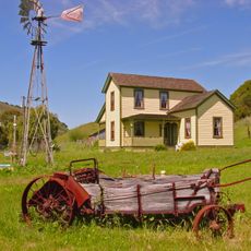
The settlement began in the early 1900s as a residential area for oil field workers and was named after William Warren Orcutt from Union Oil Company. The location grew as part of regional oil industry development during that era.

The Orcutt Union School District maintains educational facilities throughout the community, serving students from elementary through middle school levels with competitive academic standards.

The area is connected to nearby Santa Maria and Lompoc through main highways for easy travel. Visitors and residents can find groceries, shops, and services distributed throughout the residential neighborhoods.

William Warren Orcutt, the namesake of the area, discovered prehistoric animal fossils at nearby Hancock Ranch. These findings contributed to paleontological research connected to the La Brea Tar Pits and linked local history to scientific discovery.

The community of curious travelers

AroundUs brings together thousands of curated places, local tips, and hidden gems, enriched daily by 60,000 contributors worldwide.

Start exploring
GPS coordinates
34.87444,-120.42806
Latest update
December 7, 2025 10:08
Around this place
Neverland Ranch
United States of America

Neverland Ranch

34.2 km
Mission Santa Inés
United States of America

Mission Santa Inés

41 km
Guadalupe-Nipomo Dunes
United States of America

Guadalupe-Nipomo Dunes

23.2 km
Pismo State Beach
United States of America

Pismo State Beach

32.1 km
Figueroa Mountain
United States of America

Figueroa Mountain

43 km
Point Sal State Beach
United States of America

Point Sal State Beach

20.3 km
OstrichLand USA
United States of America

OstrichLand USA

37.6 km
Guadalupe-Nipomo Dunes National Wildlife Refuge
United States of America

Guadalupe-Nipomo Dunes National Wildlife Refuge

22.2 km
Twitchell Reservoir
United States of America

Twitchell Reservoir

16.3 km
Oceano Dunes
United States of America

Oceano Dunes

31.7 km
Point Arguello Light
United States of America

Point Arguello Light

38.7 km
Pismo Beach
United States of America

Pismo Beach

32.9 km
La Purisima Mission
United States of America

La Purisima Mission

22.7 km
Dana Adobe
United States of America

Dana Adobe

17.5 km
Solvang Vintage Motorcycle Museum
United States of America

Solvang Vintage Motorcycle Museum

40.8 km
Vandenberg Space Force Base Space Launch Complex 10
United States of America

Vandenberg Space Force Base Space Launch Complex 10

21.6 km
Los Alamos Ranch House
United States of America

Los Alamos Ranch House

16.6 km
Chapel of San Ramon
United States of America

Chapel of San Ramon

17.3 km
Arroyo Grande IOOF Hall
United States of America

Arroyo Grande IOOF Hall

30.8 km
John Price House
United States of America

John Price House

36 km
Elverhøj Museum of History and Art
United States of America

Elverhøj Museum of History and Art

40.8 km
Pirates Cove
United States of America

Pirates Cove

42.5 km
Solvang Park
United States of America

Solvang Park

40.7 km
Espada Bluff
United States of America

Espada Bluff

39.1 km
Solvang Festival Theater
United States of America

Solvang Festival Theater

40.8 km
Minuteman Beach
United States of America

Minuteman Beach

16.8 km
Zaca Creek Bridge No. 1
United States of America

Zaca Creek Bridge No. 1

33.1 km
Zaca Creek Bridge No. 2
United States of America

Zaca Creek Bridge No. 2

33.6 km
Show the full map
Reviews
Share your experience

No review yet

Discussions
Start a discussion...

No discussion yet

« Orcutt - Census-designated place in Santa Barbara County, United States » is provided by Around Us (aroundus.com). Images and texts are derived from Wikimedia project under a Creative Commons license. You are allowed to copy, distribute, and modify copies of this page, under the conditions set by the license, as long as this note is clearly visible.

Discover hidden gems everywhere you go!

From secret cafés to breathtaking viewpoints, skip the crowded tourist spots and find places that match your style. Our app makes it easy with voice search, smart filtering, route optimization, and insider tips from travelers worldwide. Download now for the complete mobile experience.

Around Us App Screenshot

A unique approach to discovering new places

Le Figaro

All the places worth exploring

France Info

A tailor-made excursion in just a few clicks

20 Minutes

Around Us
Travel Guide & Maps
Download

Send to your phone

QR Code
1

Open the camera app on your mobile.

2

Point at the QR code with your camera. A notification will appear.

3

Tap the notification to open the link.