Figueroa Mountain

Log in to your account

AroundUs is a community-driven map of interesting places, built by curious explorers like you. It grows with every review, story, and photo you share.
Connect to save your favorite spots, contribute locations, and create personalized routes.
Continue with Google
Continue with Apple
Continue with X
Continue with Facebook
Continue with email
By continuing, you accept our Terms and Conditions and our Privacy Policy
Create an account
Add to collection
Map
Suggest a change
Share

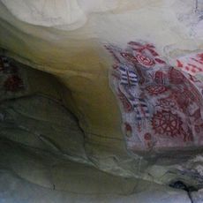
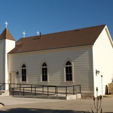
Figueroa Mountain, Mountain summit in Santa Barbara County, United States.

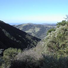
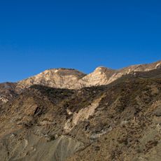
Figueroa Mountain rises to 4,534 feet within Los Padres National Forest, displaying oak woodlands mixed with chaparral shrubland vegetation. The area offers multiple trailheads and parking locations across different elevations for visitor access.

The mountain takes its name from José Figueroa, who served as governor of Alta California from 1833 to 1835. His leadership during this period marked an important era in the region's early political history.

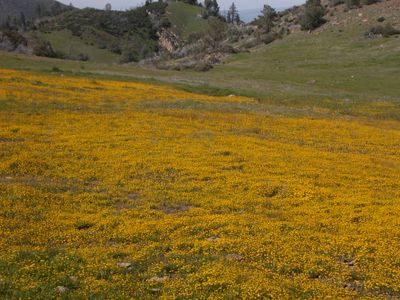
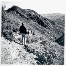
The slopes display native California wildflowers during spring months, with poppies, lupines, and chocolate lilies blooming across the landscape. Visitors walking the trails can observe these flowers in their natural habitat throughout the season.

Spring offers ideal conditions for visiting when wildflowers bloom and temperatures remain moderate. Bring plenty of water and proper footwear as trails vary in difficulty across different elevations.

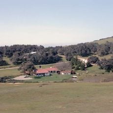
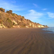
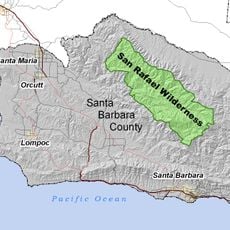
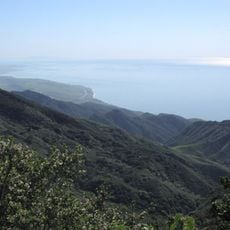
Viewpoints along the trails reveal vistas of the San Rafael Wilderness and distant valleys stretching toward the coast. These overlooks provide perspective on the vast protected forest lands in this corner of Los Padres.

Location: Santa Barbara County

GPS coordinates: 34.74332,-119.98514

Latest update: December 10, 2025 16:22

Photos
Around this place
Neverland Ranch
United States of America

Neverland Ranch

9.4 km
Rancho del Cielo
United States of America

Rancho del Cielo

25.1 km
Mission Santa Inés
United States of America

Mission Santa Inés

21.6 km
Knapp's Castle
United States of America

Knapp's Castle

30.2 km
Chumash Painted Cave State Historic Park
United States of America

Chumash Painted Cave State Historic Park

32.2 km
Refugio State Beach
United States of America

Refugio State Beach

32.3 km
Gaviota State Park
United States of America

Gaviota State Park

36 km
Nojoqui Falls
United States of America

Nojoqui Falls

29.4 km
El Capitán State Beach
United States of America

El Capitán State Beach

31.7 km
Cold Spring Canyon Arch Bridge
United States of America

Cold Spring Canyon Arch Bridge

27.8 km
San Rafael Wilderness
United States of America

San Rafael Wilderness

13.5 km
Las Cumbres Observatory Global Telescope Network
United States of America

Las Cumbres Observatory Global Telescope Network

36.3 km
OstrichLand USA
United States of America

OstrichLand USA

23.2 km
Lake Cachuma
United States of America

Lake Cachuma

17.4 km
Gibraltar Dam
United States of America

Gibraltar Dam

36.4 km
Stow House
United States of America

Stow House

35.6 km
Solvang Vintage Motorcycle Museum
United States of America

Solvang Vintage Motorcycle Museum

21.6 km
Gaviota Peak
United States of America

Gaviota Peak

33.3 km
South Coast Railroad Museum
United States of America

South Coast Railroad Museum

35.6 km
Los Alamos Ranch House
United States of America

Los Alamos Ranch House

30.9 km
Chapel of San Ramon
United States of America

Chapel of San Ramon

26.1 km
Little Pine Mountain
United States of America

Little Pine Mountain

27.6 km
Madulce Peak
United States of America

Madulce Peak

36.5 km
Elverhøj Museum of History and Art
United States of America

Elverhøj Museum of History and Art

22.2 km
Ken Brown Wines
United States of America

Ken Brown Wines

24 km
Solvang Park
United States of America

Solvang Park

21.7 km
Solvang Festival Theater
United States of America

Solvang Festival Theater

21.9 km
Zaca Creek Bridge No. 1
United States of America

Zaca Creek Bridge No. 1

20.6 km
Show the full map
Reviews

Visited this place? Tap the stars to rate it and share your experience / photos with the community! Try now! You can cancel it anytime.

« Figueroa Mountain - Mountain summit in Santa Barbara County, United States » is provided by Around Us (aroundus.com). Images and texts are derived from Wikimedia project under a Creative Commons license. You are allowed to copy, distribute, and modify copies of this page, under the conditions set by the license, as long as this note is clearly visible.

Discover hidden gems everywhere you go!

From secret cafés to breathtaking viewpoints, skip the crowded tourist spots and find places that match your style. Our app makes it easy with voice search, smart filtering, route optimization, and insider tips from travelers worldwide. Download now for the complete mobile experience.

Around Us App Screenshot

A unique approach to discovering new places

Le Figaro

All the places worth exploring

France Info

A tailor-made excursion in just a few clicks

20 Minutes