Enable Location

We need your location to show you interesting places around you

Discover nearby places

Find interesting locations and hidden gems around you

Precise directions

Get accurate directions and distances to places

Your location is never shared with other users. It's only used when you tap the location button.

Point Arguello Light

Log in to your account

Start exploring — it's free

Trusted by 61,368 travelers worldwide

Continue with Google
Continue with Apple
or

We will send you a code to connect

By continuing, you accept our Terms and Conditions and our Privacy Policy

Check your inbox

We've sent a pincode in your inbox. Please enter the code below.

Point Arguello Light

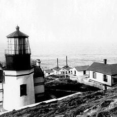
Point Arguello Light, Lighthouse in Santa Barbara County, US

Description

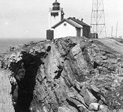
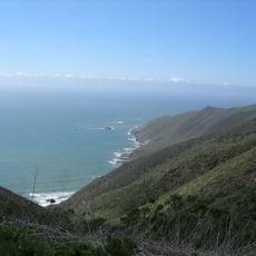
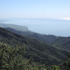
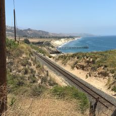
Point Arguello Light is a lighthouse in Santa Barbara County that guides ships through a hazardous coastal section where the shoreline curves eastward toward Santa Barbara Channel. The structure features a rotating beacon and a two-tone fog signal for poor visibility conditions.

History

Construction began in 1899 after Congress approved funding, with keeper William A. Beeman lighting the beacon for the first time on February 22, 1901. This activation marked the start of more than a century of maritime safety service at this treacherous stretch of coast.

Culture

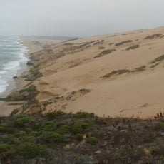
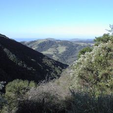
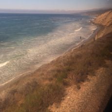
The Chumash people originally called this location Nocto and worked the local flint deposits for their tools. Today visitors can sense this heritage along the rocky shore where the area's past remains woven into the landscape.

Practical

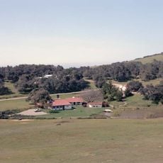
The lighthouse sits within Vandenberg Space Force Base, so public access is restricted for security reasons. Visitors interested in seeing it should check ahead about viewing opportunities or viewing areas that may be available from nearby vantage points.

Did you know?

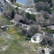
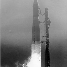
The lighthouse stands near rocket launch facilities that send spacecraft into polar orbits from the California coast. This unusual pairing of historic maritime technology with modern spaceflight creates a distinctive intersection of two eras at the same location.

Inception
1901
GPS coordinates
34.57694,-120.64722
Latest update
December 11, 2025 18:08

AroundUs brings together thousands of curated places, local tips, and hidden gems, enriched daily by 60,000 contributors worldwide. Discover all places nearby (Santa Barbara County).

Around this place
Neverland Ranch
United States of America

Neverland Ranch

54.5 km
Rancho del Cielo
United States of America

Rancho del Cielo

52.6 km
Mission Santa Inés
United States of America

Mission Santa Inés

46.8 km
Guadalupe-Nipomo Dunes
United States of America

Guadalupe-Nipomo Dunes

44.4 km
Refugio State Beach
United States of America

Refugio State Beach

54.2 km
Gaviota State Park
United States of America

Gaviota State Park

39.5 km
Nojoqui Falls
United States of America

Nojoqui Falls

43.9 km
Point Sal State Beach
United States of America

Point Sal State Beach

36.1 km
Point Conception Light
United States of America

Point Conception Light

21.6 km
OstrichLand USA
United States of America

OstrichLand USA

43.3 km
Guadalupe-Nipomo Dunes National Wildlife Refuge
United States of America

Guadalupe-Nipomo Dunes National Wildlife Refuge

47.6 km
La Purisima Mission
United States of America

La Purisima Mission

23.2 km
Solvang Vintage Motorcycle Museum
United States of America

Solvang Vintage Motorcycle Museum

46.7 km
Dana Adobe
United States of America

Dana Adobe

52.8 km
Vandenberg Space Force Base Space Launch Complex 10
United States of America

Vandenberg Space Force Base Space Launch Complex 10

21 km
Gaviota Peak
United States of America

Gaviota Peak

42 km
Los Alamos Ranch House
United States of America

Los Alamos Ranch House

35.6 km
Chapel of San Ramon
United States of America

Chapel of San Ramon

47.9 km
Elverhøj Museum of History and Art
United States of America

Elverhøj Museum of History and Art

46.2 km
Gaviota Beach
United States of America

Gaviota Beach

40.5 km
Solvang Park
United States of America

Solvang Park

46.6 km
Espada Bluff
United States of America

Espada Bluff

12.5 km
Solvang Festival Theater
United States of America

Solvang Festival Theater

46.4 km
Gaviota Beach
United States of America

Gaviota Beach

40.5 km
Minuteman Beach
United States of America

Minuteman Beach

31.3 km
Refugio Beach
United States of America

Refugio Beach

54.4 km
Zaca Creek Bridge No. 1
United States of America

Zaca Creek Bridge No. 1

43.4 km
Zaca Creek Bridge No. 2
United States of America

Zaca Creek Bridge No. 2

43.2 km
Show the full map
« Point Arguello Light - Lighthouse in Santa Barbara County, US » is provided by Around Us (aroundus.com). Images and texts are derived from Wikimedia project under a Creative Commons license. You are allowed to copy, distribute, and modify copies of this page, under the conditions set by the license, as long as this note is clearly visible.

Discover hidden gems everywhere you go!

From secret cafés to breathtaking viewpoints, skip the crowded tourist spots and find places that match your style. Our app makes it easy with voice search, smart filtering, route optimization, and insider tips from travelers worldwide. Download now for the complete mobile experience.

Around Us App Screenshot

A unique approach to discovering new places

Le Figaro

All the places worth exploring

France Info

A tailor-made excursion in just a few clicks

20 Minutes

Around Us
Travel Guide & Maps
Download

Send to your phone

QR Code
1

Open the camera app on your mobile.

2

Point at the QR code with your camera. A notification will appear.

3

Tap the notification to open the link.