Enable Location

We need your location to show you interesting places around you

Discover nearby places

Find interesting locations and hidden gems around you

Precise directions

Get accurate directions and distances to places

Your location is never shared with other users. It's only used when you tap the location button.

Point Conception Light

Log in to your account

Start exploring — it's free

Trusted by 61,367 travelers worldwide

Continue with Google
Continue with Apple
or

We will send you a code to connect

By continuing, you accept our Terms and Conditions and our Privacy Policy

Check your inbox

We've sent a pincode in your inbox. Please enter the code below.

Point Conception Light

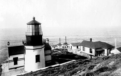
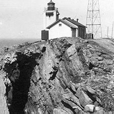
Point Conception Light, Maritime lighthouse station at Point Conception, Santa Barbara County, United States

Description

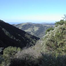
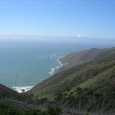
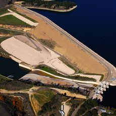
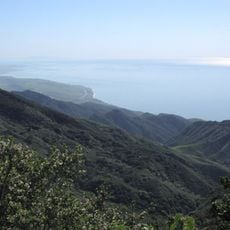
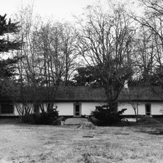
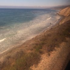
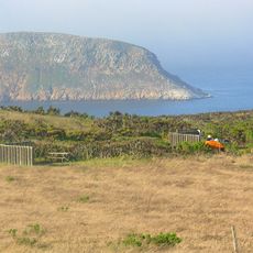
Point Conception Light is a maritime lighthouse station on the California coast that marks the western entrance to the Santa Barbara Channel. The structure sits on an elevated point and remains part of an active monitoring station, though it is now largely automated in its operations.

History

The lighthouse was first built in 1856 and relocated to a higher bluff in 1881 to improve visibility for vessels in these dangerous waters. This move reflected lessons learned about the effectiveness of the beacon's original placement.

Culture

The site holds significance as a navigation landmark that guided sailors for generations along this stretch of coast. The lens on display at the Santa Barbara Maritime Museum represents the maritime traditions that once depended on such beacons for safe passage.

Practical

The site is located on private land and not accessible to visitors due to its location within a military space force base and a nature preserve. The original French lens is displayed at the Santa Barbara Maritime Museum, which offers an alternative way to see key components of the station.

Did you know?

The modern VRB-25 lens produces a beam visible from over 20 nautical miles on clear nights, showing how technology has transformed traditional navigation methods. This makes the location a living example of how maritime systems continue to adapt and improve.

GPS coordinates
34.44870,-120.47080
Latest update
December 10, 2025 16:29

AroundUs brings together thousands of curated places, local tips, and hidden gems, enriched daily by 60,000 contributors worldwide. Discover all places nearby (United States of America).

Around this place
Neverland Ranch
United States of America

Neverland Ranch

48.2 km
Rancho del Cielo
United States of America

Rancho del Cielo

37.4 km
Mission Santa Inés
United States of America

Mission Santa Inés

34.7 km
United States of America

Offshore oil and gas in California

52.3 km
Refugio State Beach
United States of America

Refugio State Beach

36.5 km
Gaviota State Park
United States of America

Gaviota State Park

22.7 km
Nojoqui Falls
United States of America

Nojoqui Falls

28.8 km
El Capitán State Beach
United States of America

El Capitán State Beach

41 km
Channel Islands National Marine Sanctuary
United States of America

Channel Islands National Marine Sanctuary

50.2 km
Figueroa Mountain
United States of America

Figueroa Mountain

55.3 km
Point Sal State Beach
United States of America

Point Sal State Beach

52.9 km
OstrichLand USA
United States of America

OstrichLand USA

32.2 km
Lake Cachuma
United States of America

Lake Cachuma

47.5 km
Point Arguello Light
United States of America

Point Arguello Light

21.6 km
La Purisima Mission
United States of America

La Purisima Mission

25.1 km
Solvang Vintage Motorcycle Museum
United States of America

Solvang Vintage Motorcycle Museum

34.6 km
Bradbury Dam
United States of America

Bradbury Dam

47.3 km
Vandenberg Space Force Base Space Launch Complex 10
United States of America

Vandenberg Space Force Base Space Launch Complex 10

37.8 km
Gaviota Peak
United States of America

Gaviota Peak

25.7 km
Los Alamos Ranch House
United States of America

Los Alamos Ranch House

36.5 km
Chapel of San Ramon
United States of America

Chapel of San Ramon

49.2 km
Elverhøj Museum of History and Art
United States of America

Elverhøj Museum of History and Art

34 km
Solvang Park
United States of America

Solvang Park

34.5 km
Espada Bluff
United States of America

Espada Bluff

10.4 km
Gaviota Beach
United States of America

Gaviota Beach

22.7 km
Solvang Festival Theater
United States of America

Solvang Festival Theater

34.3 km
San Miguel Island Campground
United States of America

San Miguel Island Campground

46.8 km
Zaca Creek Bridge No. 1
United States of America

Zaca Creek Bridge No. 1

35 km
Show the full map
« Point Conception Light - Maritime lighthouse station at Point Conception, Santa Barbara County, United States » is provided by Around Us (aroundus.com). Images and texts are derived from Wikimedia project under a Creative Commons license. You are allowed to copy, distribute, and modify copies of this page, under the conditions set by the license, as long as this note is clearly visible.

Discover hidden gems everywhere you go!

From secret cafés to breathtaking viewpoints, skip the crowded tourist spots and find places that match your style. Our app makes it easy with voice search, smart filtering, route optimization, and insider tips from travelers worldwide. Download now for the complete mobile experience.

Around Us App Screenshot

A unique approach to discovering new places

Le Figaro

All the places worth exploring

France Info

A tailor-made excursion in just a few clicks

20 Minutes

Around Us
Travel Guide & Maps
Download

Send to your phone

QR Code
1

Open the camera app on your mobile.

2

Point at the QR code with your camera. A notification will appear.

3

Tap the notification to open the link.