Enable Location

We need your location to show you interesting places around you

Discover nearby places

Find interesting locations and hidden gems around you

Precise directions

Get accurate directions and distances to places

Your location is never shared with other users. It's only used when you tap the location button.

Channel Islands National Marine Sanctuary

Log in to your account

Start exploring — it's free

Trusted by 61,367 travelers worldwide

Continue with Google
Continue with Apple
or

We will send you a code to connect

By continuing, you accept our Terms and Conditions and our Privacy Policy

Check your inbox

We've sent a pincode in your inbox. Please enter the code below.

Channel Islands National Marine Sanctuary

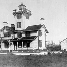
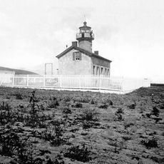
Channel Islands National Marine Sanctuary, Marine reserve off Santa Barbara County, United States

Description

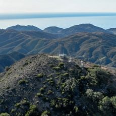
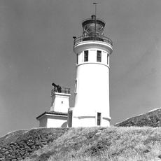
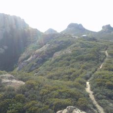
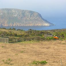
The Channel Islands National Marine Sanctuary is an ocean reserve off the California coast that protects several islands and the surrounding marine waters. The area supports diverse marine life and allows visitors to engage in activities like diving, snorkeling, and wildlife watching in specific zones.

History

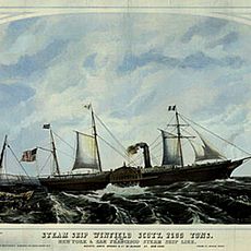
The sanctuary was established in 1980 after an oil spill prompted environmental concerns and the need for protection. Creating this reserve became a turning point in safeguarding the marine region from further damage.

Culture

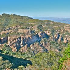
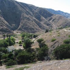
The islands hold deep meaning for the Chumash people, whose ancestors lived here for thousands of years and developed a special relationship with the sea. Visitors can learn about these connections through stories shared by local community members during guided tours and cultural events.

Practical

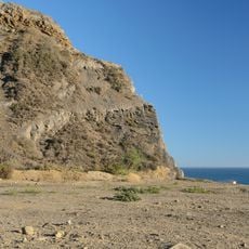
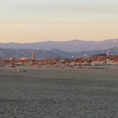
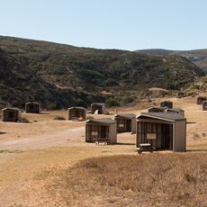
The site is only accessible by boat or plane, and different areas are reserved for specific activities. Before visiting, check conditions and rules to make the most of your trip.

Did you know?

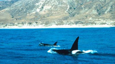
The reserve sits where two major ocean currents meet, creating special conditions for marine life to thrive. This location supports impressive populations of remarkable animals, with some species found nowhere else.

Operator
National Oceanic and Atmospheric Administration
GPS coordinates
34.00041,-120.40951
Latest update
December 8, 2025 19:56

AroundUs brings together thousands of curated places, local tips, and hidden gems, enriched daily by 60,000 contributors worldwide. Discover all places nearby (United States of America).

Around this place
747 Wing House
United States of America

747 Wing House

133.4 km
Leo Carrillo State Park
United States of America

Leo Carrillo State Park

136.2 km
Point Mugu State Park
United States of America

Point Mugu State Park

128.6 km
Mullin Automotive Museum
United States of America

Mullin Automotive Museum

116.6 km
Backbone Trail
United States of America

Backbone Trail

136.4 km
Henry Levy House
United States of America

Henry Levy House

114.9 km
Conejo Grade
United States of America

Conejo Grade

135.5 km
SS Winfield Scott
United States of America

SS Winfield Scott

94.7 km
Boney Peak
United States of America

Boney Peak

136.1 km
Devils Peak
United States of America

Devils Peak

57.8 km
Mandalay State Beach
United States of America

Mandalay State Beach

109.3 km
Anacapa Island Light
United States of America

Anacapa Island Light

97 km
Conejo Mountain
United States of America

Conejo Mountain

133 km
Point Hueneme Light
United States of America

Point Hueneme Light

111.8 km
Rancho Sierra Vista
United States of America

Rancho Sierra Vista

134.4 km
Henry T. Oxnard Historic District
United States of America

Henry T. Oxnard Historic District

114.9 km
Santa Barbara Light
United States of America

Santa Barbara Light

77.1 km
United States of America

Big Sycamore Canyon

130.2 km
Timber School
United States of America

Timber School

138.8 km
Hollywood Storage Center of Thousand Oaks
United States of America

Hollywood Storage Center of Thousand Oaks

136.4 km
Berylwood
United States of America

Berylwood

113.2 km
Tri Peaks
United States of America

Tri Peaks

135.3 km
Exchange Peak
United States of America

Exchange Peak

135.6 km
Carnegie Art Museum
United States of America

Carnegie Art Museum

115.4 km
Women's Improvement Club of Hueneme
United States of America

Women's Improvement Club of Hueneme

113 km
Santa Cruz Island Scorpion Ranch Campground
United States of America

Santa Cruz Island Scorpion Ranch Campground

78.4 km
Santa Rosa Island Campground
United States of America

Santa Rosa Island Campground

33.4 km
San Miguel Island Campground
United States of America

San Miguel Island Campground

7.1 km
Show the full map
« Channel Islands National Marine Sanctuary - Marine reserve off Santa Barbara County, United States » is provided by Around Us (aroundus.com). Images and texts are derived from Wikimedia project under a Creative Commons license. You are allowed to copy, distribute, and modify copies of this page, under the conditions set by the license, as long as this note is clearly visible.

Discover hidden gems everywhere you go!

From secret cafés to breathtaking viewpoints, skip the crowded tourist spots and find places that match your style. Our app makes it easy with voice search, smart filtering, route optimization, and insider tips from travelers worldwide. Download now for the complete mobile experience.

Around Us App Screenshot

A unique approach to discovering new places

Le Figaro

All the places worth exploring

France Info

A tailor-made excursion in just a few clicks

20 Minutes

Around Us
Travel Guide & Maps
Download

Send to your phone

QR Code
1

Open the camera app on your mobile.

2

Point at the QR code with your camera. A notification will appear.

3

Tap the notification to open the link.