Enable Location

We need your location to show you interesting places around you

Discover nearby places

Find interesting locations and hidden gems around you

Precise directions

Get accurate directions and distances to places

Your location is never shared with other users. It's only used when you tap the location button.

Farallon Island Light

Log in to your account

Start exploring — it's free

Trusted by 65,393 travelers worldwide

Continue with Google
Continue with Apple
or

We will send you a code to connect

By continuing, you accept our Terms and Conditions and our Privacy Policy

Check your inbox

We've sent a pincode in your inbox. Please enter the code below.

Farallon Island Light
Discussion Reviews 1 Photos
4.3k Popularity

Farallon Island Light, Maritime lighthouse in Southeast Farallon Island, California.

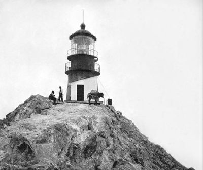
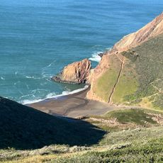
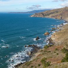
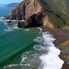
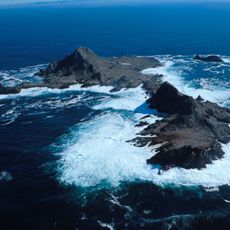
Farallon Island Light is a lighthouse on Southeast Farallon Island, a small and rocky outcrop off the California coast roughly 27 miles (43 km) west of San Francisco. The tower stands on a steep, exposed island that has no permanent public access, sitting above the water with no vegetation around it.

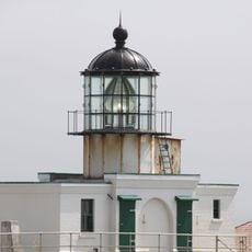
The lighthouse was first built in 1853, making it one of the earliest on the West Coast of the US, but it had to be fully rebuilt just two years later due to structural problems. The rebuilt version was fitted with a more powerful lens that served ships for many decades.

The name Farallon comes from a Spanish word meaning small rocky cliff, which describes exactly what a visitor sees from the water. The tower rises from bare, windswept rock with no trees or shelter in sight, giving the place a raw and exposed appearance.

The island is closed to the general public as it is a protected wildlife area, but the lighthouse can be seen from boat tours that depart from San Francisco. The waters around the island can be rough, so visitors on such tours should dress for wind and cold even in summer.

During the early years of operation, a mule lived on the island and was used to carry supplies across the steep terrain, as no other means of transport was available. This detail gives a sense of how isolated and demanding life was for the keepers who lived there.

The community of curious travelers

AroundUs brings together thousands of curated places, local tips, and hidden gems, enriched daily by 60,000 contributors worldwide.

Start exploring
Location
GPS coordinates
37.69918,-123.00171
Latest update
March 3, 2026 08:11
Around this place
Alamere Falls
United States of America

Alamere Falls

34.2 km
Point Reyes National Seashore
United States of America

Point Reyes National Seashore

42.2 km
Point Reyes Lighthouse
United States of America

Point Reyes Lighthouse

33.1 km
Point Bonita Lighthouse
United States of America

Point Bonita Lighthouse

43.5 km
Mount Tamalpais State Park
United States of America

Mount Tamalpais State Park

40.6 km
Green Gulch Farm Zen Center
United States of America

Green Gulch Farm Zen Center

42.7 km
Rodeo Beach
United States of America

Rodeo Beach

43.5 km
Alpine Lake
United States of America

Alpine Lake

41.7 km
Cushing Memorial Amphitheatre
United States of America

Cushing Memorial Amphitheatre

41.9 km
Kule Loklo
United States of America

Kule Loklo

42.3 km
Muir Beach Overlook
United States of America

Muir Beach Overlook

40.9 km
Point Reyes Lifeboat Station
United States of America

Point Reyes Lifeboat Station

32.9 km
Phillip Burton Wilderness
United States of America

Phillip Burton Wilderness

38.1 km
Audubon Canyon
United States of America

Audubon Canyon

38 km
Olema Lime Kilns
United States of America

Olema Lime Kilns

39.3 km
Tennessee Beach
United States of America

Tennessee Beach

42.6 km
Scenic viewpoint
United States of America

Scenic viewpoint

40.8 km
Scenic viewpoint
United States of America

Scenic viewpoint

42.6 km
Muir Woods Visitor Center
United States of America

Muir Woods Visitor Center

43.5 km
Muir Beach
United States of America

Muir Beach

41.4 km
Muir Woods National Monument Historic District
United States of America

Muir Woods National Monument Historic District

43.5 km
Agate Beach
United States of America

Agate Beach

33.8 km
Drakes Bay Historic and Archeological District
United States of America

Drakes Bay Historic and Archeological District

35.6 km
Muir Woods National Monument Entrance Gate
United States of America

Muir Woods National Monument Entrance Gate

43.5 km
Farallon Islands National Wildlife Refuge
United States of America

Farallon Islands National Wildlife Refuge

150 m
Kenneth C. Patrick Visitor Center
United States of America

Kenneth C. Patrick Visitor Center

36.8 km
Bolinas Library
United States of America

Bolinas Library

36.3 km
Muir Woods National Monument Administration-Concession Building
United States of America

Muir Woods National Monument Administration-Concession Building

43.5 km
Show the full map
Reviews
Share your experience

No review yet

Discussions
Start a discussion...

No discussion yet

« Farallon Island Light - Maritime lighthouse in Southeast Farallon Island, California » is provided by Around Us (aroundus.com). Images and texts are derived from Wikimedia project under a Creative Commons license. You are allowed to copy, distribute, and modify copies of this page, under the conditions set by the license, as long as this note is clearly visible.

Discover hidden gems everywhere you go!

From secret cafés to breathtaking viewpoints, skip the crowded tourist spots and find places that match your style. Our app makes it easy with voice search, smart filtering, route optimization, and insider tips from travelers worldwide. Download now for the complete mobile experience.

Around Us App Screenshot

A unique approach to discovering new places

Le Figaro

All the places worth exploring

France Info

A tailor-made excursion in just a few clicks

20 Minutes

Around Us
Travel Guide & Maps
Download

Send to your phone

QR Code
1

Open the camera app on your mobile.

2

Point at the QR code with your camera. A notification will appear.

3

Tap the notification to open the link.