Coyote Creek

Log in to your account

AroundUs is a community-driven map of interesting places, built by curious explorers like you. It grows with every review, story, and photo you share.
Connect to save your favorite spots, contribute locations, and create personalized routes.
By continuing, you accept our Terms and Conditions and our Privacy Policy
Add to collection
Map
Suggest a change
Share

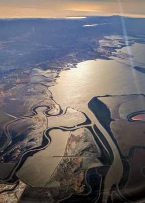
Coyote Creek, River in Santa Clara Valley, US.

Coyote Creek is a river that flows from Mount Sizer through the valleys of Morgan Hill and San Jose to the San Francisco Bay. The waterway is fed by several tributaries including Fisher Creek, San Felipe Creek, and Silver Creek and drains a large watershed in the region.

The name Arroyo del Coyote was given to the river by Spanish explorers who first mapped the region during colonial times. This designation has remained for centuries, reflecting the early European presence in this valley.

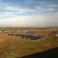
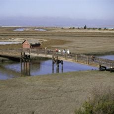
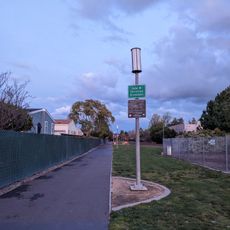
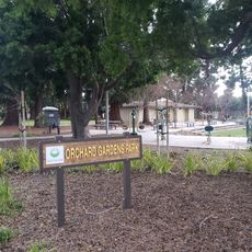
The creek serves as a gathering place for outdoor recreation, with multiple parks linked along its course that locals use for hiking and spending time in nature. These green spaces allow residents to find respite from the urban surroundings nearby.

Visitors can explore the river through various parks located along its course that offer multiple access points and entry areas. Plan your visit on warm, dry days to enjoy the trails and green spaces in pleasant conditions.

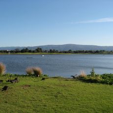
Anderson Dam, which impounds the river, has been closely monitored due to its location near fault lines and equipped with special safety measures. Water levels are deliberately kept low to protect the structural stability of the dam construction.

Location: Santa Clara County

Location: Alameda County

GPS coordinates: 37.45720,-122.04900

Latest update: December 7, 2025 20:44

Photos
Around this place
Computer History Museum
United States of America

Computer History Museum

5.4 km
Shoreline Amphitheatre
United States of America

Shoreline Amphitheatre

4.4 km
Hangar One
United States of America

Hangar One

4.9 km
Android sculptures
United States of America

Android sculptures

5.5 km
Drawbridge
United States of America

Drawbridge

6.7 km
Kuiper Airborne Observatory
United States of America

Kuiper Airborne Observatory

4.5 km
Don Edwards San Francisco Bay National Wildlife Refuge
United States of America

Don Edwards San Francisco Bay National Wildlife Refuge

4.1 km
Lunar Orbiter Image Recovery Project
United States of America

Lunar Orbiter Image Recovery Project

5.3 km
Shoreline Park, Mountain View
United States of America

Shoreline Park, Mountain View

4.6 km
Dumbarton Rail Bridge
United States of America

Dumbarton Rail Bridge

7.2 km
Rengstorff House
United States of America

Rengstorff House

4.4 km
Palo Alto Baylands Nature Preserve
United States of America

Palo Alto Baylands Nature Preserve

5 km
Mountain View Center for the Performing Arts
United States of America

Mountain View Center for the Performing Arts

8 km
NASA Ames Exploration Center
United States of America

NASA Ames Exploration Center

5.6 km
Unitary Plan Wind Tunnel
United States of America

Unitary Plan Wind Tunnel

4.6 km
Golden Gate Biosphere Reserve
United States of America

Golden Gate Biosphere Reserve

6.4 km
Greenmeadow
United States of America

Greenmeadow

7.4 km
John W. Christian Greenbelt
United States of America

John W. Christian Greenbelt

6.9 km
Historic Adobe Building
United States of America

Historic Adobe Building

7.3 km
Moffett Field Historical Society Museum
United States of America

Moffett Field Historical Society Museum

5.1 km
The Foster Museum
United States of America

The Foster Museum

5.8 km
Century Cinema 16
United States of America

Century Cinema 16

5.2 km
Orchard Gardens Park
United States of America

Orchard Gardens Park

6.7 km
Alviso Branch Library and Community Center
United States of America

Alviso Branch Library and Community Center

7.9 km
40- by 80-Foot Wind Tunnel
United States of America

40- by 80-Foot Wind Tunnel

4.8 km
Mountain View Theater
United States of America

Mountain View Theater

7.6 km
80- by 120-Foot Wind Tunnel
United States of America

80- by 120-Foot Wind Tunnel

4.7 km
3.5-Foot Hypersonic Wind Tunnel
United States of America

3.5-Foot Hypersonic Wind Tunnel

4.5 km
Show the full map
Reviews

Visited this place? Tap the stars to rate it and share your experience / photos with the community! Try now! You can cancel it anytime.

« Coyote Creek - River in Santa Clara Valley, US » is provided by Around Us (aroundus.com). Images and texts are derived from Wikimedia project under a Creative Commons license. You are allowed to copy, distribute, and modify copies of this page, under the conditions set by the license, as long as this note is clearly visible.

Discover hidden gems everywhere you go!

From secret cafés to breathtaking viewpoints, skip the crowded tourist spots and find places that match your style. Our app makes it easy with voice search, smart filtering, route optimization, and insider tips from travelers worldwide. Download now for the complete mobile experience.

Around Us App Screenshot

A unique approach to discovering new places

Le Figaro

All the places worth exploring

France Info

A tailor-made excursion in just a few clicks

20 Minutes