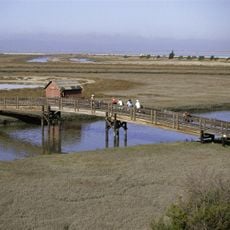
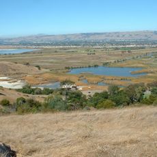
San Francisco Bay Salt Ponds, Salt evaporation ponds in San Francisco Bay, California, US
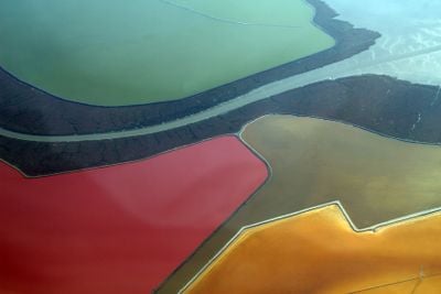
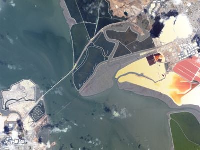
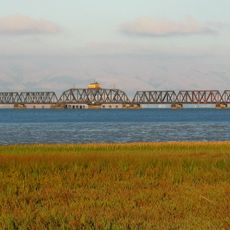
The San Francisco Bay Salt Ponds form a 16,500-acre network of shallow pools where seawater evaporates to produce salt through natural processes.
These ponds originated during the California Gold Rush era of the 1850s when local families began industrial salt production to meet preservation needs.
The area maintains connections to Native American heritage, as the Ohlone people collected salt from these lands before European settlement.
Visitors can observe the salt ponds from multiple hiking trails along the bay, with winter months offering the best opportunities for bird watching.
The ponds change color from green to pink due to specific microorganisms that thrive in high-salinity environments during the evaporation process.
Location: California
GPS coordinates: 37.49689,-122.11453
Latest update: May 27, 2025 08:46
Satellite imagery has transformed how we view remote locations on Earth, offering perspectives on places that are often invisible or difficult to reach from ground level. This collection presents natural formations, artificial structures and historical sites from an aerial vantage point. From geological features like the circular Richat Structure in Mauritania's desert to ancient geoglyphs and modern engineering achievements, these images provide a distinct view of our planet's diversity. Locations documented include the geometric Nazca Lines in Peru, the pyramid structure of El Castillo in Mexico's Yucatán Peninsula and the Badlands Guardian in Alberta, a natural rock formation that resembles a head wearing headphones when seen from above. The collection also features Palm Jumeirah in Dubai, an artificial archipelago shaped like a palm tree, the vivid blue potash evaporation ponds in Utah, the pink waters of Lake Hillier in Western Australia and the volcanic island of Surtsey off Iceland. Additional examples include the Atacama Giant in Chile, a prehistoric geoglyph, the heart shaped Galesnjak island off Croatia's coast and the ship graveyard of the former Aral Sea in Uzbekistan, which documents the ecological consequences of human intervention.
Stanford Stadium
8.1 km
HP Garage
7 km
Dumbarton Bridge
1.1 km
El Palo Alto
7.4 km
Google Garage
6.1 km
Don Edwards San Francisco Bay National Wildlife Refuge
5.1 km
Dumbarton Rail Bridge
452 m
Coyote Hills Regional Park
7.1 km
Stanford University Arboretum
8 km
Rengstorff House
7.7 km
Stanford Theatre
7.2 km
Professorville
7.1 km
Digital DNA
7.2 km
Pedro de Lemos House
7.4 km
Museum of American Heritage
7 km
Ramona Street Architectural District
7.1 km
Holbrook-Palmer Estate
7.7 km
Palo Alto Medical Clinic
7 km
T. B. Downing House
6.7 km
Theophilus Allen House
6.6 km
Norris House
6.8 km
Dunker House
5.3 km
John Adam Squire House
5.9 km
Pettigrew House
6.8 km
Elizabeth F. Gamble Garden
6.4 km
Wilson House
6 km
Fraternal Hall Building
7.3 km
Orthodox church of the Nativity of the Virgin Mary
8.1 kmReviews
Visited this place? Tap the stars to rate it and share your experience / photos with the community! Try now! You can cancel it anytime.
Discover hidden gems everywhere you go!
From secret cafés to breathtaking viewpoints, skip the crowded tourist spots and find places that match your style. Our app makes it easy with voice search, smart filtering, route optimization, and insider tips from travelers worldwide. Download now for the complete mobile experience.
A unique approach to discovering new places❞
— Le Figaro
All the places worth exploring❞
— France Info
A tailor-made excursion in just a few clicks❞
— 20 Minutes