Interstate 680

Log in to your account

AroundUs is a community-driven map of interesting places, built by curious explorers like you. It grows with every review, story, and photo you share.
Connect to save your favorite spots, contribute locations, and create personalized routes.
By continuing, you accept our Terms and Conditions and our Privacy Policy
Add to collection
Map
Suggest a change
Share

Interstate 680, North-south highway in Santa Clara and Alameda Counties, United States

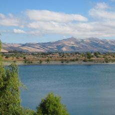
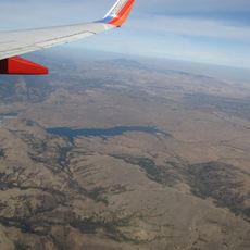
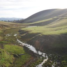
Interstate 680 is a north-south highway that runs through multiple counties in Northern California. The route passes through valleys and mountain passes, connecting San Jose with numerous communities across the East Bay region.

The highway began as State Route 21 in 1933 and received Interstate status in 1955. This designation marked a major shift in Northern California's transportation infrastructure.

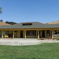
The road connects technology hubs with residential areas and shapes daily life as a central transportation artery for the region. It enables commuters and visitors to move between economic centers and communities spanning multiple counties.

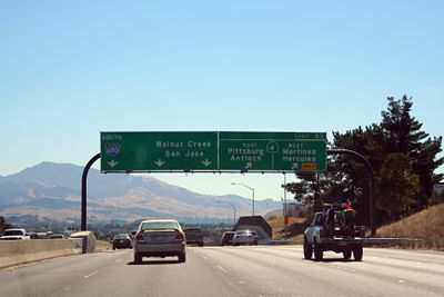
The road features multiple exits connecting to other major highways including Interstate 880, California 237, and US Route 101. Travelers should note the terrain includes mountain passages and congestion can occur during peak hours.

A large American flag mural appeared on the Sunol Grade concrete hillside after September 11, 2001, and remained visible to drivers until 2010. This temporary artwork became a notable landmark for millions of regional commuters.

Location: Santa Clara County

Location: Alameda County

Location: Contra Costa County

Location: Solano County

Inception: 1933

GPS coordinates: 37.70148,-121.92284

Latest update: December 7, 2025 09:26

Photos
Around this place
Centennial Light
United States of America

Centennial Light

16.4 km
Federal Correctional Institution, Dublin
United States of America

Federal Correctional Institution, Dublin

2.9 km
Niles Canyon
United States of America

Niles Canyon

14 km
Sunol Water Temple
United States of America

Sunol Water Temple

13.3 km
Blackhawk Museum
United States of America

Blackhawk Museum

11.1 km
Hacienda del Pozo de Verona
United States of America

Hacienda del Pozo de Verona

7.6 km
Quarry Lakes Regional Recreation Area
United States of America

Quarry Lakes Regional Recreation Area

15.7 km
Golden Gate Railroad Museum
United States of America

Golden Gate Railroad Museum

11.5 km
Niles Essanay Silent Film Museum
United States of America

Niles Essanay Silent Film Museum

14.7 km
City Center Building
United States of America

City Center Building

14.2 km
Forest Home Farms
United States of America

Forest Home Farms

4.4 km
Pioneer Stadium
United States of America

Pioneer Stadium

13.1 km
Warren Hall
United States of America

Warren Hall

12.9 km
Alviso Adobe Community Park
United States of America

Alviso Adobe Community Park

4.7 km
San Antonio Reservoir
United States of America

San Antonio Reservoir

15.8 km
Hayward City Hall
United States of America

Hayward City Hall

14.8 km
Vallejo Flour Mill
United States of America

Vallejo Flour Mill

14.3 km
Hayward Hall of Justice
United States of America

Hayward Hall of Justice

15.9 km
Don Castro Regional Recreation Area
United States of America

Don Castro Regional Recreation Area

11.3 km
Pioneer Amphitheatre
United States of America

Pioneer Amphitheatre

12.7 km
Livermore Carnegie Library and Park
United States of America

Livermore Carnegie Library and Park

13.8 km
Holy Cross Orthodox Monastery
United States of America

Holy Cross Orthodox Monastery

8 km
Niles Depot Museum
United States of America

Niles Depot Museum

14.6 km
Doolan Canyon
United States of America

Doolan Canyon

8.7 km
Sunol
United States of America

Sunol

12.3 km
Museum on Main
United States of America

Museum on Main

6.1 km
Regal Hacienda Crossings Stadium 20 & IMAX
United States of America

Regal Hacienda Crossings Stadium 20 & IMAX

3.3 km
San Ramon Library
United States of America

San Ramon Library

7.5 km
Show the full map
Reviews

Visited this place? Tap the stars to rate it and share your experience / photos with the community! Try now! You can cancel it anytime.

« Interstate 680 - North-south highway in Santa Clara and Alameda Counties, United States » is provided by Around Us (aroundus.com). Images and texts are derived from Wikimedia project under a Creative Commons license. You are allowed to copy, distribute, and modify copies of this page, under the conditions set by the license, as long as this note is clearly visible.

Discover hidden gems everywhere you go!

From secret cafés to breathtaking viewpoints, skip the crowded tourist spots and find places that match your style. Our app makes it easy with voice search, smart filtering, route optimization, and insider tips from travelers worldwide. Download now for the complete mobile experience.

Around Us App Screenshot

A unique approach to discovering new places

Le Figaro

All the places worth exploring

France Info

A tailor-made excursion in just a few clicks

20 Minutes