Chest opened
+${chestReward.xp} XP
Explorer
NOUVEAU ×${chestReward.collectible.quantity}
tapez pour fermer
Chest locked

Open chests in the app

Around Us is built for your phone — chests unlock when you walk, explore and capture nearby places.

Enable Location

We need your location to show you interesting places around you

Discover nearby places

Find interesting locations and hidden gems around you

Precise directions

Get accurate directions and distances to places

Your location is never shared with other users. It's only used when you tap the location button.

Log in to your account

Start exploring — it's free

Trusted by 72,878 travelers worldwide

Continue with Google
Continue with Apple
or

We will send you a code to connect

By continuing, you accept our Terms and Conditions and our Privacy Policy

Check your inbox

We've sent a pincode in your inbox. Please enter the code below.

Georgiana Slough
Discussion Reviews Photo
1.8k Popularity

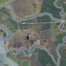
Georgiana Slough, Natural waterway in Sacramento County, United States

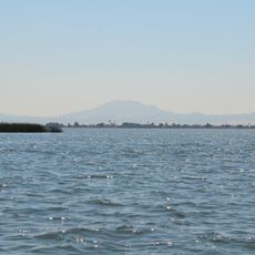
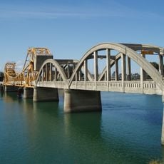
Georgiana Slough is a waterway that runs between Tyler Island and Andrus Island, linking the Sacramento River to the Mokelumne River. The passage supports both recreational boating and connects important sections of the Sacramento-San Joaquin Delta.

The waterway took its name in 1850 from the first steamboat to navigate through it, establishing a transportation link between Sacramento and Stockton. This early shipping route helped shape the region's development and trade patterns.

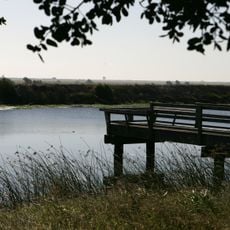
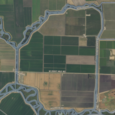
The waterway serves as a gathering place for local anglers and boaters who use it throughout the year. The calm waters and accessible shoreline draw people seeking recreation and connection with the Delta's water systems.

The waterway has several access points with boat launching areas and parking for visitors. Boaters should check local water conditions and bring appropriate safety equipment when using the slough.

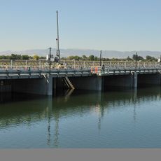
The Department of Water Resources operates a Bio-Acoustic Fish Fence that guides migrating salmon away from hazardous Delta routes. This system demonstrates how technology helps protect fish populations during their seasonal migrations.

The community of curious travelers

AroundUs brings together thousands of curated places, local tips, and hidden gems, enriched daily by 60,000 contributors worldwide.

Start exploring
GPS coordinates
38.13028,-121.57778
Latest update
December 14, 2025 12:24
Around this place
Locke
United States of America

Locke

14.7 km
Antioch Bridge
United States of America

Antioch Bridge

19.2 km
Cosumnes River Preserve
United States of America

Cosumnes River Preserve

19.3 km
Rio Vista Bridge
United States of America

Rio Vista Bridge

9.8 km
Franks Tract State Recreation Area
United States of America

Franks Tract State Recreation Area

10.5 km
Antioch Dunes National Wildlife Refuge
United States of America

Antioch Dunes National Wildlife Refuge

22.8 km
Stone Lakes National Wildlife Refuge
United States of America

Stone Lakes National Wildlife Refuge

27.2 km
Delta Meadows Park Property
United States of America

Delta Meadows Park Property

15.7 km
Mokelumne Aqueduct
United States of America

Mokelumne Aqueduct

23.7 km
Contra Costa Canal
United States of America

Contra Costa Canal

20.5 km
Isleton Bridge
United States of America

Isleton Bridge

4.8 km
Contra Loma Regional Park
United States of America

Contra Loma Regional Park

26 km
Jones Tract
United States of America

Jones Tract

23 km
Walnut Grove Japanese-American Historic District
United States of America

Walnut Grove Japanese-American Historic District

13.8 km
Hastings Adobe
United States of America

Hastings Adobe

22.9 km
Isleton Chinese and Japanese Commercial Districts
United States of America

Isleton Chinese and Japanese Commercial Districts

4.3 km
Brewster Building
United States of America

Brewster Building

23.4 km
Twitchell Island
United States of America

Twitchell Island

6.6 km
Bouldin Island
United States of America

Bouldin Island

4.8 km
King Island
United States of America

King Island

14.3 km
Shannon-Williamson Ranch
United States of America

Shannon-Williamson Ranch

24.8 km
Roswell Butler Hard House
United States of America

Roswell Butler Hard House

24.4 km
Woodbridge Masonic Lodge No. 131
United States of America

Woodbridge Masonic Lodge No. 131

24.4 km
Riverview Union High School Building
United States of America

Riverview Union High School Building

25.2 km
I.O.O.F. Hall
United States of America

I.O.O.F. Hall

24.5 km
Bird and Dinkelspiel Store
United States of America

Bird and Dinkelspiel Store

25.6 km
Antioch WaterPark
United States of America

Antioch WaterPark

25 km
Walnut Grove Bridge
United States of America

Walnut Grove Bridge

13.6 km
Show the full map
Reviews
Share your experience

No review yet

Discussions
Start a discussion...

No discussion yet

« Georgiana Slough - Natural waterway in Sacramento County, United States » is provided by Around Us (aroundus.com). Images and texts are derived from Wikimedia project under a Creative Commons license. You are allowed to copy, distribute, and modify copies of this page, under the conditions set by the license, as long as this note is clearly visible.

Discover hidden gems everywhere you go!

From secret cafés to breathtaking viewpoints, skip the crowded tourist spots and find places that match your style. Our app makes it easy with voice search, smart filtering, route optimization, and insider tips from travelers worldwide. Download now for the complete mobile experience.

Around Us App Screenshot

A unique approach to discovering new places

Le Figaro

All the places worth exploring

France Info

A tailor-made excursion in just a few clicks

20 Minutes

Around Us
Travel Guide & Maps
Download

Send to your phone

QR Code
1

Open the camera app on your mobile.

2

Point at the QR code with your camera. A notification will appear.

3

Tap the notification to open the link.