Chest opened
+${chestReward.xp} XP
Explorer
NOUVEAU ×${chestReward.collectible.quantity}
tapez pour fermer
Chest locked

Open chests in the app

Around Us is built for your phone — chests unlock when you walk, explore and capture nearby places.

Enable Location

We need your location to show you interesting places around you

Discover nearby places

Find interesting locations and hidden gems around you

Precise directions

Get accurate directions and distances to places

Your location is never shared with other users. It's only used when you tap the location button.

Montclair

Log in to your account

Start exploring — it's free

Trusted by 72,967 travelers worldwide

Continue with Google
Continue with Apple
or

We will send you a code to connect

By continuing, you accept our Terms and Conditions and our Privacy Policy

Check your inbox

We've sent a pincode in your inbox. Please enter the code below.

Montclair
Discussion Reviews 1 Photos
13.3k Popularity

Montclair, Residential neighborhood in Oakland Hills, United States.

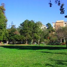
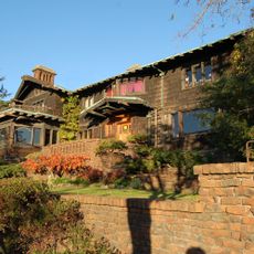
Montclair is a residential neighborhood along the western slope of the Oakland Hills, featuring tree-lined streets and a central shopping district. The area sits at a higher elevation than surrounding parts of Oakland, creating a distinct residential setting with access to local commercial amenities.

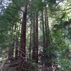
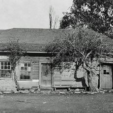
The area was originally inhabited by the Ohlone people before becoming a Spanish land grant in 1820. Industrial development arrived in the mid-1800s when logging became the primary activity, transforming the landscape through timber extraction.

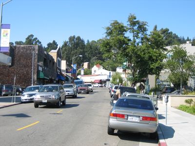
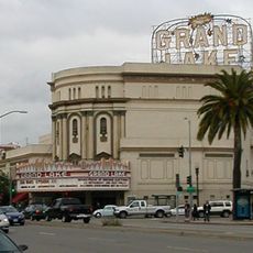
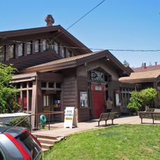
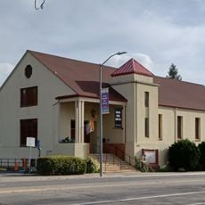
The Montclair Village district serves as a gathering place where residents shop at local stores, dine at neighborhood restaurants, and participate in seasonal markets. This social role has shaped how people experience and use the space today.

The neighborhood connects to major transportation routes, particularly Highway 24, which provides direct access to San Francisco and surrounding regions. Visitors can explore the area by car or use local roads to walk through the residential streets and visit the central shopping district.

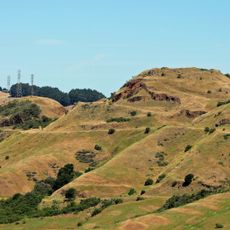
Two natural creek valleys run through the terrain from the Oakland Hills, following the path of the underlying Hayward Fault. This geological feature shapes the physical layout of the neighborhood in ways that many visitors do not immediately notice.

The community of curious travelers

AroundUs brings together thousands of curated places, local tips, and hidden gems, enriched daily by 60,000 contributors worldwide.

Start exploring
Location
GPS coordinates
37.83222,-122.20917
Latest update
March 5, 2026 21:06
Around this place
People's Park
United States of America

People's Park

5.6 km
Chabot Space and Science Center
United States of America

Chabot Space and Science Center

2.9 km
Head-Royce School
United States of America

Head-Royce School

2.7 km
Children's Fairyland
United States of America

Children's Fairyland

5.2 km
Oakland Buddha Shrine
United States of America

Oakland Buddha Shrine

5.2 km
Thorsen House
United States of America

Thorsen House

5.6 km
Grand Lake Theatre
United States of America

Grand Lake Theatre

4 km
Robert Sibley Volcanic Regional Preserve
United States of America

Robert Sibley Volcanic Regional Preserve

2.6 km
Dr. Aurelia Reinhardt Redwood Regional Park
United States of America

Dr. Aurelia Reinhardt Redwood Regional Park

4.3 km
University of California Botanical Garden
United States of America

University of California Botanical Garden

5.4 km
Kaiser Center
United States of America

Kaiser Center

5.5 km
Ordway Building
United States of America

Ordway Building

5.4 km
Idora Park
United States of America

Idora Park

4.9 km
Maynard Buehler House
United States of America

Maynard Buehler House

4.9 km
Ordinaire
United States of America

Ordinaire

3.9 km
St. John's Presbyterian Church
United States of America

St. John's Presbyterian Church

5 km
La Peña Cultural Center
United States of America

La Peña Cultural Center

5.6 km
Joaquin Miller House
United States of America

Joaquin Miller House

2.8 km
United States of America

Round Top

2.5 km
Leimert Bridge
United States of America

Leimert Bridge

2.2 km
Huckleberry Botanic Regional Preserve
United States of America

Huckleberry Botanic Regional Preserve

2.2 km
J. Mora Moss House
United States of America

J. Mora Moss House

4.7 km
University High School
United States of America

University High School

5.3 km
Levine-Fricke Field
United States of America

Levine-Fricke Field

5.5 km
Moraga Adobe
United States of America

Moraga Adobe

5.1 km
Lake Merritt Plaza
United States of America

Lake Merritt Plaza

5.6 km
Temescal Regional Recreation Area
United States of America

Temescal Regional Recreation Area

2.6 km
Kehilla Community Synagogue
United States of America

Kehilla Community Synagogue

3.4 km
Show the full map
Reviews
Share your experience

No review yet

Discussions
Start a discussion...

No discussion yet

« Montclair - Residential neighborhood in Oakland Hills, United States » is provided by Around Us (aroundus.com). Images and texts are derived from Wikimedia project under a Creative Commons license. You are allowed to copy, distribute, and modify copies of this page, under the conditions set by the license, as long as this note is clearly visible.

Discover hidden gems everywhere you go!

From secret cafés to breathtaking viewpoints, skip the crowded tourist spots and find places that match your style. Our app makes it easy with voice search, smart filtering, route optimization, and insider tips from travelers worldwide. Download now for the complete mobile experience.

Around Us App Screenshot

A unique approach to discovering new places

Le Figaro

All the places worth exploring

France Info

A tailor-made excursion in just a few clicks

20 Minutes

Around Us
Travel Guide & Maps
Download

Send to your phone

QR Code
1

Open the camera app on your mobile.

2

Point at the QR code with your camera. A notification will appear.

3

Tap the notification to open the link.