Chest opened
+${chestReward.xp} XP
Explorer
NOUVEAU ×${chestReward.collectible.quantity}
tapez pour fermer
Chest locked

Open chests in the app

Around Us is built for your phone — chests unlock when you walk, explore and capture nearby places.

Enable Location

We need your location to show you interesting places around you

Discover nearby places

Find interesting locations and hidden gems around you

Precise directions

Get accurate directions and distances to places

Your location is never shared with other users. It's only used when you tap the location button.

Dutch Flat

Log in to your account

Start exploring — it's free

Trusted by 72,883 travelers worldwide

Continue with Google
Continue with Apple
or

We will send you a code to connect

By continuing, you accept our Terms and Conditions and our Privacy Policy

Check your inbox

We've sent a pincode in your inbox. Please enter the code below.

Discussion Reviews 1 Photos
11.6k Popularity

Dutch Flat, Gold Rush settlement in Placer County, United States.

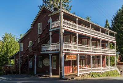
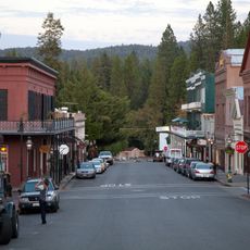
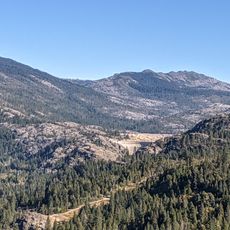
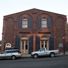
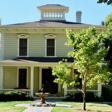
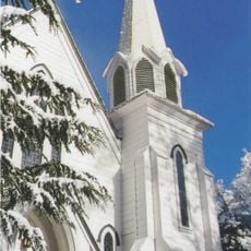
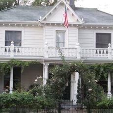
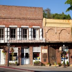
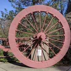
Dutch Flat is a Gold Rush settlement in the mountains of Placer County with buildings and homes dating from the 1800s. The community occupies a plateau in hilly terrain and retains the character of a historic mining town.

The settlement was founded in 1851 by German-born immigrants and rapidly became one of the region's major gold mining centers. The founders built a thriving community that flourished for several decades.

The name reflects the early German-speaking settlers who made this place their home during the 1800s. The community gathered to share ideas and listen to speakers, establishing itself as a center for intellectual exchange in the region.

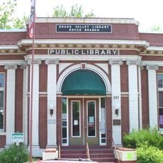
The place is a small community with residential properties and basic services typical of rural mountain settlements. Visitors should expect simpler amenities and explore the area during daylight hours.

A railroad engineer named Theodore Judah surveyed this location as a potential route for a transcontinental railroad, drawing attention to how major infrastructure projects were planned. This evaluation influenced the future direction of regional development.

The community of curious travelers

AroundUs brings together thousands of curated places, local tips, and hidden gems, enriched daily by 60,000 contributors worldwide.

Start exploring
Location
GPS coordinates
39.20611,-120.83778
Latest update
December 7, 2025 20:50
Around this place
Empire Mine State Historic Park
United States of America

Empire Mine State Historic Park

17.7 km
New Bullards Bar Reservoir
United States of America

New Bullards Bar Reservoir

33.4 km
Emigrant Gap
United States of America

Emigrant Gap

18.3 km
Auburn State Recreation Area
United States of America

Auburn State Recreation Area

25.1 km
Lake Clementine
United States of America

Lake Clementine

33 km
South Yuba River State Park
United States of America

South Yuba River State Park

32.3 km
Bridgeport Covered Bridge
United States of America

Bridgeport Covered Bridge

32.3 km
Scotts Flat Reservoir
United States of America

Scotts Flat Reservoir

10.9 km
Sugar Pine Reservoir
United States of America

Sugar Pine Reservoir

9 km
Home of Lola Montez
United States of America

Home of Lola Montez

19.5 km
United States of America

Placer County Big Trees Grove

28 km
North Star House
United States of America

North Star House

20.6 km
Nevada City Downtown Historic District
United States of America

Nevada City Downtown Historic District

16.8 km
Lake Spaulding Dam
United States of America

Lake Spaulding Dam

21.5 km
Mount Saint Mary's Convent and Academy
United States of America

Mount Saint Mary's Convent and Academy

19.8 km
Nevada Theatre
United States of America

Nevada Theatre

16.9 km
Grass Valley Public Library
United States of America

Grass Valley Public Library

19.5 km
Oregon Creek Covered Bridge
United States of America

Oregon Creek Covered Bridge

29.9 km
Doris Foley Library for Historical Research
United States of America

Doris Foley Library for Historical Research

16.9 km
Martin Luther Marsh House
United States of America

Martin Luther Marsh House

16.3 km
Trinity Church (Nevada City)
United States of America

Trinity Church (Nevada City)

16.6 km
Aaron A. Sargent House
United States of America

Aaron A. Sargent House

17 km
Ott's Assay Office
United States of America

Ott's Assay Office

16.6 km
Northstar Mining Museum
United States of America

Northstar Mining Museum

20 km
Grass Valley Library-Royce Branch
United States of America

Grass Valley Library-Royce Branch

19.5 km
Purdon Crossing Bridge
United States of America

Purdon Crossing Bridge

22.5 km
Red Mountain Lookout
United States of America

Red Mountain Lookout

29.4 km
Freeman's Crossing Bridge
United States of America

Freeman's Crossing Bridge

29.9 km
Show the full map
Reviews
Share your experience

No review yet

Discussions
Start a discussion...

No discussion yet

« Dutch Flat - Gold Rush settlement in Placer County, United States » is provided by Around Us (aroundus.com). Images and texts are derived from Wikimedia project under a Creative Commons license. You are allowed to copy, distribute, and modify copies of this page, under the conditions set by the license, as long as this note is clearly visible.

Discover hidden gems everywhere you go!

From secret cafés to breathtaking viewpoints, skip the crowded tourist spots and find places that match your style. Our app makes it easy with voice search, smart filtering, route optimization, and insider tips from travelers worldwide. Download now for the complete mobile experience.

Around Us App Screenshot

A unique approach to discovering new places

Le Figaro

All the places worth exploring

France Info

A tailor-made excursion in just a few clicks

20 Minutes

Around Us
Travel Guide & Maps
Download

Send to your phone

QR Code
1

Open the camera app on your mobile.

2

Point at the QR code with your camera. A notification will appear.

3

Tap the notification to open the link.