Chest opened
+${chestReward.xp} XP
Explorer
NOUVEAU ×${chestReward.collectible.quantity}
tapez pour fermer

See the monuments around you in AR Open chests in the app

Around Us is built for your phone — point your camera at the streets and discover the monuments and places around you in augmented reality. Around Us is built for your phone — chests unlock when you walk, explore and capture nearby places.

Enable Location

We need your location to show you interesting places around you

Discover nearby places

Find interesting locations and hidden gems around you

Precise directions

Get accurate directions and distances to places

Your location is never shared with other users. It's only used when you tap the location button.

Log in to your account

Start exploring — it's free

Trusted by 83,961 travelers worldwide

Continue with Google
Continue with Apple
or

We will send you a code to connect

By continuing, you accept our Terms and Conditions and our Privacy Policy

Check your inbox

We've sent a pincode in your inbox. Please enter the code below.

Discussion Reviews Photo
2k Popularity

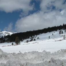
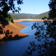
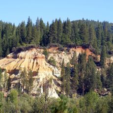
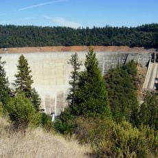
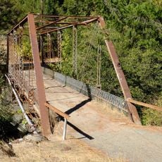
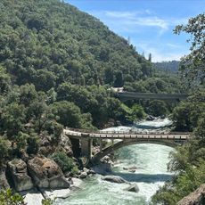
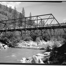
Foote's Crossing Road, Historic mountain road in Tahoe National Forest, California

Foote's Crossing Road is a mountain track in Tahoe National Forest that stretches roughly 24 miles through two counties in northern California. The single-lane path winds along canyon walls with the Middle Yuba River far below, supported by extensive stone walls.

Civil engineer Arthur De Wint Foote designed and built this road in 1913 to connect two mining operations in the Sierra Nevada mountains. The project significantly reduced travel time between the mining sites and opened the remote area to better access.

Italian stonemasons built the dry stone walls that line this road, leaving traces of their skilled craftsmanship visible today. The carefully laid rocks along the canyon curves show construction methods that have lasted over a century.

Visitors need vehicles with high clearance because the unpaved surface has deep ruts and steep mountain grades that can be challenging. The road conditions are best during dry months when the ground is firmer and safer to navigate.

Construction workers hung hundreds of meters above the river to drill steel eyelets into cliff faces and anchor the road shelf. This daring method allowed engineers to carve a path where a traditional road could never have been built.

The community of curious travelers

AroundUs brings together thousands of curated places, local tips, and hidden gems, enriched daily by 60,000 contributors worldwide.
Start exploring
Location
Inception
1913
GPS coordinates
39.42833,-120.91611
Latest update
August 24, 2026 09:24
Around this place
Tahoe National Forest
United States of America

Tahoe National Forest

20 km
New Bullards Bar Reservoir
United States of America

New Bullards Bar Reservoir

19.7 km
Malakoff Diggins State Historic Park
United States of America

Malakoff Diggins State Historic Park

6.6 km
New Bullards Bar Dam
United States of America

New Bullards Bar Dam

19.9 km
Scotts Flat Reservoir
United States of America

Scotts Flat Reservoir

17.4 km
Nevada City Downtown Historic District
United States of America

Nevada City Downtown Historic District

20.4 km
Nevada County Narrow Gauge Railroad & Transportation Museum
United States of America

Nevada County Narrow Gauge Railroad & Transportation Museum

21.8 km
Oregon Creek Covered Bridge
United States of America

Oregon Creek Covered Bridge

14.7 km
Doris Foley Library for Historical Research
United States of America

Doris Foley Library for Historical Research

20.4 km
Sierra County Sheriff's Gallows
United States of America

Sierra County Sheriff's Gallows

16.3 km
Martin Luther Marsh House
United States of America

Martin Luther Marsh House

19.6 km
Trinity Church (Nevada City)
United States of America

Trinity Church (Nevada City)

20.3 km
Aaron A. Sargent House
United States of America

Aaron A. Sargent House

20.4 km
Hospital Bridge
United States of America

Hospital Bridge

17.7 km
Hoyt Crossing Nude Beach
United States of America

Hoyt Crossing Nude Beach

19.9 km
Purdon Crossing Bridge
United States of America

Purdon Crossing Bridge

15.9 km
Durgan Bridge
United States of America

Durgan Bridge

16.4 km
Miners Tunnel
United States of America

Miners Tunnel

20.1 km
United States of America

Edwards Crossing

12.4 km
United States of America

China Dam

14.7 km
United States of America

Purdon Crossing

15.8 km
United States of America

Illinois Bar

11.4 km
United States of America

Missouri Bar

9.6 km
United States of America

Installation artwork

13.1 km
United States of America

West Diggins Viewpoint

6.9 km
United States of America

Alpha and Omega Overlook

18.7 km
United States of America

Scenic viewpoint

15 km
United States of America

Yuba Rim Overlook

20.9 km
Show the full map
Reviews
Share your experience

No review yet

Discussions
Start a discussion...

No discussion yet

« Foote's Crossing Road - Historic mountain road in Tahoe National Forest, California » is provided by Around Us (aroundus.com). Images and texts are derived from Wikimedia project under a Creative Commons license. You are allowed to copy, distribute, and modify copies of this page, under the conditions set by the license, as long as this note is clearly visible.

Discover hidden gems everywhere you go!

From secret cafés to breathtaking viewpoints, skip the crowded tourist spots and find places that match your style. Our app makes it easy with voice search, smart filtering, route optimization, and insider tips from travelers worldwide. Download now for the complete mobile experience.

Around Us App Screenshot

A unique approach to discovering new places

Le Figaro

All the places worth exploring

France Info

A tailor-made excursion in just a few clicks

20 Minutes

Around Us
Travel Guide & Maps
Download

Send to your phone

QR Code
1

Open the camera app on your mobile.

2

Point at the QR code with your camera. A notification will appear.

3

Tap the notification to open the link.