Saddle Mountain, Mountain summit in Clatsop County, Oregon, US
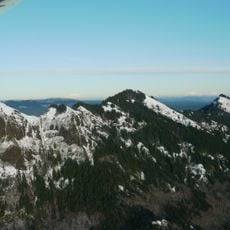
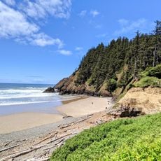
Saddle Mountain is the highest point in Clatsop County, Oregon, reaching 3,288 feet (1,002 m). It consists of volcanic breccia, a rock of broken basalt fragments fused in a fine-grained matrix, formed by steam explosions when lava met the Astoria Sea. Dense spruce and hemlock forests cover its slopes.
In 1788 British captain John Meares named the peak Mont de la Selle. Lewis and Clark observed it in 1805, and the Wilkes Expedition recorded it in 1841. The mountain lies within Saddle Mountain State Natural Area and is listed on Oregon's Register of Natural Heritage Resources.
The name Mont de la Selle, given by British captain John Meares in 1788, means "Mount of the Saddle," referring to the mountain's two-peaked profile. The English name Saddle Mountain is a direct translation of this French designation.
The trail to the summit is steep and demanding, so wear sturdy hiking boots and bring plenty of water. Plan for several hours of hiking and prepare for changeable weather conditions that can shift quickly at elevation.
Saddle Mountain is listed on Oregon's Register of Natural Heritage Resources. Its summit is built of volcanic breccia: broken basalt fragments fused in a fine-grained matrix, formed about 15 million years ago when lava met the Astoria Sea.
The community of curious travelers
AroundUs brings together thousands of curated places, local tips, and hidden gems, enriched daily by 92,893 contributors worldwide.