Enable Location

We need your location to show you interesting places around you

Discover nearby places

Find interesting locations and hidden gems around you

Precise directions

Get accurate directions and distances to places

Your location is never shared with other users. It's only used when you tap the location button.

Arcadia Beach State Recreation Site

Log in to your account

Start exploring — it's free

Trusted by 61,906 travelers worldwide

Continue with Google
Continue with Apple
or

We will send you a code to connect

By continuing, you accept our Terms and Conditions and our Privacy Policy

Check your inbox

We've sent a pincode in your inbox. Please enter the code below.

Arcadia Beach State Recreation Site

Arcadia Beach State Recreation Site, State recreation site on Oregon coast, United States.

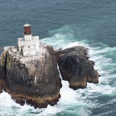
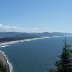
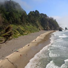
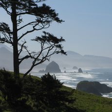
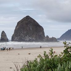
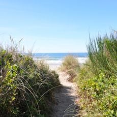
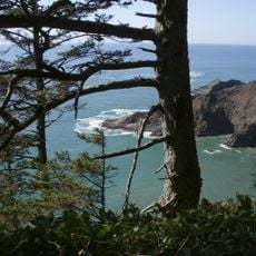
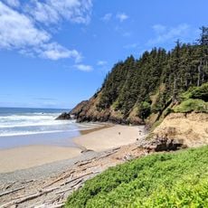
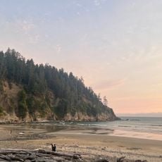
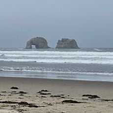
Arcadia Beach is a recreation site on the Oregon coast situated between two headlands with sandstone bluffs and offshore rocks. The coastline offers marine viewing opportunities and stretches along the Pacific Ocean.

The recreation area was established through land acquisitions from multiple owners between 1971 and 1985, including the forested Humbug Point. These purchases formed the foundation of the current state recreation site.

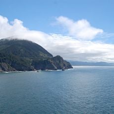
The north headland bears the name Humbug Point because early settlers repeatedly confused it with nearby Hug Point to the south. This mix-up has stuck as the official place name.

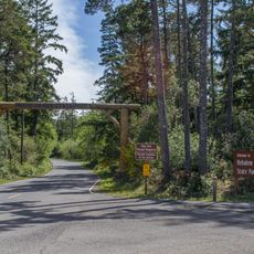
Access to the neighboring headlands requires careful timing with low tide to safely navigate the area. The main beach area offers convenient parking and walking paths for visitors.

The sandstone rock formations display twisted patterns in their layered structures, revealing their origin beneath ancient seas. This geological feature tells the story of how the rocks were lifted up from the ocean floor.

The community of curious travelers

AroundUs brings together thousands of curated places, local tips, and hidden gems, enriched daily by 60,000 contributors worldwide.

Start exploring
Location
GPS coordinates
45.84650,-123.96236
Latest update
December 11, 2025 18:06
Around this place
Fort Clatsop
United States of America

Fort Clatsop

32.6 km
Tillamook Rock Light
United States of America

Tillamook Rock Light

11 km
Oswald West State Park
United States of America

Oswald West State Park

8.5 km
Nehalem Bay State Park
United States of America

Nehalem Bay State Park

16.6 km
Neahkahnie Mountain
United States of America

Neahkahnie Mountain

11.1 km
Lewis and Clark National Historical Park
United States of America

Lewis and Clark National Historical Park

32.6 km
Saddle Mountain
United States of America

Saddle Mountain

25.4 km
Hug Point State Recreation Site
United States of America

Hug Point State Recreation Site

2.4 km
Ecola State Park
United States of America

Ecola State Park

8.5 km
Seaside Aquarium
United States of America

Seaside Aquarium

16.8 km
Tolovana Beach Wayside
United States of America

Tolovana Beach Wayside

2.9 km
Youngs River Falls
United States of America

Youngs River Falls

28 km
Del Rey Beach State Recreation Site
United States of America

Del Rey Beach State Recreation Site

22.2 km
Saddle Mountain State Natural Area
United States of America

Saddle Mountain State Natural Area

25.2 km
Manhattan Beach State Recreation Site
United States of America

Manhattan Beach State Recreation Site

22.7 km
Lewis and Clark River Bridge
United States of America

Lewis and Clark River Bridge

35 km
Harry F. Wentz Studio
United States of America

Harry F. Wentz Studio

12.7 km
Cape Falcon Marine Reserve
United States of America

Cape Falcon Marine Reserve

9.5 km
A. E. Doyle Cottage
United States of America

A. E. Doyle Cottage

13.2 km
Mary Frances Isom Cottage
United States of America

Mary Frances Isom Cottage

13.2 km
Lewis and Clark National and State Historical Parks
United States of America

Lewis and Clark National and State Historical Parks

32.6 km
Indian Beach
United States of America

Indian Beach

9.2 km
Sunset Beach
United States of America

Sunset Beach

14.4 km
Short Sand Beach
United States of America

Short Sand Beach

9.6 km
Blumenthal Falls
United States of America

Blumenthal Falls

9.2 km
Nehalem River Bridge
United States of America

Nehalem River Bridge

31.6 km
Mohler Bridge
United States of America

Mohler Bridge

17.3 km
Twin Rocks Turnaround
United States of America

Twin Rocks Turnaround

27.3 km
Show the full map
« Arcadia Beach State Recreation Site - State recreation site on Oregon coast, United States » is provided by Around Us (aroundus.com). Images and texts are derived from Wikimedia project under a Creative Commons license. You are allowed to copy, distribute, and modify copies of this page, under the conditions set by the license, as long as this note is clearly visible.

Discover hidden gems everywhere you go!

From secret cafés to breathtaking viewpoints, skip the crowded tourist spots and find places that match your style. Our app makes it easy with voice search, smart filtering, route optimization, and insider tips from travelers worldwide. Download now for the complete mobile experience.

Around Us App Screenshot

A unique approach to discovering new places

Le Figaro

All the places worth exploring

France Info

A tailor-made excursion in just a few clicks

20 Minutes

Around Us
Travel Guide & Maps
Download

Send to your phone

QR Code
1

Open the camera app on your mobile.

2

Point at the QR code with your camera. A notification will appear.

3

Tap the notification to open the link.