Enable Location

We need your location to show you interesting places around you

Discover nearby places

Find interesting locations and hidden gems around you

Precise directions

Get accurate directions and distances to places

Your location is never shared with other users. It's only used when you tap the location button.

Tillamook Rock Light

Log in to your account

Start exploring — it's free

Trusted by 61,906 travelers worldwide

Continue with Google
Continue with Apple
or

We will send you a code to connect

By continuing, you accept our Terms and Conditions and our Privacy Policy

Check your inbox

We've sent a pincode in your inbox. Please enter the code below.

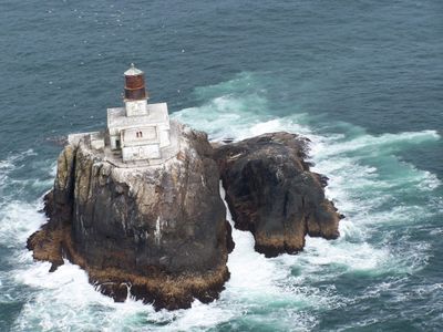
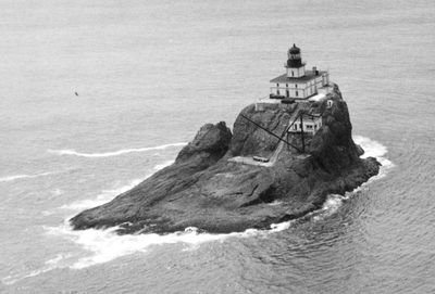
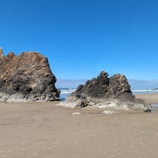
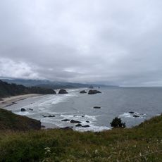
Tillamook Rock Light, Historic lighthouse on Tillamook Head, Oregon, United States.

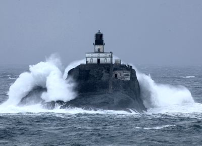
Tillamook Rock Light stands on a basalt outcrop two kilometers off the Oregon coast and reaches 19 meters above the Pacific. The decommissioned beacon uses a combination of concrete, basalt, brick, and iron to resist powerful ocean forces.

Congress approved construction in 1878 and a crew needed 500 days to complete work on the stormy rock in January 1881. Builders fought heavy waves and dangerous conditions throughout the entire construction period.

Local mariners gave this station its nickname 'Terrible Tilly' after hearing stories from keepers who lived through months of crashing waves and wind. Their daily routines included climbing outside to clean lenses while spray soaked the entire structure.

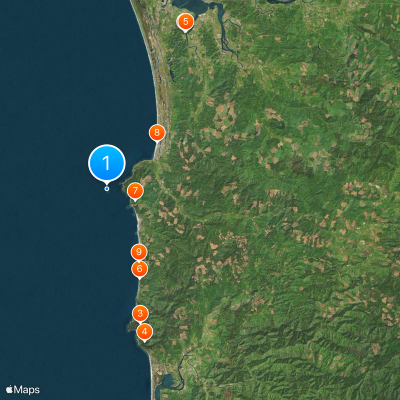
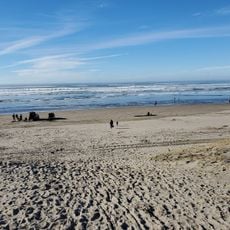
The best view of the beacon comes from the Oregon Coast Trail between Ecola State Park and Seaside, especially at Indian Beach. Clear weather is important because fog and rain often limit visibility.

This project cost more than any other West Coast lighthouse at the time because workers had to transport every stone and iron piece by boat in dangerous conditions. Most deliveries reached the rock platform only during brief periods of calmer seas.

The community of curious travelers

AroundUs brings together thousands of curated places, local tips, and hidden gems, enriched daily by 60,000 contributors worldwide.

Start exploring
Location
Made from material
concrete, basalt, brick, iron
GPS coordinates
45.93750,-124.01900
Latest update
December 20, 2025 13:35
Natural and historical sites across Oregon

Oregon offers a notable diversity of geological formations and natural landscapes ranging from the Pacific coastline to the volcanic plateaus of the eastern portion of the state. The Cascade Range dominates western Oregon with dense forests, waterfalls, and thermal springs, while the dry east...

Around this place
Fort Clatsop
United States of America

Fort Clatsop

24.3 km
Oswald West State Park
United States of America

Oswald West State Park

19.2 km
Neahkahnie Mountain
United States of America

Neahkahnie Mountain

21.8 km
Lewis and Clark National Historical Park
United States of America

Lewis and Clark National Historical Park

24.4 km
Hug Point State Recreation Site
United States of America

Hug Point State Recreation Site

13.3 km
Ecola State Park
United States of America

Ecola State Park

4.2 km
Seaside Aquarium
United States of America

Seaside Aquarium

9.5 km
Arcadia Beach State Recreation Site
United States of America

Arcadia Beach State Recreation Site

11 km
Tolovana Beach Wayside
United States of America

Tolovana Beach Wayside

8.5 km
Youngs River Falls
United States of America

Youngs River Falls

22.9 km
Del Rey Beach State Recreation Site
United States of America

Del Rey Beach State Recreation Site

13.9 km
Saddle Mountain State Natural Area
United States of America

Saddle Mountain State Natural Area

26 km
Harry F. Wentz Studio
United States of America

Harry F. Wentz Studio

23.5 km
Cape Falcon Marine Reserve
United States of America

Cape Falcon Marine Reserve

19.1 km
A. E. Doyle Cottage
United States of America

A. E. Doyle Cottage

24 km
Lewis and Clark National and State Historical Parks
United States of America

Lewis and Clark National and State Historical Parks

24.4 km
Mary Frances Isom Cottage
United States of America

Mary Frances Isom Cottage

24 km
Captain Kid Amusement Park
United States of America

Captain Kid Amusement Park

8.2 km
Indian Beach
United States of America

Indian Beach

3.3 km
Sunset Beach
United States of America

Sunset Beach

25.2 km
Seaside Beach
United States of America

Seaside Beach

9.4 km
Indian Beach
United States of America

Indian Beach

3.4 km
Short Sand Beach
United States of America

Short Sand Beach

20.1 km
Blumenthal Falls
United States of America

Blumenthal Falls

19.6 km
Arcadia Beach
United States of America

Arcadia Beach

11.8 km
Del Rey Beach
United States of America

Del Rey Beach

13.7 km
Crescent Beach
United States of America

Crescent Beach

4.6 km
Chapman Beach
United States of America

Chapman Beach

5.7 km
Show the full map
« Tillamook Rock Light - Historic lighthouse on Tillamook Head, Oregon, United States » is provided by Around Us (aroundus.com). Images and texts are derived from Wikimedia project under a Creative Commons license. You are allowed to copy, distribute, and modify copies of this page, under the conditions set by the license, as long as this note is clearly visible.

Discover hidden gems everywhere you go!

From secret cafés to breathtaking viewpoints, skip the crowded tourist spots and find places that match your style. Our app makes it easy with voice search, smart filtering, route optimization, and insider tips from travelers worldwide. Download now for the complete mobile experience.

Around Us App Screenshot

A unique approach to discovering new places

Le Figaro

All the places worth exploring

France Info

A tailor-made excursion in just a few clicks

20 Minutes

Around Us
Travel Guide & Maps
Download

Send to your phone

QR Code
1

Open the camera app on your mobile.

2

Point at the QR code with your camera. A notification will appear.

3

Tap the notification to open the link.