Enable Location

We need your location to show you interesting places around you

Discover nearby places

Find interesting locations and hidden gems around you

Precise directions

Get accurate directions and distances to places

Your location is never shared with other users. It's only used when you tap the location button.

Clatsop State Forest

Log in to your account

Start exploring — it's free

Trusted by 61,908 travelers worldwide

Continue with Google
Continue with Apple
or

We will send you a code to connect

By continuing, you accept our Terms and Conditions and our Privacy Policy

Check your inbox

We've sent a pincode in your inbox. Please enter the code below.

Clatsop State Forest

Clatsop State Forest, State forest in northwest Oregon, United States.

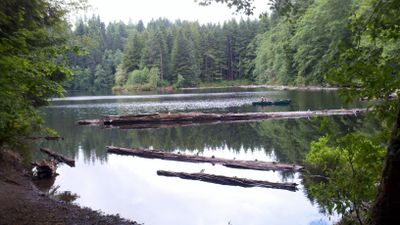
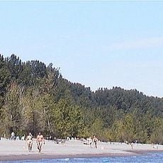
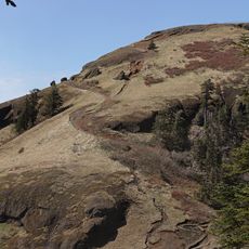
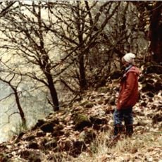
Clatsop State Forest is a woodland area in northwest Oregon featuring mixed timber stands, wetland zones, and several lakes throughout its territory. The landscape includes multiple hiking trails, campgrounds, and fishing spots scattered across the different sections.

The forest was established by the Oregon Department of Forestry to balance timber production with conservation of natural resources. Forestry management has shaped the territory's development since its creation.

Local Native American tribes utilized the forest's resources, establishing connections with the land through hunting, gathering, and material collection.

The forest can be accessed through several entry points and trailheads where visitors can start their explorations. Basic facilities like parking areas and rest spots are located near the main access points throughout the territory.

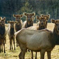
The forest sits at the boundary between coastal influences and inland forest conditions, creating rare habitat types. These special conditions allow for the presence of specialized wildlife and plant species not commonly found in other regions.

The community of curious travelers

AroundUs brings together thousands of curated places, local tips, and hidden gems, enriched daily by 60,000 contributors worldwide.

Start exploring
Location
GPS coordinates
45.93690,-123.21900
Latest update
December 12, 2025 14:25
Around this place
Collins Beach
United States of America

Collins Beach

37 km
Nutty Narrows Bridge
United States of America

Nutty Narrows Bridge

31.3 km
Lewis and Clark Bridge
United States of America

Lewis and Clark Bridge

27.3 km
Saddle Mountain
United States of America

Saddle Mountain

36.3 km
Banks-Vernonia State Trail
United States of America

Banks-Vernonia State Trail

30.6 km
L. L. "Stub" Stewart State Park
United States of America

L. L. "Stub" Stewart State Park

22.4 km
Peace Candle of the World
United States of America

Peace Candle of the World

34.2 km
Warrior Rock Light
United States of America

Warrior Rock Light

34.8 km
Great Vow Zen Monastery
United States of America

Great Vow Zen Monastery

24.7 km
Jewell Meadows Wildlife Area
United States of America

Jewell Meadows Wildlife Area

23.5 km
Bradley State Scenic Viewpoint
United States of America

Bradley State Scenic Viewpoint

31 km
Hulda Klager Lilac Gardens
United States of America

Hulda Klager Lilac Gardens

36.4 km
Julia Butler Hansen Bridge
United States of America

Julia Butler Hansen Bridge

31.5 km
Saddle Mountain State Natural Area
United States of America

Saddle Mountain State Natural Area

36.3 km
Thomas J. Flippin House
United States of America

Thomas J. Flippin House

18.3 km
Pioneer Church
United States of America

Pioneer Church

32.1 km
Round Top
United States of America

Round Top

31 km
Vernonia Pioneer Museum
United States of America

Vernonia Pioneer Museum

9.3 km
Longview Community Church-Saint Helen's Addition
United States of America

Longview Community Church-Saint Helen's Addition

29 km
Cox–Williams House
United States of America

Cox–Williams House

33.7 km
Banks Public Library
United States of America

Banks Public Library

36.2 km
Basalt Cobblestone Quarries District
United States of America

Basalt Cobblestone Quarries District

37 km
Caples House Museum
United States of America

Caples House Museum

32.3 km
Columbia Theatre
United States of America

Columbia Theatre

33.6 km
Columbia Theatre for the Performing Arts
United States of America

Columbia Theatre for the Performing Arts

31.7 km
Mills Building
United States of America

Mills Building

31.2 km
Woodland Theatre
United States of America

Woodland Theatre

36.7 km
Nehalem River Bridge
United States of America

Nehalem River Bridge

27.4 km
Show the full map
« Clatsop State Forest - State forest in northwest Oregon, United States » is provided by Around Us (aroundus.com). Images and texts are derived from Wikimedia project under a Creative Commons license. You are allowed to copy, distribute, and modify copies of this page, under the conditions set by the license, as long as this note is clearly visible.

Discover hidden gems everywhere you go!

From secret cafés to breathtaking viewpoints, skip the crowded tourist spots and find places that match your style. Our app makes it easy with voice search, smart filtering, route optimization, and insider tips from travelers worldwide. Download now for the complete mobile experience.

Around Us App Screenshot

A unique approach to discovering new places

Le Figaro

All the places worth exploring

France Info

A tailor-made excursion in just a few clicks

20 Minutes

Around Us
Travel Guide & Maps
Download

Send to your phone

QR Code
1

Open the camera app on your mobile.

2

Point at the QR code with your camera. A notification will appear.

3

Tap the notification to open the link.