Log in to your account

AroundUs is a community-driven map of interesting places, built by curious explorers like you. It grows with every review, story, and photo you share.
Connect to save your favorite spots, contribute locations, and create personalized routes.
Continue with Google
Continue with Apple
Continue with X
Continue with Facebook
Continue with email
By continuing, you accept our Terms and Conditions and our Privacy Policy
Create an account
Add to collection
Map
Suggest a change
Share

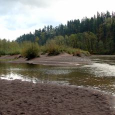
Camas Potholes, Protected area in Washington, United States

Camas Potholes are deep depressions carved into basalt rock by the erosive force of Lacamas Creek over time. These natural basins dot the landscape and create a distinctive rocky terrain throughout the area.

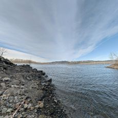
These geological formations began with ancient volcanic activity that shaped the broader region. Water erosion then carved and deepened these potholes over thousands of years into their current form.

The name comes from the Camas flower, which was an important food source for Native American peoples of the Pacific Northwest. This plant shaped how people used and valued the land for generations.

Visitors can reach the potholes via an easy walking trail from Lacamas Park with free parking at the starting point. The path is straightforward and requires no special gear, though sturdy shoes are a good idea.

The individual potholes display natural circular shapes in varying sizes, formed as rolling stones slowly wore away the basalt surface. This type of formation is relatively uncommon in the region and shows the power of water working over vast stretches of time.

Location: Washington

GPS coordinates: 45.59833,-122.40194

Latest update: December 13, 2025 12:20

Photos
Around this place
Historic Columbia River Highway
United States of America

Historic Columbia River Highway

7 km
Multnomah County Poor Farm
United States of America

Multnomah County Poor Farm

6.7 km
Government Island
United States of America

Government Island

8.7 km
Steigerwald Lake National Wildlife Refuge
United States of America

Steigerwald Lake National Wildlife Refuge

8.5 km
Lewis and Clark State Recreation Site
United States of America

Lewis and Clark State Recreation Site

6.7 km
Dabney State Recreation Area
United States of America

Dabney State Recreation Area

9.9 km
Blue Lake Regional Park

Blue Lake Regional Park

5.8 km
Stark Street Bridge
United States of America

Stark Street Bridge

9.8 km
Jacob Zimmerman House
United States of America

Jacob Zimmerman House

8.6 km
Rockwood Library
United States of America

Rockwood Library

10.6 km
Living Room
United States of America

Living Room

10.8 km
Gresham Carnegie Library
United States of America

Gresham Carnegie Library

11.1 km
Farrell Building
United States of America

Farrell Building

1.2 km
John Roffler House
United States of America

John Roffler House

854 m
Springdale School
United States of America

Springdale School

10.4 km
Louise Home Hospital and Residence Hall
United States of America

Louise Home Hospital and Residence Hall

7.8 km
Fairview-Columbia Library
United States of America

Fairview-Columbia Library

7.9 km
Pittock House
United States of America

Pittock House

3.4 km
Troutdale Methodist Episcopal Church
United States of America

Troutdale Methodist Episcopal Church

7.1 km
Fred Harlow House
United States of America

Fred Harlow House

6.9 km
Troutdale Library
United States of America

Troutdale Library

7.7 km
Fairview City Jail
United States of America

Fairview City Jail

7 km
Troutdale Sandy River Bridge
United States of America

Troutdale Sandy River Bridge

7 km
Sandy Swimming Hole
United States of America

Sandy Swimming Hole

2.9 km
Cottonwood Beach
United States of America

Cottonwood Beach

6.2 km
Sunrise Park
United States of America

Sunrise Park

8.1 km
Regal Cascade Stadium 16 IMAX & RPX
United States of America

Regal Cascade Stadium 16 IMAX & RPX

8.3 km
Sundial Beach
United States of America

Sundial Beach

3.5 km
Show the full map
Reviews

Visited this place? Tap the stars to rate it and share your experience / photos with the community! Try now! You can cancel it anytime.

« Camas Potholes - Protected area in Washington, United States » is provided by Around Us (aroundus.com). Images and texts are derived from Wikimedia project under a Creative Commons license. You are allowed to copy, distribute, and modify copies of this page, under the conditions set by the license, as long as this note is clearly visible.

Discover hidden gems everywhere you go!

From secret cafés to breathtaking viewpoints, skip the crowded tourist spots and find places that match your style. Our app makes it easy with voice search, smart filtering, route optimization, and insider tips from travelers worldwide. Download now for the complete mobile experience.

Around Us App Screenshot

A unique approach to discovering new places

Le Figaro

All the places worth exploring

France Info

A tailor-made excursion in just a few clicks

20 Minutes