Enable Location

We need your location to show you interesting places around you

Discover nearby places

Find interesting locations and hidden gems around you

Precise directions

Get accurate directions and distances to places

Your location is never shared with other users. It's only used when you tap the location button.

Mason County

Log in to your account

Start exploring — it's free

Trusted by 62,374 travelers worldwide

Continue with Google
Continue with Apple
or

We will send you a code to connect

By continuing, you accept our Terms and Conditions and our Privacy Policy

Check your inbox

We've sent a pincode in your inbox. Please enter the code below.

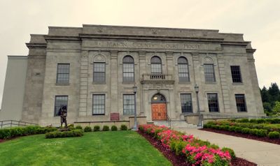
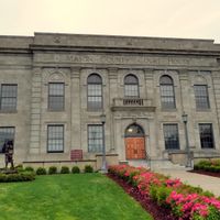
Mason County, Administrative division in Washington State, US.

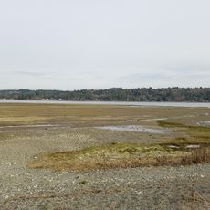
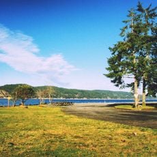
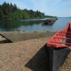
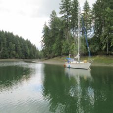
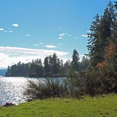
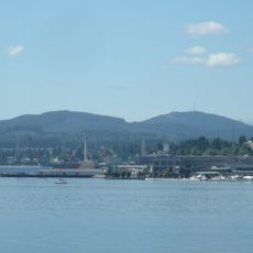
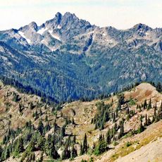
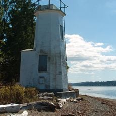
Mason County is a county in west-central Washington with forests, waterways, and coastal access. The area stretches from Hood Canal in the north to several bays along Puget Sound and includes the town of Shelton as its administrative center.

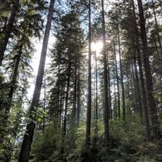
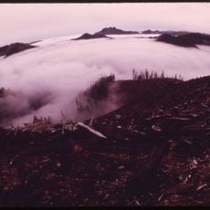
The area was first established in 1854 as Sawamish County, carved from Thurston County, then renamed to its present name in 1864. For more than a century, logging remained the backbone of the local economy and shaped how communities grew.

Logging shaped the way families lived and worked here for generations, leaving marks on small towns and how people see themselves. Walking through older neighborhoods, you still notice the mill houses and community layouts that grew out of that era.

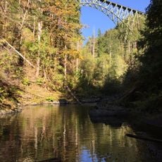
Most visitors explore the region by car to see forests, lakes, and access points to Puget Sound. The area works best for day trips or weekend visits since points of interest are spread across a larger territory.

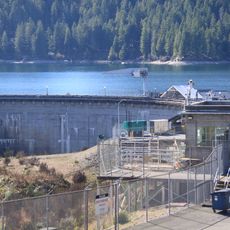
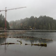
The 1980s brought a major shift when timber sales were restricted to protect spotted owls, forcing mills to close and reshape the economy. This transition led to the growth of different industries that remain important to the region today.

The community of curious travelers

AroundUs brings together thousands of curated places, local tips, and hidden gems, enriched daily by 60,000 contributors worldwide.

Start exploring
Location
Inception
March 13, 1854
Capital city
Shelton
Shares border with
Jefferson County, Kitsap County, Pierce County, Thurston County, Grays Harbor County
GPS coordinates
47.35000,-123.18000
Latest update
December 20, 2025 13:47
Around this place
High Steel Bridge
United States of America

High Steel Bridge

7.8 km
Vance Creek Bridge
United States of America

Vance Creek Bridge

10.8 km
Mount Ellinor
United States of America

Mount Ellinor

20.1 km
Belfair State Park
United States of America

Belfair State Park

24.6 km
Mount Washington
United States of America

Mount Washington

20.8 km
Twanoh State Park
United States of America

Twanoh State Park

15.7 km
Cushman Dam
United States of America

Cushman Dam

8.7 km
Woodard Bay Natural Resources Conservation Area
United States of America

Woodard Bay Natural Resources Conservation Area

34.7 km
Schafer State Park
United States of America

Schafer State Park

35.6 km
Joemma Beach State Park
United States of America

Joemma Beach State Park

31.4 km
Jarrell Cove State Park
United States of America

Jarrell Cove State Park

23.6 km
United States of America

Hope Island Marine State Park - Mason County

26.2 km
United States of America

Potlatch State Park

3.7 km
Lower Cushman Dam
United States of America

Lower Cushman Dam

5.5 km
United States of America

Ink Blot Natural Area Preserve

8 km
Mount Skokomish Wilderness
United States of America

Mount Skokomish Wilderness

23.9 km
Kennedy Creek Natural Area Preserve
United States of America

Kennedy Creek Natural Area Preserve

29.4 km
Triton Cove State Park
United States of America

Triton Cove State Park

32 km
United States of America

McMicken Island Marine State Park

26.5 km
United States of America

Wonder Mountain Wilderness

25.7 km
United States of America

Stretch Point State Park

27.2 km
United States of America

Hamma Hamma Balds Natural Area Preserve

27.3 km
Satsop Hills
United States of America

Satsop Hills

20.5 km
Green Mountain
United States of America

Green Mountain

36.7 km
Mount Stone
United States of America

Mount Stone

29.3 km
United States of America

Lake Kokanee

6.3 km
Dofflemyer Point Light
United States of America

Dofflemyer Point Light

31.1 km
United States of America

Mount Rose

19.2 km
Show the full map
Administrative divisions
« Mason County - Administrative division in Washington State, US » is provided by Around Us (aroundus.com). Images and texts are derived from Wikimedia project under a Creative Commons license. You are allowed to copy, distribute, and modify copies of this page, under the conditions set by the license, as long as this note is clearly visible.

Discover hidden gems everywhere you go!

From secret cafés to breathtaking viewpoints, skip the crowded tourist spots and find places that match your style. Our app makes it easy with voice search, smart filtering, route optimization, and insider tips from travelers worldwide. Download now for the complete mobile experience.

Around Us App Screenshot

A unique approach to discovering new places

Le Figaro

All the places worth exploring

France Info

A tailor-made excursion in just a few clicks

20 Minutes

Around Us
Travel Guide & Maps
Download

Send to your phone

QR Code
1

Open the camera app on your mobile.

2

Point at the QR code with your camera. A notification will appear.

3

Tap the notification to open the link.