Chest opened
+${chestReward.xp} XP
Explorer
NOUVEAU ×${chestReward.collectible.quantity}
tapez pour fermer
Chest locked

Open chests in the app

Around Us is built for your phone — chests unlock when you walk, explore and capture nearby places.

Enable Location

We need your location to show you interesting places around you

Discover nearby places

Find interesting locations and hidden gems around you

Precise directions

Get accurate directions and distances to places

Your location is never shared with other users. It's only used when you tap the location button.

Log in to your account

Start exploring — it's free

Trusted by 72,892 travelers worldwide

Continue with Google
Continue with Apple
or

We will send you a code to connect

By continuing, you accept our Terms and Conditions and our Privacy Policy

Check your inbox

We've sent a pincode in your inbox. Please enter the code below.

Discussion Reviews Photo
10.9k Popularity

Freeland, Census-designated place in Island County, United States

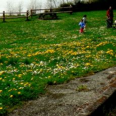
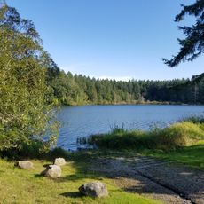
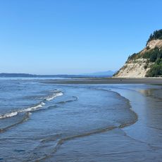
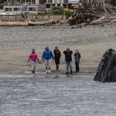
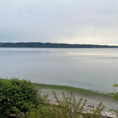
Freeland is a small community on southern Whidbey Island, situated between Holmes Harbor and Mutiny Bay. The area features flat terrain with easy access to nearby beaches and state parks.

The settlement began in the early 1900s as a socialist community founded by veterans from the Equality Colony. These founders used innovative financing through shared ownership to purchase and develop the land.

The name 'Freeland' reflects the founders' vision of accessible land for working people. This idealistic origin still shapes how the community thinks about itself today.

The location is easily reached via Washington State Route 525 and sits conveniently between Clinton and Keystone. The flat terrain makes it straightforward to explore nearby beaches and parks on foot or by bike.

Residents could pay for their land using dividends from community store shares, an innovative system for that era. This approach let working people become landowners without needing large sums of cash upfront.

The community of curious travelers

AroundUs brings together thousands of curated places, local tips, and hidden gems, enriched daily by 60,000 contributors worldwide.

Start exploring
Location
Elevation above the sea
35 m
GPS coordinates
48.01556,-122.53361
Latest update
December 8, 2025 13:44
Around this place
Hood Canal Bridge
United States of America

Hood Canal Bridge

18.6 km
Fort Casey
United States of America

Fort Casey

19.8 km
Fort Flagler Historical State Park
United States of America

Fort Flagler Historical State Park

15 km
Cama Beach Historical State Park
United States of America

Cama Beach Historical State Park

14.2 km
Camano Island State Park
United States of America

Camano Island State Park

12.8 km
Point No Point Light
United States of America

Point No Point Light

11.5 km
Fort Townsend State Park
United States of America

Fort Townsend State Park

20.7 km
Tamanowas Rock
United States of America

Tamanowas Rock

19.4 km
Admiralty Head Light
United States of America

Admiralty Head Light

19.5 km
Kayak Point County Park
United States of America

Kayak Point County Park

18.1 km
Mukilteo Light
United States of America

Mukilteo Light

18.5 km
Port Townsend Historic District
United States of America

Port Townsend Historic District

20.3 km
Anderson Lake State Park
United States of America

Anderson Lake State Park

20.5 km
United States of America

Hedgebrook

930 m
Rothschild House
United States of America

Rothschild House

20 km
Marrowstone Point Light
United States of America

Marrowstone Point Light

15 km
St. Anne's Roman Catholic Church
United States of America

St. Anne's Roman Catholic Church

19.9 km
St. Paul's Episcopal Church
United States of America

St. Paul's Episcopal Church

20.1 km
Capt. Enoch S. Fowler House
United States of America

Capt. Enoch S. Fowler House

20.1 km
Jefferson County Courthouse
United States of America

Jefferson County Courthouse

20.4 km
Double Bluff Beach
United States of America

Double Bluff Beach

4.2 km
Methodist Episcopal Church of Port Hadlock
United States of America

Methodist Episcopal Church of Port Hadlock

17.6 km
South Whidbey State Park
United States of America

South Whidbey State Park

6.4 km
Christian Congregation Church of Port Ludlow
United States of America

Christian Congregation Church of Port Ludlow

15.2 km
Langley Whale Center
United States of America

Langley Whale Center

9.6 km
Port Townsend First Baptist Church
United States of America

Port Townsend First Baptist Church

20.4 km
Rose Theatre
United States of America

Rose Theatre

20 km
Tulalip Shores
United States of America

Tulalip Shores

17.5 km
Show the full map
Reviews
Share your experience

No review yet

Discussions
Start a discussion...

No discussion yet

« Freeland - Census-designated place in Island County, United States » is provided by Around Us (aroundus.com). Images and texts are derived from Wikimedia project under a Creative Commons license. You are allowed to copy, distribute, and modify copies of this page, under the conditions set by the license, as long as this note is clearly visible.

Discover hidden gems everywhere you go!

From secret cafés to breathtaking viewpoints, skip the crowded tourist spots and find places that match your style. Our app makes it easy with voice search, smart filtering, route optimization, and insider tips from travelers worldwide. Download now for the complete mobile experience.

Around Us App Screenshot

A unique approach to discovering new places

Le Figaro

All the places worth exploring

France Info

A tailor-made excursion in just a few clicks

20 Minutes

Around Us
Travel Guide & Maps
Download

Send to your phone

QR Code
1

Open the camera app on your mobile.

2

Point at the QR code with your camera. A notification will appear.

3

Tap the notification to open the link.