Chest opened
+${chestReward.xp} XP
Explorer
NOUVEAU ×${chestReward.collectible.quantity}
tapez pour fermer
Chest locked

Open chests in the app

Around Us is built for your phone — chests unlock when you walk, explore and capture nearby places.

Enable Location

We need your location to show you interesting places around you

Discover nearby places

Find interesting locations and hidden gems around you

Precise directions

Get accurate directions and distances to places

Your location is never shared with other users. It's only used when you tap the location button.

Indian Arm

Log in to your account

Start exploring — it's free

Trusted by 72,878 travelers worldwide

Continue with Google
Continue with Apple
or

We will send you a code to connect

By continuing, you accept our Terms and Conditions and our Privacy Policy

Check your inbox

We've sent a pincode in your inbox. Please enter the code below.

Indian Arm
Discussion Reviews 1 Photos
15.3k Popularity

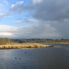
Indian Arm, Glacial fjord in British Columbia, Canada.

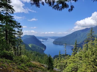
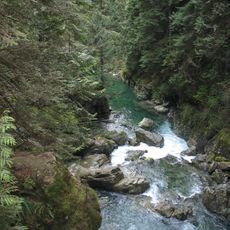
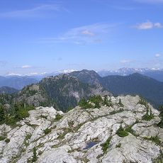
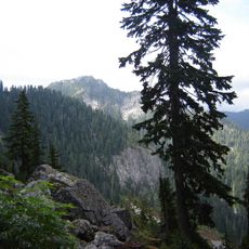
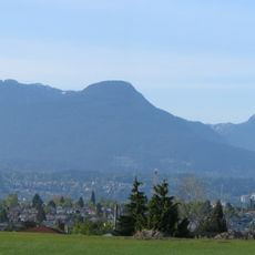
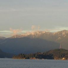
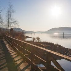
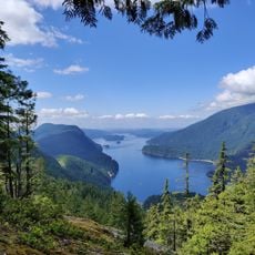
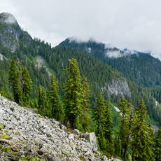
Indian Arm is a glacial fjord extending roughly 20 kilometers north from Burrard Inlet, bordered by steep granite cliffs, dense forests, and cascading waterfalls that run down the mountainsides. The waters run deep and are enclosed by towering shorelines that give the place a distinctive alpine character.

The fjord was mapped by Captain George Vancouver in the late 18th century, with detailed exploration following from Dionisio Alcalá Galiano in June 1792. These early expeditions established the foundation for European knowledge of this coastal region.

The Tsleil-Waututh First Nation holds deep ties to this waterway and co-manages Say Nuth Khaw Yum Provincial Park with BC Government along the shoreline. The place remains central to the daily life and traditions of the local indigenous community.

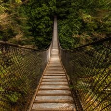
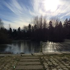
The best time for kayaking is between April and October when weather conditions are most favorable. Deep Cove in North Vancouver and Belcarra Regional Park serve as the main launch points for those wishing to explore the fjord by water.

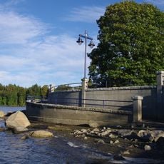
The Buntzen Generating Station on the eastern shore houses two hydroelectric plants that have powered Vancouver since the early 1900s. These facilities remain a lesser-known piece of industrial history hidden within the fjord's wilderness.

The community of curious travelers

AroundUs brings together thousands of curated places, local tips, and hidden gems, enriched daily by 60,000 contributors worldwide.

Start exploring
Location
GPS coordinates
49.36667,-122.88333
Latest update
December 7, 2025 19:31
Reviews
Share your experience

No review yet

Discussions
Start a discussion...

No discussion yet

« Indian Arm - Glacial fjord in British Columbia, Canada » is provided by Around Us (aroundus.com). Images and texts are derived from Wikimedia project under a Creative Commons license. You are allowed to copy, distribute, and modify copies of this page, under the conditions set by the license, as long as this note is clearly visible.

Discover hidden gems everywhere you go!

From secret cafés to breathtaking viewpoints, skip the crowded tourist spots and find places that match your style. Our app makes it easy with voice search, smart filtering, route optimization, and insider tips from travelers worldwide. Download now for the complete mobile experience.

Around Us App Screenshot

A unique approach to discovering new places

Le Figaro

All the places worth exploring

France Info

A tailor-made excursion in just a few clicks

20 Minutes

Around Us
Travel Guide & Maps
Download

Send to your phone

QR Code
1

Open the camera app on your mobile.

2

Point at the QR code with your camera. A notification will appear.

3

Tap the notification to open the link.