Chest opened
+${chestReward.xp} XP
Explorer
NOUVEAU ×${chestReward.collectible.quantity}
tapez pour fermer
Chest locked

Open chests in the app

Around Us is built for your phone — chests unlock when you walk, explore and capture nearby places.

Enable Location

We need your location to show you interesting places around you

Discover nearby places

Find interesting locations and hidden gems around you

Precise directions

Get accurate directions and distances to places

Your location is never shared with other users. It's only used when you tap the location button.

Kern River

Log in to your account

Start exploring — it's free

Trusted by 72,952 travelers worldwide

Continue with Google
Continue with Apple
or

We will send you a code to connect

By continuing, you accept our Terms and Conditions and our Privacy Policy

Check your inbox

We've sent a pincode in your inbox. Please enter the code below.

Kern River
Discussion Reviews 1 Photos
47.1k Popularity

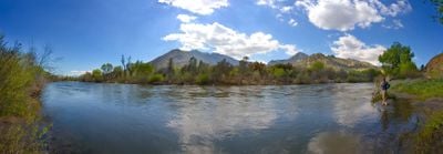
Kern River, River system in Sierra Nevada mountains, California.

The Kern River is a river system flowing through the Sierra Nevada mountains in California. The waterway descends from high mountain sources through deep canyons and eventually into the lower San Joaquin Valley.

Spanish missionaries first explored the area in the late 1700s and named the waterway after a saint. During the mid-1800s, the river received its current name, honoring a person involved in surveying the region.

The Yokuts Native American tribes lived along the river banks, using its resources for their daily needs and community traditions.

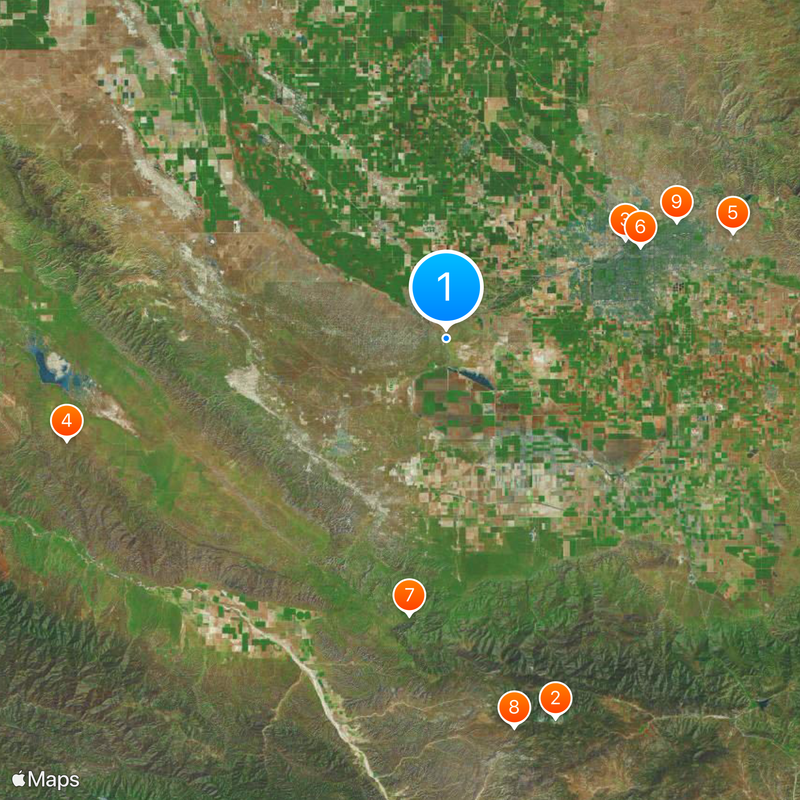
The river has different sections suitable for paddling and kayaking depending on your experience level. Camping and picnic areas are available in various locations, and it helps to check water conditions before planning your visit.

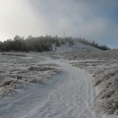
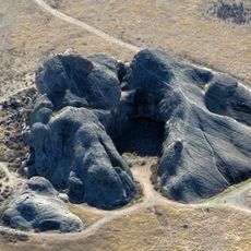
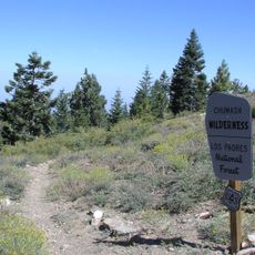
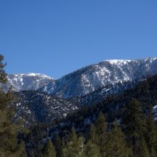
The North Fork section forms one of the longest glacially carved linear valleys on Earth. This deep canyon displays the powerful geological forces that shaped the landscape over thousands of years.

The community of curious travelers

AroundUs brings together thousands of curated places, local tips, and hidden gems, enriched daily by 60,000 contributors worldwide.

Start exploring
Location
GPS coordinates
35.26774,-119.30706
Latest update
December 14, 2025 19:38
Around this place
Mount Pinos
United States of America

Mount Pinos

52.7 km
Buck Owens Crystal Palace
United States of America

Buck Owens Crystal Palace

27.4 km
Painted Rock
United States of America

Painted Rock

52.3 km
Kevin Harvick's Kern Raceway
United States of America

Kevin Harvick's Kern Raceway

40.7 km
Fox Theater
United States of America

Fox Theater

28.6 km
Bitter Creek National Wildlife Refuge
United States of America

Bitter Creek National Wildlife Refuge

37.2 km
Chumash Wilderness
United States of America

Chumash Wilderness

52.7 km
Memorial Stadium
United States of America

Memorial Stadium

34.4 km
California Living Museum
United States of America

California Living Museum

42.5 km
Kern County Museum
United States of America

Kern County Museum

29.6 km
Wasco Union High School
United States of America

Wasco Union High School

36.6 km
United States of America

Antimony Peak

47 km
Caliente Mountain
United States of America

Caliente Mountain

48.6 km
Beale Memorial Clock Tower
United States of America

Beale Memorial Clock Tower

29.6 km
Bakersfield City Hall
United States of America

Bakersfield City Hall

28.6 km
Bakersfield Museum of Art
United States of America

Bakersfield Museum of Art

29.7 km
Sawmill Mountain
United States of America

Sawmill Mountain

52.2 km
Bakersfield California Building
United States of America

Bakersfield California Building

28.7 km
The Fort
United States of America

The Fort

19.4 km
Buena Vista Museum of Natural History
United States of America

Buena Vista Museum of Natural History

29 km
Baker Branch Library
United States of America

Baker Branch Library

31.6 km
Tevis Block
United States of America

Tevis Block

28.7 km
Jastro Building
United States of America

Jastro Building

28.6 km
Shafter Research Station
United States of America

Shafter Research Station

29.4 km
Kern County Chamber of Commerce Building
United States of America

Kern County Chamber of Commerce Building

29.6 km
Kern Veterans Memorial
United States of America

Kern Veterans Memorial

29.6 km
Alano Club Of Bakersfield
United States of America

Alano Club Of Bakersfield

30 km
Fort Preservation Society
United States of America

Fort Preservation Society

19.5 km
Show the full map
Reviews
Share your experience

No review yet

Discussions
Start a discussion...

No discussion yet

« Kern River - River system in Sierra Nevada mountains, California » is provided by Around Us (aroundus.com). Images and texts are derived from Wikimedia project under a Creative Commons license. You are allowed to copy, distribute, and modify copies of this page, under the conditions set by the license, as long as this note is clearly visible.

Discover hidden gems everywhere you go!

From secret cafés to breathtaking viewpoints, skip the crowded tourist spots and find places that match your style. Our app makes it easy with voice search, smart filtering, route optimization, and insider tips from travelers worldwide. Download now for the complete mobile experience.

Around Us App Screenshot

A unique approach to discovering new places

Le Figaro

All the places worth exploring

France Info

A tailor-made excursion in just a few clicks

20 Minutes

Around Us
Travel Guide & Maps
Download

Send to your phone

QR Code
1

Open the camera app on your mobile.

2

Point at the QR code with your camera. A notification will appear.

3

Tap the notification to open the link.