Enable Location

We need your location to show you interesting places around you

Discover nearby places

Find interesting locations and hidden gems around you

Precise directions

Get accurate directions and distances to places

Your location is never shared with other users. It's only used when you tap the location button.

Mount Pinos

Log in to your account

Start exploring — it's free

Trusted by 62,126 travelers worldwide

Continue with Google
Continue with Apple
or

We will send you a code to connect

By continuing, you accept our Terms and Conditions and our Privacy Policy

Check your inbox

We've sent a pincode in your inbox. Please enter the code below.

Mount Pinos

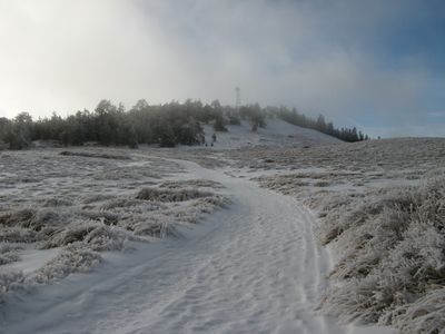
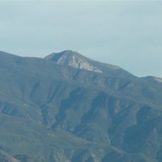
Mount Pinos, Mountain summit in Los Padres National Forest, California, US.

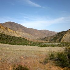
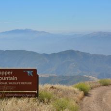
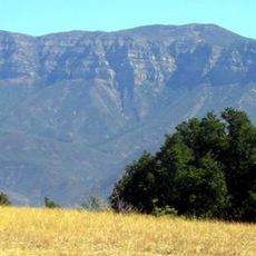
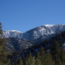
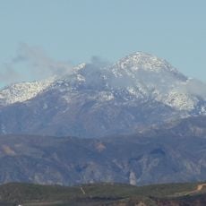
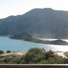
Mount Pinos is a summit in the Los Padres National Forest that rises above 8,800 feet, marking the boundary between Ventura and Kern counties with dense groves of Jeffrey pines and white firs covering its slopes. The mountain's location within the Transverse Range gives it a prominent position in Southern California's landscape.

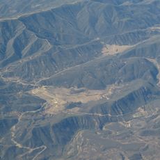
The mountain formed more than 100 million years ago as part of the Transverse Range, a geological structure shaped by intense crustal forces. The San Andreas Fault runs along its northern side, marking an active geological boundary that continues to shape the region.

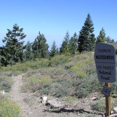
The Chumash people called this mountain Iwihinmu, and they regarded the summit as the spiritual center of their world. This sacred meaning remains part of local heritage and how the landscape is understood today.

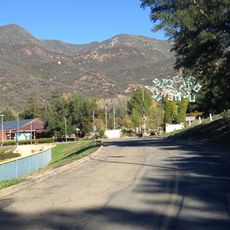
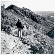
The hike to the summit covers roughly 3 kilometers from the trailhead at Los Padres National Forest Road S349S and demands moderate physical fitness. The path is generally well-marked, and visitors should allow a few hours for the round trip depending on their pace.

The summit sits high enough and far enough from cities that the night sky remains exceptionally dark and clear, making it a favored spot for stargazing. People who watch the sky are drawn here specifically for the quality of observations without light interference.

The community of curious travelers

AroundUs brings together thousands of curated places, local tips, and hidden gems, enriched daily by 60,000 contributors worldwide.

Start exploring
Location
GPS coordinates
34.81282,-119.14540
Latest update
December 7, 2025 20:20
Around this place
Show the full map
« Mount Pinos - Mountain summit in Los Padres National Forest, California, US » is provided by Around Us (aroundus.com). Images and texts are derived from Wikimedia project under a Creative Commons license. You are allowed to copy, distribute, and modify copies of this page, under the conditions set by the license, as long as this note is clearly visible.

Discover hidden gems everywhere you go!

From secret cafés to breathtaking viewpoints, skip the crowded tourist spots and find places that match your style. Our app makes it easy with voice search, smart filtering, route optimization, and insider tips from travelers worldwide. Download now for the complete mobile experience.

Around Us App Screenshot

A unique approach to discovering new places

Le Figaro

All the places worth exploring

France Info

A tailor-made excursion in just a few clicks

20 Minutes

Around Us
Travel Guide & Maps
Download

Send to your phone

QR Code
1

Open the camera app on your mobile.

2

Point at the QR code with your camera. A notification will appear.

3

Tap the notification to open the link.