·

Enable Location

We need your location to show you interesting places around you

Discover nearby places

Find interesting locations and hidden gems around you

Precise directions

Get accurate directions and distances to places

Your location is never shared with other users. It's only used when you tap the location button.

Caliente Mountain

Log in to your account

Start exploring — it's free

Trusted by 62,651 travelers worldwide

Continue with Google
Continue with Apple
or

We will send you a code to connect

By continuing, you accept our Terms and Conditions and our Privacy Policy

Check your inbox

We've sent a pincode in your inbox. Please enter the code below.

Caliente Mountain

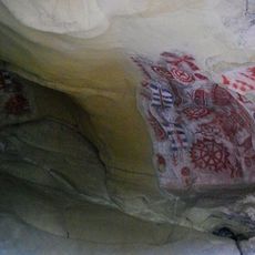
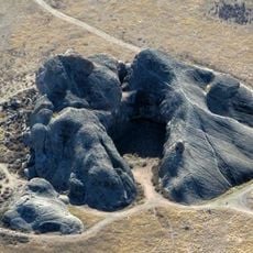
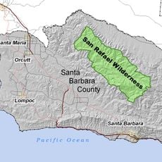
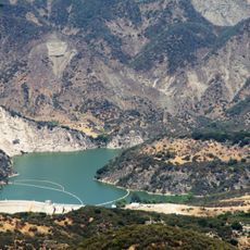
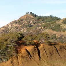
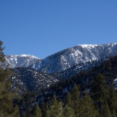
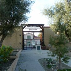
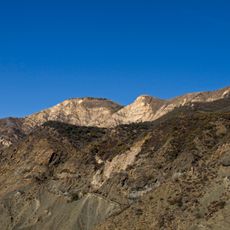
Caliente Mountain, Mountain summit in San Luis Obispo County, California, USA.

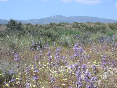
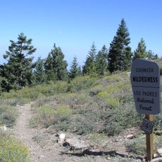
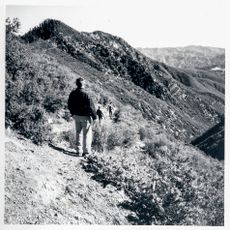
Caliente Mountain is a summit in San Luis Obispo County that rises to about 5,100 feet and forms the western boundary of the Carrizo Plains National Monument. The peak can be reached by hiking trails that cross the surrounding grassland and chaparral.

During World War II, military personnel stationed a lookout tower at the summit to observe the California coast. This military use marked an important chapter in the mountain's past as a strategic vantage point.

The Sierra Club's Angeles Chapter maintains a register inside the mountain tower, marking it as the only San Luis Obispo County peak above 5,000 feet.

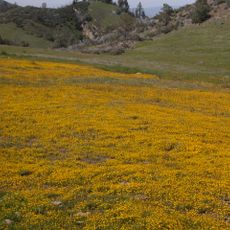
Spring offers the best hiking conditions with moderate temperatures and wildflowers blooming along the trails. The mountain is accessible year-round, but bring plenty of water and sturdy hiking boots for the terrain.

A white chevron marking adorns the summit and can be spotted from numerous vantage points across the plain. This distinctive sign helps hikers and observers locate the peak from far away.

The community of curious travelers

AroundUs brings together thousands of curated places, local tips, and hidden gems, enriched daily by 60,000 contributors worldwide.

Start exploring
Location
GPS coordinates
35.03632,-119.76047
Latest update
December 14, 2025 09:44
Around this place
Neverland Ranch
United States of America

Neverland Ranch

44.1 km
Mission Santa Inés
United States of America

Mission Santa Inés

60 km
Taft Correctional Institution
United States of America

Taft Correctional Institution

35.1 km
Knapp's Castle
United States of America

Knapp's Castle

57.2 km
Chumash Painted Cave State Historic Park
United States of America

Chumash Painted Cave State Historic Park

59.4 km
Painted Rock
United States of America

Painted Rock

15.3 km
Cold Spring Canyon Arch Bridge
United States of America

Cold Spring Canyon Arch Bridge

57.2 km
Figueroa Mountain
United States of America

Figueroa Mountain

38.5 km
San Rafael Wilderness
United States of America

San Rafael Wilderness

26.7 km
Bitter Creek National Wildlife Refuge
United States of America

Bitter Creek National Wildlife Refuge

38.2 km
Chumash Wilderness
United States of America

Chumash Wilderness

56.8 km
Twitchell Reservoir
United States of America

Twitchell Reservoir

52.4 km
Lake Cachuma
United States of America

Lake Cachuma

54 km
Gibraltar Dam
United States of America

Gibraltar Dam

57.1 km
La Cumbre Peak
United States of America

La Cumbre Peak

60.5 km
Solvang Vintage Motorcycle Museum
United States of America

Solvang Vintage Motorcycle Museum

59.9 km
Sawmill Mountain
United States of America

Sawmill Mountain

59.6 km
Big Caliente Hot Springs
United States of America

Big Caliente Hot Springs

58.2 km
The Fort
United States of America

The Fort

29.8 km
Los Alamos Ranch House
United States of America

Los Alamos Ranch House

60.2 km
Chapel of San Ramon
United States of America

Chapel of San Ramon

48.6 km
Little Pine Mountain
United States of America

Little Pine Mountain

48.5 km
Madulce Peak
United States of America

Madulce Peak

41.4 km
Elverhøj Museum of History and Art
United States of America

Elverhøj Museum of History and Art

60.6 km
Fort Preservation Society
United States of America

Fort Preservation Society

29.7 km
Solvang Park
United States of America

Solvang Park

60 km
Solvang Festival Theater
United States of America

Solvang Festival Theater

60.3 km
Zaca Creek Bridge No. 1
United States of America

Zaca Creek Bridge No. 1

57.4 km
Show the full map
« Caliente Mountain - Mountain summit in San Luis Obispo County, California, USA » is provided by Around Us (aroundus.com). Images and texts are derived from Wikimedia project under a Creative Commons license. You are allowed to copy, distribute, and modify copies of this page, under the conditions set by the license, as long as this note is clearly visible.

Discover hidden gems everywhere you go!

From secret cafés to breathtaking viewpoints, skip the crowded tourist spots and find places that match your style. Our app makes it easy with voice search, smart filtering, route optimization, and insider tips from travelers worldwide. Download now for the complete mobile experience.

Around Us App Screenshot

A unique approach to discovering new places

Le Figaro

All the places worth exploring

France Info

A tailor-made excursion in just a few clicks

20 Minutes

Around Us
Travel Guide & Maps
Download

Send to your phone

QR Code
1

Open the camera app on your mobile.

2

Point at the QR code with your camera. A notification will appear.

3

Tap the notification to open the link.