Enable Location

We need your location to show you interesting places around you

Discover nearby places

Find interesting locations and hidden gems around you

Precise directions

Get accurate directions and distances to places

Your location is never shared with other users. It's only used when you tap the location button.

Telescope Peak

Log in to your account

Start exploring — it's free

Trusted by 60,645 travelers worldwide

Continue with Google
Continue with Apple
or

We will send you a code to connect

By continuing, you accept our Terms and Conditions and our Privacy Policy

Check your inbox

We've sent a pincode in your inbox. Please enter the code below.

Telescope Peak

Telescope Peak, Mountain summit in Death Valley National Park, United States.

Description

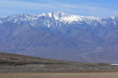
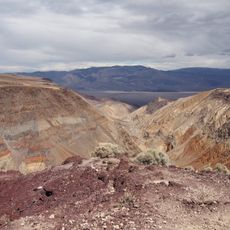
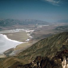
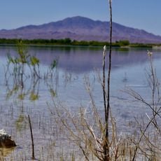
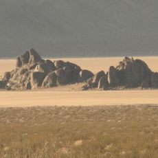
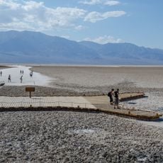
Telescope Peak is the highest point of the Panamint Range at 3,366 meters (11,043 feet). From the summit, you can see across Death Valley on one side and the Sierra Nevada mountains on the other.

History

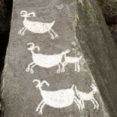
Indigenous peoples crossed the Panamint Range for centuries using seasonal routes between the surrounding valleys. The peak itself was named in the 19th century by surveyors working on early maps of California.

Culture

Native American tribes traversed the Panamint Range for generations, establishing seasonal pathways between valleys through the mountain passages.

Practical

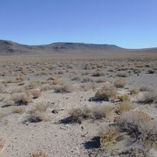
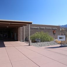
The hike to the summit takes several hours and starts from Mahogany Flat Campground. Bring plenty of water and watch the weather, as conditions can change quickly at this elevation.

Did you know?

On clear days, you can see both the lowest point in North America at Badwater Basin and snow-capped Sierra peaks from the summit at the same time. This rare view connects two extremes of elevation in one location.

Location
Elevation above the sea
3,366 m
GPS coordinates
36.16985,-117.08921
Latest update
December 7, 2025 10:04

AroundUs brings together thousands of curated places, local tips, and hidden gems, enriched daily by 60,000 contributors worldwide. Discover all places nearby (Inyo County).

Around this place
Death Valley
United States of America

Death Valley

37.7 km
Sailing stones
United States of America

Sailing stones

71 km
Barker Ranch
United States of America

Barker Ranch

34.5 km
Rainbow Canyon
United States of America

Rainbow Canyon

44.2 km
Trona Pinnacles
United States of America

Trona Pinnacles

66.5 km
Dante's View
United States of America

Dante's View

33 km
Amargosa Opera House and Hotel
United States of America

Amargosa Opera House and Hotel

62.3 km
Darwin Falls
United States of America

Darwin Falls

42.5 km
Ash Meadows National Wildlife Refuge
United States of America

Ash Meadows National Wildlife Refuge

75.2 km
Coso Rock Art District
United States of America

Coso Rock Art District

57.5 km
Darwin Falls Wilderness
United States of America

Darwin Falls Wilderness

49.7 km
The Grandstand
United States of America

The Grandstand

72.2 km
Coso Hot Springs
United States of America

Coso Hot Springs

62.8 km
Naval Museum of Armament & Technology
United States of America

Naval Museum of Armament & Technology

76 km
Eagle Borax Works
United States of America

Eagle Borax Works

20.3 km
T&T Ranch
United States of America

T&T Ranch

65 km
Racetrack mountain area
United States of America

Racetrack mountain area

71 km
Borax Museum
United States of America

Borax Museum

37.7 km
Jubilee Pass
United States of America

Jubilee Pass

54.2 km
Father Crowley Viewpoint
United States of America

Father Crowley Viewpoint

45.5 km
Salsberry Pass
United States of America

Salsberry Pass

65.3 km
Furnace Creek Visitor Center
United States of America

Furnace Creek Visitor Center

38.1 km
Mesquite Flat Sand Dunes
United States of America

Mesquite Flat Sand Dunes

54.6 km
Old Stovepipe Wells
United States of America

Old Stovepipe Wells

54.5 km
Stovepipe Wells Campground
United States of America

Stovepipe Wells Campground

49.1 km
Badwater Observation Point
United States of America

Badwater Observation Point

29.6 km
Trona Branch Library
United States of America

Trona Branch Library

52.8 km
Death Valley Junction Historic District
United States of America

Death Valley Junction Historic District

62.3 km
Show the full map
« Telescope Peak - Mountain summit in Death Valley National Park, United States » is provided by Around Us (aroundus.com). Images and texts are derived from Wikimedia project under a Creative Commons license. You are allowed to copy, distribute, and modify copies of this page, under the conditions set by the license, as long as this note is clearly visible.

Discover hidden gems everywhere you go!

From secret cafés to breathtaking viewpoints, skip the crowded tourist spots and find places that match your style. Our app makes it easy with voice search, smart filtering, route optimization, and insider tips from travelers worldwide. Download now for the complete mobile experience.

Around Us App Screenshot

A unique approach to discovering new places

Le Figaro

All the places worth exploring

France Info

A tailor-made excursion in just a few clicks

20 Minutes

Around Us
Travel Guide & Maps
Download

Send to your phone

QR Code
1

Open the camera app on your mobile.

2

Point at the QR code with your camera. A notification will appear.

3

Tap the notification to open the link.