Chest opened
+${chestReward.xp} XP
Explorer
NOUVEAU ×${chestReward.collectible.quantity}
tapez pour fermer
Chest locked

Open chests in the app

Around Us is built for your phone — chests unlock when you walk, explore and capture nearby places.

Enable Location

We need your location to show you interesting places around you

Discover nearby places

Find interesting locations and hidden gems around you

Precise directions

Get accurate directions and distances to places

Your location is never shared with other users. It's only used when you tap the location button.

Log in to your account

Start exploring — it's free

Trusted by 72,948 travelers worldwide

Continue with Google
Continue with Apple
or

We will send you a code to connect

By continuing, you accept our Terms and Conditions and our Privacy Policy

Check your inbox

We've sent a pincode in your inbox. Please enter the code below.

Pete Knight High School
Discussion Reviews Photo
17.4k Popularity

Pete Knight High School, four-year public high school located in Palmdale, California

Pete Knight High School is a secondary school in Palmdale serving grades nine through twelve and part of the Antelope Valley Union High School District. The campus features an open layout with classrooms, a gymnasium, and spacious outdoor areas where students move between classes throughout the day.

The school was founded several decades ago and has grown alongside Palmdale as the city expanded. Since its establishment, it has served as a central institution for local families and has educated generations of students.

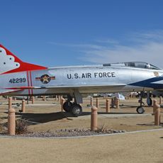
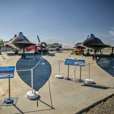
The school's name honors a local pilot and reflects Palmdale's strong connection to aviation history. This heritage shapes how students and families view the school's role within the broader identity of the area.

The school is accessible by local roads and provides parking areas for visitors and staff. The entire facility is designed to support both classroom learning and extracurricular activities with clear pathways and organized spaces.

The school has built strong connections with local organizations over the years and regularly hosts events that bring students and community members together. This creates a network that extends beyond typical school operations and deepens ties with surrounding neighborhoods.

The community of curious travelers

AroundUs brings together thousands of curated places, local tips, and hidden gems, enriched daily by 60,000 contributors worldwide.

Start exploring
Location
Palmdale
GPS coordinates
34.56399,-118.00865
Latest update
February 17, 2026 00:40
Around this place
Shambala Preserve
United States of America

Shambala Preserve

26.2 km
Devil's Punchbowl
United States of America

Devil's Punchbowl

22.7 km
Crystal Lake Recreation Area
United States of America

Crystal Lake Recreation Area

30.8 km
Scaled Composites Triumph
United States of America

Scaled Composites Triumph

8.5 km
San Gabriel Mountains National Monument
United States of America

San Gabriel Mountains National Monument

29.7 km
Mount Baden-Powell
United States of America

Mount Baden-Powell

32 km
Joe Davies Heritage Airpark
United States of America

Joe Davies Heritage Airpark

8.5 km
Antelope Valley Indian Museum State Historic Park
United States of America

Antelope Valley Indian Museum State Historic Park

17.5 km
Saddleback Butte State Park
United States of America

Saddleback Butte State Park

22.8 km
Gabrielino Trail
United States of America

Gabrielino Trail

33.6 km
Dry Town Water Park
United States of America

Dry Town Water Park

4.8 km
Littlerock Dam
United States of America

Littlerock Dam

8.8 km
Strawberry Peak
United States of America

Strawberry Peak

32.9 km
Mount Islip
United States of America

Mount Islip

28.9 km
Mount Burnham
United States of America

Mount Burnham

30.9 km
Vetter Mountain
United States of America

Vetter Mountain

29.8 km
United States of America

Waterman Mountain

26.2 km
Throop Peak
United States of America

Throop Peak

30.6 km
Windy Gap Trail
United States of America

Windy Gap Trail

29.6 km
Western Hotel
United States of America

Western Hotel

19.1 km
Stony Ridge Observatory
United States of America

Stony Ridge Observatory

29.3 km
Vasquez Rocks
United States of America

Vasquez Rocks

29.8 km
Blackbird Airpark
United States of America

Blackbird Airpark

8.3 km
Moah:cedar
United States of America

Moah:cedar

19.1 km
Elyze Clifford Interpretive Center
United States of America

Elyze Clifford Interpretive Center

20.5 km
Blackbird Airpark
United States of America

Blackbird Airpark

8.3 km
Vasquez Rocks Park
United States of America

Vasquez Rocks Park

29.8 km
Vetter Mountain Lookout
United States of America

Vetter Mountain Lookout

29.8 km
Show the full map
Reviews
Share your experience

No review yet

Discussions
Start a discussion...

No discussion yet

« Pete Knight High School - four-year public high school located in Palmdale, California » is provided by Around Us (aroundus.com). Images and texts are derived from Wikimedia project under a Creative Commons license. You are allowed to copy, distribute, and modify copies of this page, under the conditions set by the license, as long as this note is clearly visible.

Discover hidden gems everywhere you go!

From secret cafés to breathtaking viewpoints, skip the crowded tourist spots and find places that match your style. Our app makes it easy with voice search, smart filtering, route optimization, and insider tips from travelers worldwide. Download now for the complete mobile experience.

Around Us App Screenshot

A unique approach to discovering new places

Le Figaro

All the places worth exploring

France Info

A tailor-made excursion in just a few clicks

20 Minutes

Around Us
Travel Guide & Maps
Download

Send to your phone

QR Code
1

Open the camera app on your mobile.

2

Point at the QR code with your camera. A notification will appear.

3

Tap the notification to open the link.