·

Enable Location

We need your location to show you interesting places around you

Discover nearby places

Find interesting locations and hidden gems around you

Precise directions

Get accurate directions and distances to places

Your location is never shared with other users. It's only used when you tap the location button.

El Portal

Log in to your account

Start exploring — it's free

Trusted by 62,650 travelers worldwide

Continue with Google
Continue with Apple
or

We will send you a code to connect

By continuing, you accept our Terms and Conditions and our Privacy Policy

Check your inbox

We've sent a pincode in your inbox. Please enter the code below.

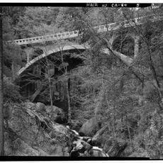
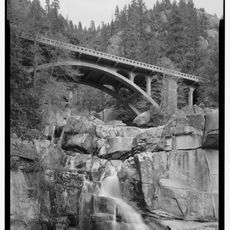
El Portal, Census-designated place in Mariposa County, United States

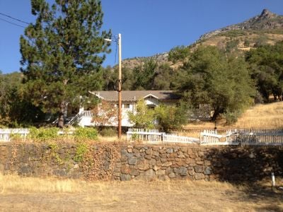
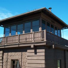
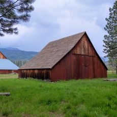
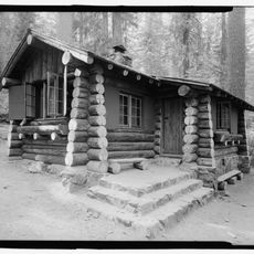
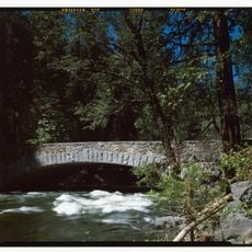
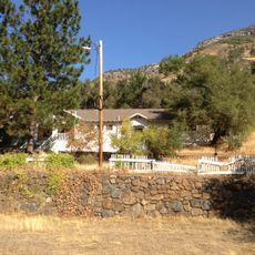
El Portal is a small settlement in Mariposa County positioned at about 600 feet elevation along State Route 140 and bordering the Merced River at the western entrance to Yosemite National Park. The community provides two hotels, a general store, gas station, post office, community center, and a small school for both residents and passing travelers.

The first post office opened in 1907, establishing the settlement as a supply point for travelers. The Hotel Del Portal, built in the early years, was destroyed by fire in 1917, marking a significant shift in the community's development.

This settlement serves as a gateway community where residents and local business owners have adapted their daily routines around serving visitors heading to Yosemite National Park. The place functions as a stopping point where travelers can find local services before or after their park visits.

Travelers can find all essential services on-site, including lodging, groceries, and fuel, making it a convenient stopping point before entering or after leaving the park. It makes sense to refuel or stock up on supplies here rather than waiting until the journey continues.

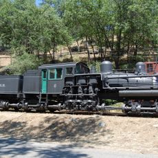
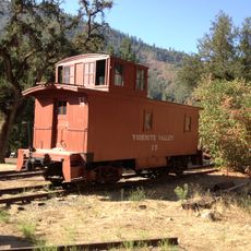
A historic locomotive numbered 6 from the Yosemite Valley Railroad sits in the community as a reminder that this location once marked the end of the rail line. The engine has been preserved since 1978 and tells the story of the region's railroad heritage.

The community of curious travelers

AroundUs brings together thousands of curated places, local tips, and hidden gems, enriched daily by 60,000 contributors worldwide.

Start exploring
Location
Elevation above the sea
591 m
GPS coordinates
37.67472,-119.78417
Latest update
December 8, 2025 13:40
Around this place
The Nose
United States of America

The Nose

14.3 km
Tunnel View
United States of America

Tunnel View

10.5 km
Ribbon Fall
United States of America

Ribbon Fall

13.8 km
Ferguson landslide
United States of America

Ferguson landslide

10.5 km
Crane Flat Campground
United States of America

Crane Flat Campground

8.3 km
Middle Cathedral Rock
United States of America

Middle Cathedral Rock

13.7 km
Silver Strand Falls
United States of America

Silver Strand Falls

10.6 km
Crane Flat Fire Lookout
United States of America

Crane Flat Fire Lookout

10 km
Hetch Hetchy Railroad 6
United States of America

Hetch Hetchy Railroad 6

202 m
McGurk Cabin
United States of America

McGurk Cabin

14.1 km
Henness Ridge Fire Lookout
United States of America

Henness Ridge Fire Lookout

6.8 km
Tamarack Flat Campground
United States of America

Tamarack Flat Campground

9.6 km
McCauley and Meyer Barns
United States of America

McCauley and Meyer Barns

4.3 km
Merced Grove Ranger Station
United States of America

Merced Grove Ranger Station

9.6 km
Bagby Stationhouse, Water Tanks and Turntable
United States of America

Bagby Stationhouse, Water Tanks and Turntable

145 m
Dead Giant Tunnel Tree
United States of America

Dead Giant Tunnel Tree

10.6 km
Crane Flat
United States of America

Crane Flat

11.3 km
Pohono Bridge
United States of America

Pohono Bridge

11.4 km
Tamarack Flat
United States of America

Tamarack Flat

9.5 km
South Fork Tuolumne River Bridge
United States of America

South Fork Tuolumne River Bridge

14.2 km
Dewey Point
United States of America

Dewey Point

12 km
Yosemite Valley Railroad Caboose No. 15
United States of America

Yosemite Valley Railroad Caboose No. 15

195 m
El Portal Old Schoolhouse
United States of America

El Portal Old Schoolhouse

251 m
Arch Rock
United States of America

Arch Rock

5 km
Arch Rock Entrance Station
United States of America

Arch Rock Entrance Station

4.9 km
Wildcat Creek Bridge
United States of America

Wildcat Creek Bridge

8.1 km
Tamarack Creek Bridge
United States of America

Tamarack Creek Bridge

8.5 km
Cascade Creek Bridge
United States of America

Cascade Creek Bridge

8.6 km
Show the full map
« El Portal - Census-designated place in Mariposa County, United States » is provided by Around Us (aroundus.com). Images and texts are derived from Wikimedia project under a Creative Commons license. You are allowed to copy, distribute, and modify copies of this page, under the conditions set by the license, as long as this note is clearly visible.

Discover hidden gems everywhere you go!

From secret cafés to breathtaking viewpoints, skip the crowded tourist spots and find places that match your style. Our app makes it easy with voice search, smart filtering, route optimization, and insider tips from travelers worldwide. Download now for the complete mobile experience.

Around Us App Screenshot

A unique approach to discovering new places

Le Figaro

All the places worth exploring

France Info

A tailor-made excursion in just a few clicks

20 Minutes

Around Us
Travel Guide & Maps
Download

Send to your phone

QR Code
1

Open the camera app on your mobile.

2

Point at the QR code with your camera. A notification will appear.

3

Tap the notification to open the link.