Enable Location

We need your location to show you interesting places around you

Discover nearby places

Find interesting locations and hidden gems around you

Precise directions

Get accurate directions and distances to places

Your location is never shared with other users. It's only used when you tap the location button.

Matterhorn Peak

Log in to your account

Start exploring — it's free

Trusted by 61,320 travelers worldwide

Continue with Google
Continue with Apple
or

We will send you a code to connect

By continuing, you accept our Terms and Conditions and our Privacy Policy

Check your inbox

We've sent a pincode in your inbox. Please enter the code below.

Matterhorn Peak

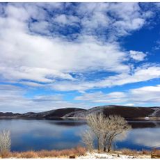
Matterhorn Peak, Mountain summit in Sierra Nevada, California.

Description

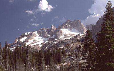
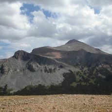
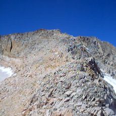
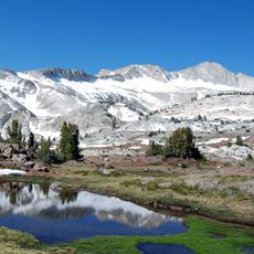
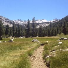
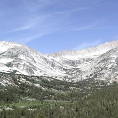
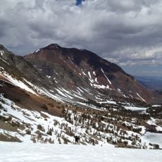
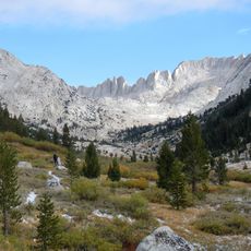
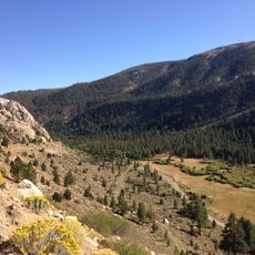
Matterhorn Peak is a granite summit in California's Sierra Nevada that marks the northern boundary of Yosemite National Park. The peak stands at 12,285 feet and forms part of the distinctive Sawtooth Ridge formation.

History

The peak was first documented as climbed by M.R. Dempster and his expedition in 1899. The route they established remains in use by climbers today.

Culture

Author Jack Kerouac featured Matterhorn Peak in his 1958 novel 'The Dharma Bums', describing his personal attempt to reach the summit.

Practical

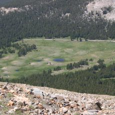
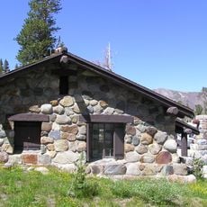
The Twin Lakes trailhead is the main starting point for reaching the summit. Overnight camping requires permits obtained in advance of your visit.

Did you know?

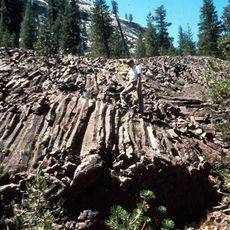
The summit holds the northernmost glacier system found along the Sierra Nevada range. This frozen feature marks a notable geological boundary in the northern mountains.

Location
Location
Location
Part of
Sierra Peaks Section Peaks List, Vagmarken Club Sierra Crest List
GPS coordinates
38.09304,-119.38170
Latest update
December 10, 2025 15:57

AroundUs brings together thousands of curated places, local tips, and hidden gems, enriched daily by 60,000 contributors worldwide. Discover all places nearby (Tuolumne County).

Around this place
Tioga Pass
United States of America

Tioga Pass

23 km
Mount Dana
United States of America

Mount Dana

25.7 km
Hoover Wilderness
United States of America

Hoover Wilderness

3.5 km
Mount Conness
United States of America

Mount Conness

15 km
Conness Glacier
United States of America

Conness Glacier

14.7 km
Tioga Pass Entrance Station
United States of America

Tioga Pass Entrance Station

23 km
Waterwheel Falls
United States of America

Waterwheel Falls

19.7 km
Glen Aulin High Sierra Camp
United States of America

Glen Aulin High Sierra Camp

20.7 km
Bridgeport Reservoir
United States of America

Bridgeport Reservoir

25.5 km
Little Devils Postpile
United States of America

Little Devils Postpile

21.6 km
Parsons Memorial Lodge
United States of America

Parsons Memorial Lodge

23.9 km
Lyell Canyon
United States of America

Lyell Canyon

26.4 km
Soda Springs Cabin
United States of America

Soda Springs Cabin

23.9 km
Great Sierra Mine Historic Site
United States of America

Great Sierra Mine Historic Site

20.9 km
Tuolumne Meadows Ranger Stations and Comfort Stations
United States of America

Tuolumne Meadows Ranger Stations and Comfort Stations

24.3 km
Mono County Courthouse
United States of America

Mono County Courthouse

22.6 km
United States of America

Victoria Peak

9.1 km
Hall Natural Area
United States of America

Hall Natural Area

16.8 km
Dunderberg Peak
United States of America

Dunderberg Peak

9.9 km
Yosemite Wilderness
United States of America

Yosemite Wilderness

23.7 km
Lee Vining Canyon
United States of America

Lee Vining Canyon

24.8 km
McCauley Cabin
United States of America

McCauley Cabin

24 km
Tuolumne Meadows Campground
United States of America

Tuolumne Meadows Campground

24.8 km
Tuolumne Meadows Ranger Station
United States of America

Tuolumne Meadows Ranger Station

24.3 km
Tuolumne Meadows Bridge
United States of America

Tuolumne Meadows Bridge

24.2 km
Tioga Lake Overlook
United States of America

Tioga Lake Overlook

22.1 km
Tioga Pass Road Valley View
United States of America

Tioga Pass Road Valley View

21.5 km
Lee Vining Canyon Bridge
United States of America

Lee Vining Canyon Bridge

21.5 km
Show the full map
« Matterhorn Peak - Mountain summit in Sierra Nevada, California » is provided by Around Us (aroundus.com). Images and texts are derived from Wikimedia project under a Creative Commons license. You are allowed to copy, distribute, and modify copies of this page, under the conditions set by the license, as long as this note is clearly visible.

Discover hidden gems everywhere you go!

From secret cafés to breathtaking viewpoints, skip the crowded tourist spots and find places that match your style. Our app makes it easy with voice search, smart filtering, route optimization, and insider tips from travelers worldwide. Download now for the complete mobile experience.

Around Us App Screenshot

A unique approach to discovering new places

Le Figaro

All the places worth exploring

France Info

A tailor-made excursion in just a few clicks

20 Minutes

Around Us
Travel Guide & Maps
Download

Send to your phone

QR Code
1

Open the camera app on your mobile.

2

Point at the QR code with your camera. A notification will appear.

3

Tap the notification to open the link.