Enable Location

We need your location to show you interesting places around you

Discover nearby places

Find interesting locations and hidden gems around you

Precise directions

Get accurate directions and distances to places

Your location is never shared with other users. It's only used when you tap the location button.

Goldfield

Log in to your account

Start exploring — it's free

Trusted by 61,616 travelers worldwide

Continue with Google
Continue with Apple
or

We will send you a code to connect

By continuing, you accept our Terms and Conditions and our Privacy Policy

Check your inbox

We've sent a pincode in your inbox. Please enter the code below.

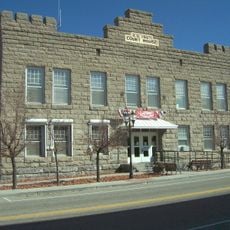
Goldfield, Mining heritage site in Nevada, United States.

Description

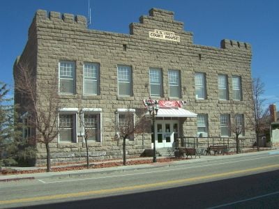
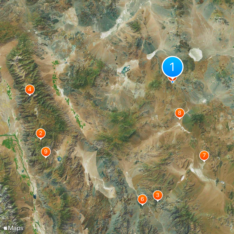
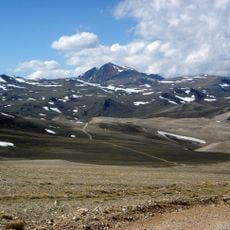
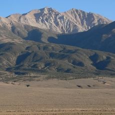
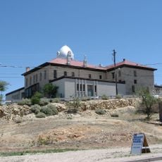
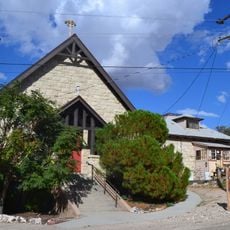
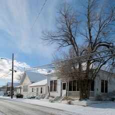
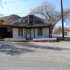
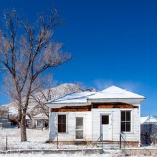
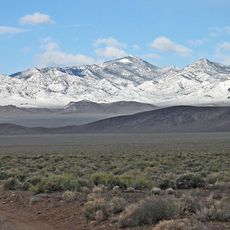
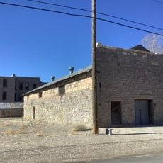
Goldfield is a former mining center in the desert of southwestern Nevada, situated at about 1,730 meters (5,680 feet) elevation in dry terrain. The area is surrounded by mountain ranges, and the town still retains the physical structures from its peak era.

History

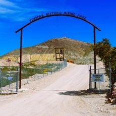
Gold was discovered in the area in 1902 and quickly turned it into Nevada's largest city six years later. The town experienced rapid growth followed by gradual decline as mining operations slowed down.

Culture

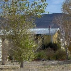
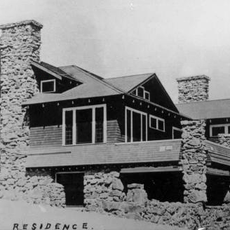
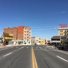
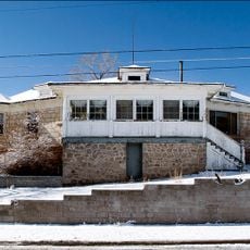
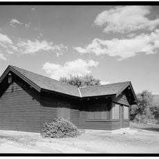
The buildings from around 1904 to 1909 in the town center show how settlements looked during the gold rush period. The craftsmanship and design choices of early mining-era construction remain visible along the streets today.

Practical

The town is easy to explore on foot, with most historic buildings located in the center. Visitors should prepare for dry climate and strong sun exposure, especially during warmer months.

Did you know?

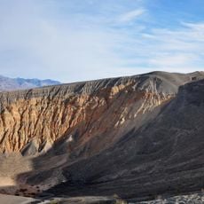
Between 1903 and 1940, the area yielded raw materials of significant economic worth, showing just how valuable the natural deposits were. This underground wealth drove the town's sudden rise.

Location
Inception
1902
Elevation above the sea
1,733 m
GPS coordinates
37.70854,-117.23563
Latest update
December 14, 2025 18:59

AroundUs brings together thousands of curated places, local tips, and hidden gems, enriched daily by 60,000 contributors worldwide. Discover all places nearby (Esmeralda County).

Around this place
Methuselah
United States of America

Methuselah

90.5 km
Scotty's Castle
United States of America

Scotty's Castle

75.9 km
White Mountain Peak
United States of America

White Mountain Peak

90.3 km
Goldfield Hotel
United States of America

Goldfield Hotel

41 m
Ubehebe Crater
United States of America

Ubehebe Crater

80.1 km
Shady Lady Ranch
United States of America

Shady Lady Ranch

54 km
Cottontail Ranch
United States of America

Cottontail Ranch

23.5 km
Combined Array for Research in Millimeter-wave Astronomy
United States of America

Combined Array for Research in Millimeter-wave Astronomy

93.2 km
Eureka Dunes
United States of America

Eureka Dunes

78.5 km
Esmeralda County Courthouse
United States of America

Esmeralda County Courthouse

129 m
White Mountains Wilderness
United States of America

White Mountains Wilderness

85.9 km
Goldfield Historic District
United States of America

Goldfield Historic District

129 m
George A. Bartlett House
United States of America

George A. Bartlett House

39.9 km
Nye County Courthouse
United States of America

Nye County Courthouse

39.8 km
State Bank and Trust Company Building
United States of America

State Bank and Trust Company Building

40 km
Tonopah Historic Mining Park
United States of America

Tonopah Historic Mining Park

40.1 km
St. Mark's Episcopal Church
United States of America

St. Mark's Episcopal Church

39.7 km
E.R. Shields House
United States of America

E.R. Shields House

39.8 km
John Gregovich House
United States of America

John Gregovich House

40 km
Judge W.A. Sawle House
United States of America

Judge W.A. Sawle House

39.9 km
Uri B. Curtis House
United States of America

Uri B. Curtis House

39.7 km
Grapevine Peak
United States of America

Grapevine Peak

83.1 km
Lower Vine Ranch
United States of America

Lower Vine Ranch

78 km
Death Valley Scotty Historic District
United States of America

Death Valley Scotty Historic District

78 km
Goldfield Visitor’s Center
United States of America

Goldfield Visitor’s Center

200 m
International Car Forest of The Last Church
United States of America

International Car Forest of The Last Church

1.3 km
White Mountain Research Center Summit Hut
United States of America

White Mountain Research Center Summit Hut

90.2 km
Mesquite Spring Campground
United States of America

Mesquite Spring Campground

83.8 km
Show the full map
« Goldfield - Mining heritage site in Nevada, United States » is provided by Around Us (aroundus.com). Images and texts are derived from Wikimedia project under a Creative Commons license. You are allowed to copy, distribute, and modify copies of this page, under the conditions set by the license, as long as this note is clearly visible.

Discover hidden gems everywhere you go!

From secret cafés to breathtaking viewpoints, skip the crowded tourist spots and find places that match your style. Our app makes it easy with voice search, smart filtering, route optimization, and insider tips from travelers worldwide. Download now for the complete mobile experience.

Around Us App Screenshot

A unique approach to discovering new places

Le Figaro

All the places worth exploring

France Info

A tailor-made excursion in just a few clicks

20 Minutes

Around Us
Travel Guide & Maps
Download

Send to your phone

QR Code
1

Open the camera app on your mobile.

2

Point at the QR code with your camera. A notification will appear.

3

Tap the notification to open the link.