Esmeralda County

Log in to your account

AroundUs is a community-driven map of interesting places, built by curious explorers like you. It grows with every review, story, and photo you share.
Connect to save your favorite spots, contribute locations, and create personalized routes.
Continue with Google
Continue with Apple
Continue with X
Continue with Facebook
Continue with email
By continuing, you accept our Terms and Conditions and our Privacy Policy
Create an account
Add to collection
Map
Suggest a change
Share

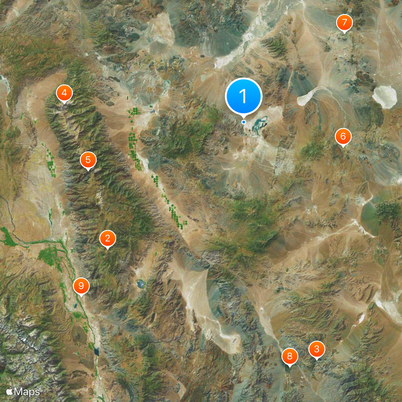
Esmeralda County, Administrative division in southwestern Nevada, United States.

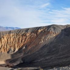
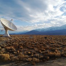
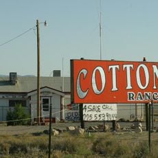
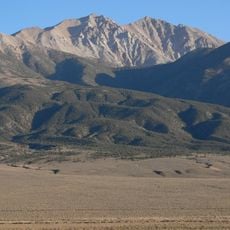
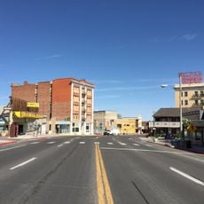
Esmeralda County is an administrative region in southwestern Nevada that spans vast desert landscapes with mountain ranges, valleys, and many abandoned mining settlements scattered throughout. The area is characterized by sparsely populated towns, with Goldfield serving as the county seat.

The area was established in 1861 during Nevada's territorial period and experienced growth through silver mining in the late 1800s, which drew many settlers to the region. Mining operations defined the economic development for much of that era.

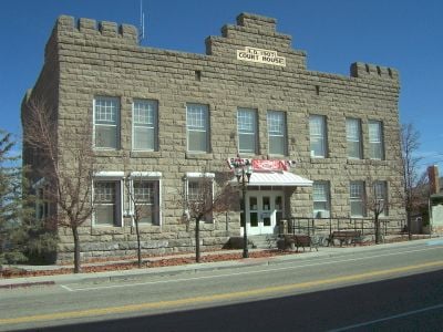
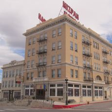
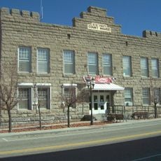
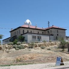
The Esmeralda County courthouse in Goldfield, constructed in 1908, functions as both an administrative center and a symbol of local governmental traditions.

Access is provided by Nevada State Route 95, which connects the main towns throughout the area. Infrastructure is sparse, so plan ahead with adequate supplies and fuel before traveling through this lightly populated region.

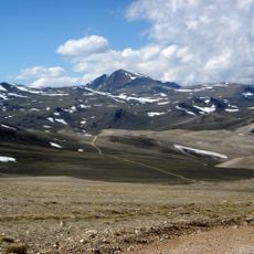
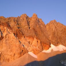
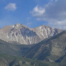
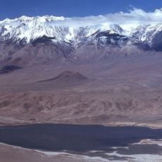
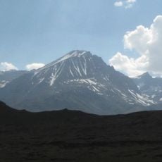
The area contains Boundary Peak, located at the highest elevation in Nevada and serving as a striking geographical landmark. This mountain rises prominently above the surrounding desert landscape and shapes the region's appearance.

Location: Nevada

Inception: November 25, 1861

Capital city: Goldfield

Elevation above the sea: 1,310 m

Shares border with: Mineral County, Nye County, Inyo County, Mono County

Website: https://accessesmeralda.com

GPS coordinates: 37.78470,-117.63237

Latest update: December 19, 2025 22:44

Photos
Around this place
Methuselah
United States of America

Methuselah

65.5 km
Scotty's Castle
United States of America

Scotty's Castle

87.6 km
Boundary Peak
United States of America

Boundary Peak

63.6 km
White Mountain Peak
United States of America

White Mountain Peak

57.4 km
Goldfield Hotel
United States of America

Goldfield Hotel

35.9 km
Mizpah Hotel
United States of America

Mizpah Hotel

47.4 km
Ubehebe Crater
United States of America

Ubehebe Crater

87.8 km
Owens Valley Radio Observatory
United States of America

Owens Valley Radio Observatory

84 km
Cottontail Ranch
United States of America

Cottontail Ranch

50.5 km
Combined Array for Research in Millimeter-wave Astronomy
United States of America

Combined Array for Research in Millimeter-wave Astronomy

71.9 km
Eureka Dunes
United States of America

Eureka Dunes

76.8 km
Split Mountain
United States of America

Split Mountain

110 km
United States of America

Keough Hot Springs

88.3 km
United States of America

Piper Mountain Wilderness

57.6 km
United States of America

Sylvania Mountains Wilderness

47 km
Montgomery Peak
United States of America

Montgomery Peak

64 km
Tinemaha Reservoir
United States of America

Tinemaha Reservoir

96.4 km
United States of America

Boundary Peak Wilderness

63.5 km
Owens Valley Solar Array
United States of America

Owens Valley Solar Array

84.1 km
Esmeralda County Courthouse
United States of America

Esmeralda County Courthouse

36.1 km
White Mountains Wilderness
United States of America

White Mountains Wilderness

53.6 km
Goldfield Historic District
United States of America

Goldfield Historic District

36.1 km
George A. Bartlett House
United States of America

George A. Bartlett House

46.9 km
Birch Mountain
United States of America

Birch Mountain

106.3 km
OVRO 40 meter Telescope
United States of America

OVRO 40 meter Telescope

84.1 km
Nye County Courthouse
United States of America

Nye County Courthouse

47.4 km
United States of America

Stone Jail Building and Row House

47.6 km
State Bank and Trust Company Building
United States of America

State Bank and Trust Company Building

47.3 km
Show the full map
Reviews

Visited this place? Tap the stars to rate it and share your experience / photos with the community! Try now! You can cancel it anytime.

« Esmeralda County - Administrative division in southwestern Nevada, United States » is provided by Around Us (aroundus.com). Images and texts are derived from Wikimedia project under a Creative Commons license. You are allowed to copy, distribute, and modify copies of this page, under the conditions set by the license, as long as this note is clearly visible.

Discover hidden gems everywhere you go!

From secret cafés to breathtaking viewpoints, skip the crowded tourist spots and find places that match your style. Our app makes it easy with voice search, smart filtering, route optimization, and insider tips from travelers worldwide. Download now for the complete mobile experience.

Around Us App Screenshot

A unique approach to discovering new places

Le Figaro

All the places worth exploring

France Info

A tailor-made excursion in just a few clicks

20 Minutes