Enable Location

We need your location to show you interesting places around you

Discover nearby places

Find interesting locations and hidden gems around you

Precise directions

Get accurate directions and distances to places

Your location is never shared with other users. It's only used when you tap the location button.

Log in to your account

Start exploring — it's free

Trusted by 62,477 travelers worldwide

Continue with Google
Continue with Apple
or

We will send you a code to connect

By continuing, you accept our Terms and Conditions and our Privacy Policy

Check your inbox

We've sent a pincode in your inbox. Please enter the code below.

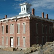
Stone Jail Building and Row House, The Stone Jail Building and Row House are two adjacent stone buildings located on Water Street in Tonopah, Nevada

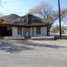
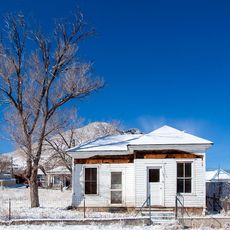
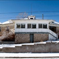
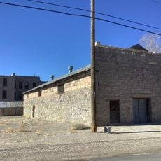
The Stone Jail Building and Row House are two stone structures on Water Street in Tonopah, Nevada, constructed in 1903 and 1908 respectively. The jail is a small, one-story building with irregular stones and original steel barred windows, while the row house contains three separate rooms each with its own entrance and window.

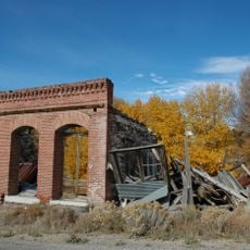
The jail was built in 1903 as a more permanent replacement for an earlier timber structure following Tonopah's rapid growth after silver ore was discovered in 1900. The row house was constructed in 1908, and both buildings were added to the National Register of Historic Places in 1982.

The jail and row house reflected the informal social order of an early mining town, where law enforcement and less reputable activities coexisted on the same street. The row house's separate rooms reveal how the town managed different aspects of its economy during the silver boom.

The structures are located in central Tonopah on Water Street and are easily accessible on foot. Visitors can view the exteriors freely and appreciate the simple, sturdy stonework up close.

The jail was temporarily converted into a garage and both buildings later served as a brothel, revealing how Tonopah's early structures adapted to the town's changing economic needs. This practical reuse shows how frontier communities repurposed buildings as circumstances shifted.

The community of curious travelers

AroundUs brings together thousands of curated places, local tips, and hidden gems, enriched daily by 60,000 contributors worldwide.

Start exploring
Location
GPS coordinates
38.07167,-117.23056
Latest update
February 9, 2026 11:07
Around this place
Boundary Peak
United States of America

Boundary Peak

101.5 km
White Mountain Peak
United States of America

White Mountain Peak

102.4 km
Goldfield Hotel
United States of America

Goldfield Hotel

40.5 km
Berlin Historic District
United States of America

Berlin Historic District

96 km
Mizpah Hotel
United States of America

Mizpah Hotel

405 m
Shady Lady Ranch
United States of America

Shady Lady Ranch

92.6 km
Cottontail Ranch
United States of America

Cottontail Ranch

63.7 km
Berlin–Ichthyosaur State Park
United States of America

Berlin–Ichthyosaur State Park

95.3 km
Belmont
United States of America

Belmont

65.9 km
Arc Dome
United States of America

Arc Dome

85.4 km
Montgomery Peak
United States of America

Montgomery Peak

102.2 km
Arc Dome Wilderness
United States of America

Arc Dome Wilderness

81.8 km
Belmont Courthouse State Historic Park
United States of America

Belmont Courthouse State Historic Park

66.1 km
Alta Toquima Wilderness
United States of America

Alta Toquima Wilderness

84.2 km
Esmeralda County Courthouse
United States of America

Esmeralda County Courthouse

40.4 km
White Mountains Wilderness
United States of America

White Mountains Wilderness

99.4 km
Goldfield Historic District
United States of America

Goldfield Historic District

40.4 km
George A. Bartlett House
United States of America

George A. Bartlett House

654 m
Nye County Courthouse
United States of America

Nye County Courthouse

735 m
State Bank and Trust Company Building
United States of America

State Bank and Trust Company Building

423 m
Tonopah Historic Mining Park
United States of America

Tonopah Historic Mining Park

327 m
St. Mark's Episcopal Church
United States of America

St. Mark's Episcopal Church

721 m
E.R. Shields House
United States of America

E.R. Shields House

669 m
John Gregovich House
United States of America

John Gregovich House

494 m
Judge W.A. Sawle House
United States of America

Judge W.A. Sawle House

512 m
Uri B. Curtis House
United States of America

Uri B. Curtis House

743 m
Goldfield Visitor’s Center
United States of America

Goldfield Visitor’s Center

40.3 km
International Car Forest of The Last Church
United States of America

International Car Forest of The Last Church

41.6 km
Show the full map
« Stone Jail Building and Row House - The Stone Jail Building and Row House are two adjacent stone buildings located on Water Street in Tonopah, Nevada » is provided by Around Us (aroundus.com). Images and texts are derived from Wikimedia project under a Creative Commons license. You are allowed to copy, distribute, and modify copies of this page, under the conditions set by the license, as long as this note is clearly visible.

Discover hidden gems everywhere you go!

From secret cafés to breathtaking viewpoints, skip the crowded tourist spots and find places that match your style. Our app makes it easy with voice search, smart filtering, route optimization, and insider tips from travelers worldwide. Download now for the complete mobile experience.

Around Us App Screenshot

A unique approach to discovering new places

Le Figaro

All the places worth exploring

France Info

A tailor-made excursion in just a few clicks

20 Minutes

Around Us
Travel Guide & Maps
Download

Send to your phone

QR Code
1

Open the camera app on your mobile.

2

Point at the QR code with your camera. A notification will appear.

3

Tap the notification to open the link.