Enable Location

We need your location to show you interesting places around you

Discover nearby places

Find interesting locations and hidden gems around you

Precise directions

Get accurate directions and distances to places

Your location is never shared with other users. It's only used when you tap the location button.

Goldfield Historic District

Log in to your account

Start exploring — it's free

Trusted by 62,180 travelers worldwide

Continue with Google
Continue with Apple
or

We will send you a code to connect

By continuing, you accept our Terms and Conditions and our Privacy Policy

Check your inbox

We've sent a pincode in your inbox. Please enter the code below.

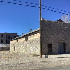
Goldfield Historic District, Historic district in Goldfield, Nevada, US.

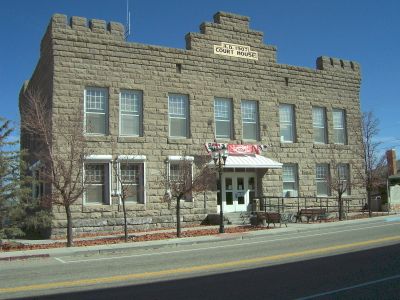
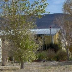
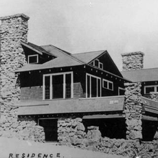
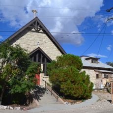
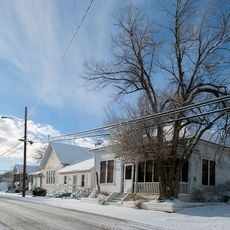
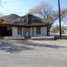
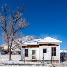
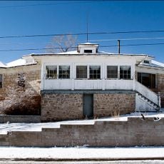
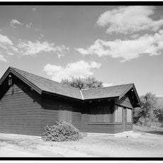
The Goldfield Historic District is a neighborhood with around 120 preserved buildings constructed between 1904 and 1909 during the city's rapid growth. The area spans several blocks and shows houses, shops, and other structures from this mining boom era.

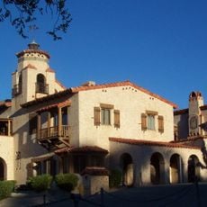
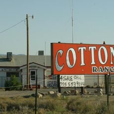
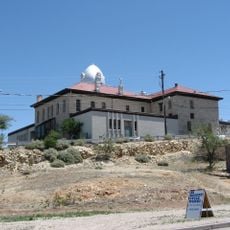
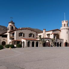
The city emerged around 1900 when gold discoveries drew thousands of people who quickly built one of Nevada's largest cities here. A major fire in 1923 destroyed many buildings, but several structures like the Goldfield Hotel survived and still stand today.

The buildings here reflect different architectural styles from the gold boom era, including Craftsman and Georgian Revival designs that show the city's former wealth. Walking through, you notice how these varied styles sit side by side, telling the story of a prosperous mining community.

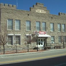
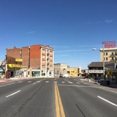
You can walk through the neighborhood and view preserved buildings like the Goldfield Hotel and the Consolidated Mines Building from the outside. Watch for information signs and markers throughout the area that help explain the different locations and structures you see.

The Goldfield Hotel is one of the few buildings that survived the city's most destructive fire in 1923 without damage and kept its original structure. The building tells the story of the mining town's resilience through its survival.

The community of curious travelers

AroundUs brings together thousands of curated places, local tips, and hidden gems, enriched daily by 60,000 contributors worldwide.

Start exploring
Location
GPS coordinates
37.70861,-117.23417
Latest update
December 14, 2025 17:03
Around this place
Methuselah
United States of America

Methuselah

90.7 km
Scotty's Castle
United States of America

Scotty's Castle

75.9 km
White Mountain Peak
United States of America

White Mountain Peak

90.4 km
Goldfield Hotel
United States of America

Goldfield Hotel

137 m
Ubehebe Crater
United States of America

Ubehebe Crater

80.1 km
Shady Lady Ranch
United States of America

Shady Lady Ranch

53.9 km
Cottontail Ranch
United States of America

Cottontail Ranch

23.5 km
Combined Array for Research in Millimeter-wave Astronomy
United States of America

Combined Array for Research in Millimeter-wave Astronomy

93.3 km
Eureka Dunes
United States of America

Eureka Dunes

78.6 km
Fallon Range Training Complex
United States of America

Fallon Range Training Complex

93.6 km
Esmeralda County Courthouse
United States of America

Esmeralda County Courthouse

0 m
White Mountains Wilderness
United States of America

White Mountains Wilderness

86 km
George A. Bartlett House
United States of America

George A. Bartlett House

39.9 km
Nye County Courthouse
United States of America

Nye County Courthouse

39.8 km
State Bank and Trust Company Building
United States of America

State Bank and Trust Company Building

40 km
Tonopah Historic Mining Park
United States of America

Tonopah Historic Mining Park

40.1 km
St. Mark's Episcopal Church
United States of America

St. Mark's Episcopal Church

39.7 km
E.R. Shields House
United States of America

E.R. Shields House

39.8 km
John Gregovich House
United States of America

John Gregovich House

40 km
Judge W.A. Sawle House
United States of America

Judge W.A. Sawle House

39.9 km
Uri B. Curtis House
United States of America

Uri B. Curtis House

39.7 km
Grapevine Peak
United States of America

Grapevine Peak

83.1 km
Lower Vine Ranch
United States of America

Lower Vine Ranch

78 km
Death Valley Scotty Historic District
United States of America

Death Valley Scotty Historic District

78 km
Goldfield Visitor’s Center
United States of America

Goldfield Visitor’s Center

319 m
International Car Forest of The Last Church
United States of America

International Car Forest of The Last Church

1.3 km
White Mountain Research Center Summit Hut
United States of America

White Mountain Research Center Summit Hut

90.4 km
Mesquite Spring Campground
United States of America

Mesquite Spring Campground

83.9 km
Show the full map
« Goldfield Historic District - Historic district in Goldfield, Nevada, US » is provided by Around Us (aroundus.com). Images and texts are derived from Wikimedia project under a Creative Commons license. You are allowed to copy, distribute, and modify copies of this page, under the conditions set by the license, as long as this note is clearly visible.

Discover hidden gems everywhere you go!

From secret cafés to breathtaking viewpoints, skip the crowded tourist spots and find places that match your style. Our app makes it easy with voice search, smart filtering, route optimization, and insider tips from travelers worldwide. Download now for the complete mobile experience.

Around Us App Screenshot

A unique approach to discovering new places

Le Figaro

All the places worth exploring

France Info

A tailor-made excursion in just a few clicks

20 Minutes

Around Us
Travel Guide & Maps
Download

Send to your phone

QR Code
1

Open the camera app on your mobile.

2

Point at the QR code with your camera. A notification will appear.

3

Tap the notification to open the link.