Chest opened
+${chestReward.xp} XP
Explorer
NOUVEAU ×${chestReward.collectible.quantity}
tapez pour fermer
Chest locked

Open chests in the app

Around Us is built for your phone — chests unlock when you walk, explore and capture nearby places.

Enable Location

We need your location to show you interesting places around you

Discover nearby places

Find interesting locations and hidden gems around you

Precise directions

Get accurate directions and distances to places

Your location is never shared with other users. It's only used when you tap the location button.

Laughlin/Bullhead International Airport

Log in to your account

Start exploring — it's free

Trusted by 73,057 travelers worldwide

Continue with Google
Continue with Apple
or

We will send you a code to connect

By continuing, you accept our Terms and Conditions and our Privacy Policy

Check your inbox

We've sent a pincode in your inbox. Please enter the code below.

Laughlin/Bullhead International Airport
Discussion Reviews 2 Photos
22.2k Popularity

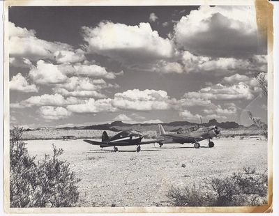
Laughlin/Bullhead International Airport, airport

Laughlin/Bullhead International Airport is an international airport in Arizona that serves the border region between Nevada and Arizona. The facility has one runway and basic terminal facilities for passengers traveling to the casinos and tourist destinations in the area.

The airport was developed to support the rapidly growing tourism industry in the casino region around Laughlin. Its opening created a direct connection for visitors from distant regions.

The airport is relatively compact and easy to navigate, with good signage for passengers. Its proximity to Laughlin and Bullhead City makes it convenient for visitors who plan to drive to their destinations.

The airport serves both Laughlin in Nevada and Bullhead City in Arizona from a single location. This dual-city arrangement makes it a unique hub for two adjacent gambling destinations.

The community of curious travelers

AroundUs brings together thousands of curated places, local tips, and hidden gems, enriched daily by 60,000 contributors worldwide.

Start exploring
Location
Operator
Mohave County Airport Authority
Phone
GPS coordinates
35.15750,-114.55944
Latest update
December 14, 2025 17:20
Around this place
Atchison, Topeka and Santa Fe Railway 3759
United States of America

Atchison, Topeka and Santa Fe Railway 3759

45.7 km
Grapevine Canyon Petroglyphs
United States of America

Grapevine Canyon Petroglyphs

13.9 km
Havasu National Wildlife Refuge
United States of America

Havasu National Wildlife Refuge

41.3 km
Spirit Mountain
United States of America

Spirit Mountain

19.9 km
AT&T Building
United States of America

AT&T Building

46.2 km
Dead Mountains
United States of America

Dead Mountains

24.3 km
Spirit Mountain Wilderness
United States of America

Spirit Mountain Wilderness

14.3 km
Warm Springs Wilderness
United States of America

Warm Springs Wilderness

37 km
United States of America

Bridge Canyon Wilderness

14.9 km
Boundary Cone
United States of America

Boundary Cone

23.3 km
Hardyville Cemetery
United States of America

Hardyville Cemetery

4.8 km
Grapevine Canyon
United States of America

Grapevine Canyon

13.9 km
United States of America

Alexey W. Von Schmidt

18.5 km
Mohave Museum of History and Arts
United States of America

Mohave Museum of History and Arts

45.5 km
Saint Mary's Catholic Church
United States of America

Saint Mary's Catholic Church

46.2 km
Kingman Commercial Historic District
United States of America

Kingman Commercial Historic District

46.3 km
Tyrell House
United States of America

Tyrell House

45.8 km
G. H. Sullivan Lodging House
United States of America

G. H. Sullivan Lodging House

46.1 km
Masonic Temple
United States of America

Masonic Temple

46.3 km
Mohave County Hospital
United States of America

Mohave County Hospital

45.7 km
Oatman Drug Company Building
United States of America

Oatman Drug Company Building

21.8 km
Hubbs House
United States of America

Hubbs House

46.3 km
House at 105 Spring St.
United States of America

House at 105 Spring St.

45.9 km
Foster S. Dennis House
United States of America

Foster S. Dennis House

45.9 km
Little Red School
United States of America

Little Red School

46.3 km
House at 809 Grand View
United States of America

House at 809 Grand View

45.6 km
J. B. Wright House
United States of America

J. B. Wright House

46.3 km
W. P. Mahoney House
United States of America

W. P. Mahoney House

46.1 km
Show the full map
Reviews
Share your experience

No review yet

Discussions
Start a discussion...

No discussion yet

« Laughlin/Bullhead International Airport - airport » is provided by Around Us (aroundus.com). Images and texts are derived from Wikimedia project under a Creative Commons license. You are allowed to copy, distribute, and modify copies of this page, under the conditions set by the license, as long as this note is clearly visible.

Discover hidden gems everywhere you go!

From secret cafés to breathtaking viewpoints, skip the crowded tourist spots and find places that match your style. Our app makes it easy with voice search, smart filtering, route optimization, and insider tips from travelers worldwide. Download now for the complete mobile experience.

Around Us App Screenshot

A unique approach to discovering new places

Le Figaro

All the places worth exploring

France Info

A tailor-made excursion in just a few clicks

20 Minutes

Around Us
Travel Guide & Maps
Download

Send to your phone

QR Code
1

Open the camera app on your mobile.

2

Point at the QR code with your camera. A notification will appear.

3

Tap the notification to open the link.