Chest opened
+${chestReward.xp} XP
Explorer
NOUVEAU ×${chestReward.collectible.quantity}
tapez pour fermer
Chest locked

Open chests in the app

Around Us is built for your phone — chests unlock when you walk, explore and capture nearby places.

Enable Location

We need your location to show you interesting places around you

Discover nearby places

Find interesting locations and hidden gems around you

Precise directions

Get accurate directions and distances to places

Your location is never shared with other users. It's only used when you tap the location button.

Operation Sunbeam

Log in to your account

Start exploring — it's free

Trusted by 72,887 travelers worldwide

Continue with Google
Continue with Apple
or

We will send you a code to connect

By continuing, you accept our Terms and Conditions and our Privacy Policy

Check your inbox

We've sent a pincode in your inbox. Please enter the code below.

Operation Sunbeam
Discussion Reviews 1 Photos
15.4k Popularity

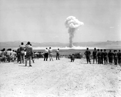
Operation Sunbeam, four nuclear tests at Nevada Test Site in 1962

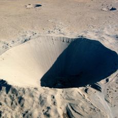
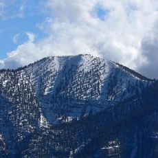
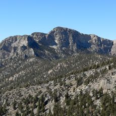
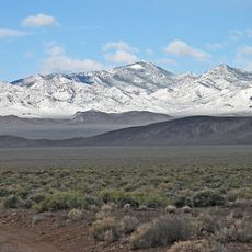
Operation Sunbeam was a series of four nuclear tests conducted by the United States at the Nevada Test Site in July 1962. The tests included both ground and tower detonations at locations such as Frenchman Flat and Buckboard Mesa to study how small nuclear devices behave and affect their surroundings.

This test series marked the last time the United States tested nuclear weapons in the open air at the Nevada site before shifting to underground testing. The shift followed growing international pressures and the later Partial Test Ban Treaty, which prompted a change in testing practices for safety and environmental reasons.

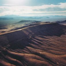
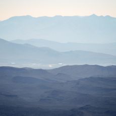
The Nevada Test Site is not accessible to the general public today and remains in a remote desert area of Nevada. Visitors seeking to learn about the tests must arrange special authorization or join official tours organized by relevant authorities.

One of the most notable tests in this series was the Davy Crockett, which demonstrated extremely small nuclear weapon capabilities and pushed the boundaries of miniaturization. The series also included experiments studying electromagnetic pulse effects on electronic systems, knowledge that later informed military defense strategies.

The community of curious travelers

AroundUs brings together thousands of curated places, local tips, and hidden gems, enriched daily by 60,000 contributors worldwide.

Start exploring
GPS coordinates
37.13610,-116.06900
Latest update
February 20, 2026 00:01
Around this place
Death Valley
United States of America

Death Valley

103.7 km
Devils Hole
United States of America

Devils Hole

81.6 km
Charleston Peak
United States of America

Charleston Peak

101.8 km
Sedan Crater
United States of America

Sedan Crater

5 km
Yucca Mountain
United States of America

Yucca Mountain

40.6 km
Amargosa Opera House and Hotel
United States of America

Amargosa Opera House and Hotel

97.8 km
Tikaboo Peak
United States of America

Tikaboo Peak

67.1 km
Shady Lady Ranch
United States of America

Shady Lady Ranch

84.4 km
Ash Meadows National Wildlife Refuge
United States of America

Ash Meadows National Wildlife Refuge

82 km
Harmony Borax Works
United States of America

Harmony Borax Works

102.3 km
Goldwell Open Air Museum
United States of America

Goldwell Open Air Museum

73.3 km
Cottontail Ranch
United States of America

Cottontail Ranch

106.8 km
Tule Springs Fossil Beds National Monument
United States of America

Tule Springs Fossil Beds National Monument

103.2 km
Angel's Ladies
United States of America

Angel's Ladies

63.2 km
Desert National Wildlife Range
United States of America

Desert National Wildlife Range

69.9 km
Fallon Range Training Complex
United States of America

Fallon Range Training Complex

45 km
Mount Charleston Wilderness
United States of America

Mount Charleston Wilderness

100.9 km
Mummy Mountain
United States of America

Mummy Mountain

100.4 km
Pahranagat National Wildlife Refuge
United States of America

Pahranagat National Wildlife Refuge

88.7 km
Griffith Peak
United States of America

Griffith Peak

107.4 km
McFarland Peak
United States of America

McFarland Peak

93.6 km
T&T Ranch
United States of America

T&T Ranch

78.5 km
Grapevine Peak
United States of America

Grapevine Peak

97.9 km
Borax Museum
United States of America

Borax Museum

103.8 km
Beatty Museum & Historical Society
United States of America

Beatty Museum & Historical Society

66.7 km
Old Stovepipe Wells
United States of America

Old Stovepipe Wells

104.5 km
Mesquite Flat Sand Dunes
United States of America

Mesquite Flat Sand Dunes

105.6 km
Furnace Creek Visitor Center
United States of America

Furnace Creek Visitor Center

103.4 km
Show the full map
Reviews
Share your experience

No review yet

Discussions
Start a discussion...

No discussion yet

« Operation Sunbeam - four nuclear tests at Nevada Test Site in 1962 » is provided by Around Us (aroundus.com). Images and texts are derived from Wikimedia project under a Creative Commons license. You are allowed to copy, distribute, and modify copies of this page, under the conditions set by the license, as long as this note is clearly visible.

Discover hidden gems everywhere you go!

From secret cafés to breathtaking viewpoints, skip the crowded tourist spots and find places that match your style. Our app makes it easy with voice search, smart filtering, route optimization, and insider tips from travelers worldwide. Download now for the complete mobile experience.

Around Us App Screenshot

A unique approach to discovering new places

Le Figaro

All the places worth exploring

France Info

A tailor-made excursion in just a few clicks

20 Minutes

Around Us
Travel Guide & Maps
Download

Send to your phone

QR Code
1

Open the camera app on your mobile.

2

Point at the QR code with your camera. A notification will appear.

3

Tap the notification to open the link.