Chest opened
+${chestReward.xp} XP
Explorer
NOUVEAU ×${chestReward.collectible.quantity}
tapez pour fermer
Chest locked

Open chests in the app

Around Us is built for your phone — chests unlock when you walk, explore and capture nearby places.

Enable Location

We need your location to show you interesting places around you

Discover nearby places

Find interesting locations and hidden gems around you

Precise directions

Get accurate directions and distances to places

Your location is never shared with other users. It's only used when you tap the location button.

Log in to your account

Start exploring — it's free

Trusted by 72,887 travelers worldwide

Continue with Google
Continue with Apple
or

We will send you a code to connect

By continuing, you accept our Terms and Conditions and our Privacy Policy

Check your inbox

We've sent a pincode in your inbox. Please enter the code below.

Discussion Reviews Photo
1.3k Popularity

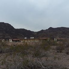
Path 62, Power transmission corridor in Nevada, United States.

Path 62 is a high-voltage transmission line running across Nevada's landscape, carrying electricity over long distances to power homes and businesses throughout the region. Steel towers support the overhead cables as they span across varied terrain and weather conditions.

Path 62 was built during a period of electrical infrastructure expansion in Nevada to meet the region's growing energy needs. The line was part of broader efforts to extend reliable power supply across the western United States.

Local communities along Path 62 participate in educational programs about power infrastructure safety and maintenance, fostering awareness about energy distribution.

The line can be best observed from designated viewing points along its route, where visitors can safely see the structure from the ground. Those visiting should be aware of high-voltage hazards and avoid standing directly under or near the cables.

Path 62 operates within a network of transmission corridors that enable electricity flow across Nevada's varied elevations and temperature zones.

The community of curious travelers

AroundUs brings together thousands of curated places, local tips, and hidden gems, enriched daily by 60,000 contributors worldwide.

Start exploring
Location
GPS coordinates
35.80111,-115.00944
Latest update
December 14, 2025 17:00
Around this place
Sam Boyd Stadium
United States of America

Sam Boyd Stadium

31.8 km
Mike O'Callaghan–Pat Tillman Memorial Bridge
United States of America

Mike O'Callaghan–Pat Tillman Memorial Bridge

33.7 km
South Point Hotel, Casino & Spa
United States of America

South Point Hotel, Casino & Spa

27.8 km
Casa de Shenandoah
United States of America

Casa de Shenandoah

31.1 km
M Resort
United States of America

M Resort

23.2 km
Ethel M Chocolate Factory
United States of America

Ethel M Chocolate Factory

30.9 km
Black Canyon of the Colorado
United States of America

Black Canyon of the Colorado

26.9 km
United States of America

Black Mountain

14.8 km
Sloan Canyon National Conservation Area
United States of America

Sloan Canyon National Conservation Area

11.4 km
El Dorado Canyon
United States of America

El Dorado Canyon

29.1 km
Clark County Wetlands Park
United States of America

Clark County Wetlands Park

33.4 km
The Grandview at Las Vegas
United States of America

The Grandview at Las Vegas

27.4 km
Tahiti Village
United States of America

Tahiti Village

32.3 km
The District at Green Valley Ranch
United States of America

The District at Green Valley Ranch

25.5 km
Nevada Southern Railroad Museum
United States of America

Nevada Southern Railroad Museum

23.4 km
Henderson Pavilion
United States of America

Henderson Pavilion

25.1 km
Acacia Demonstration Gardens
United States of America

Acacia Demonstration Gardens

25.5 km
Boulder City Historic District
United States of America

Boulder City Historic District

25.2 km
Gold Strike Hot Springs
United States of America

Gold Strike Hot Springs

32.7 km
Wee Thump Joshua Tree Wilderness, Nevada
United States of America

Wee Thump Joshua Tree Wilderness, Nevada

30.9 km
Dig This
United States of America

Dig This

22.2 km
Seven Magic Mountains
United States of America

Seven Magic Mountains

24 km
Carroll Shelby Museum
United States of America

Carroll Shelby Museum

33.8 km
Emerald Cove
United States of America

Emerald Cove

31 km
Shan-Gri-La Prehistoric Park (aka the Dinosaur House)
United States of America

Shan-Gri-La Prehistoric Park (aka the Dinosaur House)

23 km
Boulder Theatre
United States of America

Boulder Theatre

25.2 km
Liberty Bell Arch
United States of America

Liberty Bell Arch

32.2 km
North Beach
United States of America

North Beach

32.3 km
Show the full map
Reviews
Share your experience

No review yet

Discussions
Start a discussion...

No discussion yet

« Path 62 - Power transmission corridor in Nevada, United States » is provided by Around Us (aroundus.com). Images and texts are derived from Wikimedia project under a Creative Commons license. You are allowed to copy, distribute, and modify copies of this page, under the conditions set by the license, as long as this note is clearly visible.

Discover hidden gems everywhere you go!

From secret cafés to breathtaking viewpoints, skip the crowded tourist spots and find places that match your style. Our app makes it easy with voice search, smart filtering, route optimization, and insider tips from travelers worldwide. Download now for the complete mobile experience.

Around Us App Screenshot

A unique approach to discovering new places

Le Figaro

All the places worth exploring

France Info

A tailor-made excursion in just a few clicks

20 Minutes

Around Us
Travel Guide & Maps
Download

Send to your phone

QR Code
1

Open the camera app on your mobile.

2

Point at the QR code with your camera. A notification will appear.

3

Tap the notification to open the link.