Chest opened
+${chestReward.xp} XP
Explorer
NOUVEAU ×${chestReward.collectible.quantity}
tapez pour fermer

See the monuments around you in AR Open chests in the app

Around Us is built for your phone — point your camera at the streets and discover the monuments and places around you in augmented reality. Around Us is built for your phone — chests unlock when you walk, explore and capture nearby places.

Enable Location

We need your location to show you interesting places around you

Discover nearby places

Find interesting locations and hidden gems around you

Precise directions

Get accurate directions and distances to places

Your location is never shared with other users. It's only used when you tap the location button.

Log in to your account

Start exploring — it's free

Trusted by 82,877 travelers worldwide

Continue with Google
Continue with Apple
or

We will send you a code to connect

By continuing, you accept our Terms and Conditions and our Privacy Policy

Check your inbox

We've sent a pincode in your inbox. Please enter the code below.

Far South Egans Wilderness
Discussion Reviews Photo
1.3k Popularity

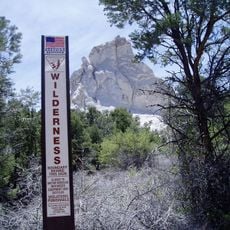
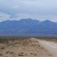
Far South Egans Wilderness, Protected wilderness area in Lincoln and Nye Counties, Nevada, United States.

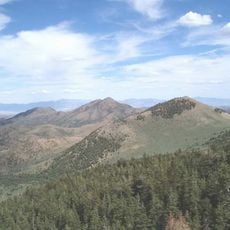
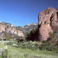
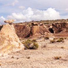
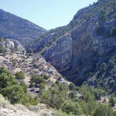
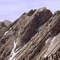
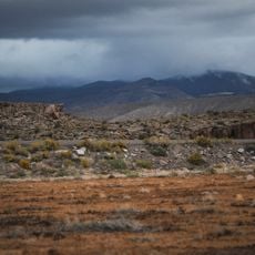
Far South Egans Wilderness is a protected area featuring limestone cliffs with colorful layered patterns that rise across varied elevations forming jagged mountain terrain. The rocky landscape includes steep slopes and natural formations shaped by geological processes over millions of years.

The wilderness was studied to document its geological makeup and mineral resources during research efforts. These investigations helped establish scientific records of this mountain landscape.

The Bureau of Land Management maintains strict regulations prohibiting motorized equipment to preserve the natural environment of this mountain wilderness.

The area is remote and requires preparation since access involves traveling through unpaved roads. Bring plenty of water, maps, and proper hiking gear when exploring the terrain.

A large cave system in the northwestern section contains impressive limestone formations and passages extending deep underground. This underground network demonstrates how water shaped the rock over countless years.

The community of curious travelers

AroundUs brings together thousands of curated places, local tips, and hidden gems, enriched daily by 60,000 contributors worldwide.
Start exploring
GPS coordinates
38.45871,-115.22745
Latest update
August 12, 2026 11:38
Around this place
City
United States of America

City

51.1 km
Basin and Range National Monument
United States of America

Basin and Range National Monument

56 km
Ward Charcoal Ovens State Historic Park
United States of America

Ward Charcoal Ovens State Historic Park

72.4 km
Lunar Crater National Natural Landmark
United States of America

Lunar Crater National Natural Landmark

73.9 km
Red Mountain Wilderness
United States of America

Red Mountain Wilderness

51.2 km
Bristol Wells Town Site
United States of America

Bristol Wells Town Site

60.9 km
Quinn Canyon Wilderness
United States of America

Quinn Canyon Wilderness

52.6 km
United States of America

Bald Mountain Wilderness

68 km
Weepah Spring Wilderness
United States of America

Weepah Spring Wilderness

52.4 km
Currant Mountain Wilderness
United States of America

Currant Mountain Wilderness

53.3 km
United States of America

Grant Range Wilderness

34.1 km
United States of America

Mount Grafton Wilderness

49.4 km
South Egan Range Wilderness
United States of America

South Egan Range Wilderness

35.3 km
Fortification Range Wilderness
United States of America

Fortification Range Wilderness

68.1 km
Currant Mountain
United States of America

Currant Mountain

53.1 km
Troy Peak
United States of America

Troy Peak

28.4 km
United States of America

Shingle Peak

26.7 km
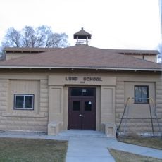
Lund Grade School
United States of America

Lund Grade School

48.4 km
United States of America

Adams-McGill Reservoir

13.7 km
United States of America

Douglas Point

35.1 km
United States of America

Tule Field Reservoir

16.2 km
United States of America

Hay Meadow Reservoir

15.4 km
United States of America

Craw Knoll

68.4 km
Ward Charcoal Ovens
United States of America

Ward Charcoal Ovens

72.3 km
United States of America

Dacey Reservoir

11.7 km
United States of America

Railroad Valley Wildlife Management Area

43.8 km
United States of America

Black Cliff

45.2 km
United States of America

The Lund L

48.5 km
Show the full map
Reviews
Share your experience

No review yet

Discussions
Start a discussion...

No discussion yet

« Far South Egans Wilderness - Protected wilderness area in Lincoln and Nye Counties, Nevada, United States » is provided by Around Us (aroundus.com). Images and texts are derived from Wikimedia project under a Creative Commons license. You are allowed to copy, distribute, and modify copies of this page, under the conditions set by the license, as long as this note is clearly visible.

Discover hidden gems everywhere you go!

From secret cafés to breathtaking viewpoints, skip the crowded tourist spots and find places that match your style. Our app makes it easy with voice search, smart filtering, route optimization, and insider tips from travelers worldwide. Download now for the complete mobile experience.

Around Us App Screenshot

A unique approach to discovering new places

Le Figaro

All the places worth exploring

France Info

A tailor-made excursion in just a few clicks

20 Minutes

Around Us
Travel Guide & Maps
Download

Send to your phone

QR Code
1

Open the camera app on your mobile.

2

Point at the QR code with your camera. A notification will appear.

3

Tap the notification to open the link.