Enable Location

We need your location to show you interesting places around you

Discover nearby places

Find interesting locations and hidden gems around you

Precise directions

Get accurate directions and distances to places

Your location is never shared with other users. It's only used when you tap the location button.

Log in to your account

Start exploring — it's free

Trusted by 63,936 travelers worldwide

Continue with Google
Continue with Apple
or

We will send you a code to connect

By continuing, you accept our Terms and Conditions and our Privacy Policy

Check your inbox

We've sent a pincode in your inbox. Please enter the code below.

Aubrey Cliffs
Discussion Reviews Photo
1.1k Popularity

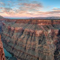
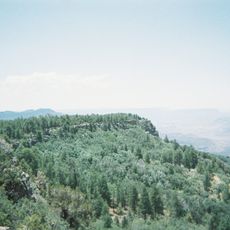
Aubrey Cliffs, cliff in Coconino County, Arizona, United States of America

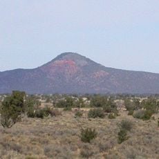
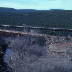
Aubrey Cliffs are a series of tall rock formations that rise about 1000 feet (300 meters) above Aubrey Valley and stretch along the edge of the Coconino Plateau. The cliffs are made of layered rock and extend northward from near Route 66 toward the Colorado River.

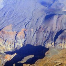
The cliffs formed millions of years ago through tectonic movement along the Toroweap Fault, which pushed rock upward and created the steep walls seen today. Native peoples inhabited the region for thousands of years and knew the landscape intimately.

The cliffs hold importance for the Navajo and Hualapai tribes whose lands border and overlap in this region. These rock formations are woven into the identity and history of the communities who have inhabited these territories for generations.

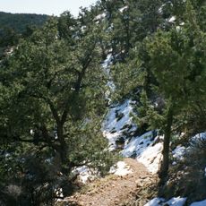
Access is best from Route 66 near Seligman, from where the cliffs are visible extending northward. The area is dry and open, so bring water and sun protection when spending time exploring near the formations.

A planned Navajo Nation wind farm project could generate electricity using turbines on the southern cliffs with a capacity of about 85 megawatts. This development represents how the community looks to harness the region's natural forces for contemporary energy needs.

The community of curious travelers

AroundUs brings together thousands of curated places, local tips, and hidden gems, enriched daily by 60,000 contributors worldwide.

Start exploring
Location
GPS coordinates
35.56000,-113.05000
Latest update
February 9, 2026 11:06
Around this place
Havasu Falls
United States of America

Havasu Falls

83.6 km
Colin Grand Canyon Skywalk
United States of America

Colin Grand Canyon Skywalk

85.2 km
Grand Canyon Railway
United States of America

Grand Canyon Railway

74.6 km
Kaibab National Forest
United States of America

Kaibab National Forest

125.7 km
Grand Canyon Caverns
United States of America

Grand Canyon Caverns

16.8 km
Delgadillo's Snow Cap Drive-In
United States of America

Delgadillo's Snow Cap Drive-In

30.6 km
Toroweap Overlook
United States of America

Toroweap Overlook

72.8 km
Red Butte
United States of America

Red Butte

91.5 km
Urban Route 66, Williams
United States of America

Urban Route 66, Williams

85.2 km
Lava Falls Trail
United States of America

Lava Falls Trail

73.6 km
Mount Logan Wilderness
United States of America

Mount Logan Wilderness

85.5 km
Seligman Commercial Historic District
United States of America

Seligman Commercial Historic District

30.5 km
South Bass Trail
United States of America

South Bass Trail

92.3 km
Tuckup Trail
United States of America

Tuckup Trail

75.7 km
Royal Arch Route
United States of America

Royal Arch Route

88.6 km
Schoolhouse at Truxton Canyon Training School
United States of America

Schoolhouse at Truxton Canyon Training School

58.6 km
Peach Springs Trading Post
United States of America

Peach Springs Trading Post

34.4 km
Camp Clover Ranger Station
United States of America

Camp Clover Ranger Station

83.6 km
Horse Valley Ranch
United States of America

Horse Valley Ranch

74.2 km
First Methodist Episcopal Church and Parsonage
United States of America

First Methodist Episcopal Church and Parsonage

82.3 km
Williams Residential Historic District
United States of America

Williams Residential Historic District

85.8 km
Route 66 Museum And Gift Shop
United States of America

Route 66 Museum And Gift Shop

85 km
Historic Angel's Barber Shop Museum
United States of America

Historic Angel's Barber Shop Museum

30.5 km
Thornton Lookout Tower
United States of America

Thornton Lookout Tower

31.9 km
Bill Williams Lookout Tower
United States of America

Bill Williams Lookout Tower

86.5 km
Red Butte Lookout Tower
United States of America

Red Butte Lookout Tower

91.6 km
Big Hell Canyon Railroad Bridge
United States of America

Big Hell Canyon Railroad Bridge

88.8 km
Little Hell Canyon Bridge
United States of America

Little Hell Canyon Bridge

79.2 km
Show the full map
Reviews
Share your experience

No review yet

Discussions
Start a discussion...

No discussion yet

« Aubrey Cliffs - cliff in Coconino County, Arizona, United States of America » is provided by Around Us (aroundus.com). Images and texts are derived from Wikimedia project under a Creative Commons license. You are allowed to copy, distribute, and modify copies of this page, under the conditions set by the license, as long as this note is clearly visible.

Discover hidden gems everywhere you go!

From secret cafés to breathtaking viewpoints, skip the crowded tourist spots and find places that match your style. Our app makes it easy with voice search, smart filtering, route optimization, and insider tips from travelers worldwide. Download now for the complete mobile experience.

Around Us App Screenshot

A unique approach to discovering new places

Le Figaro

All the places worth exploring

France Info

A tailor-made excursion in just a few clicks

20 Minutes

Around Us
Travel Guide & Maps
Download

Send to your phone

QR Code
1

Open the camera app on your mobile.

2

Point at the QR code with your camera. A notification will appear.

3

Tap the notification to open the link.