Enable Location

We need your location to show you interesting places around you

Discover nearby places

Find interesting locations and hidden gems around you

Precise directions

Get accurate directions and distances to places

Your location is never shared with other users. It's only used when you tap the location button.

Tonto Trail

Log in to your account

Start exploring — it's free

Trusted by 62,914 travelers worldwide

Continue with Google
Continue with Apple
or

We will send you a code to connect

By continuing, you accept our Terms and Conditions and our Privacy Policy

Check your inbox

We've sent a pincode in your inbox. Please enter the code below.

Tonto Trail
Discussion Reviews 1 Photos
7k Popularity

Tonto Trail, Hiking trail in Grand Canyon National Park, Arizona.

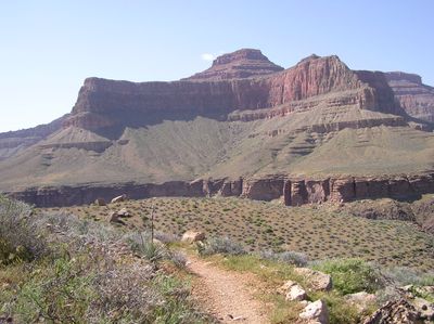
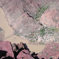
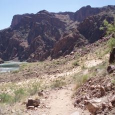
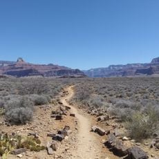
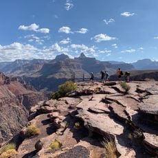
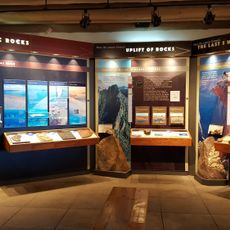
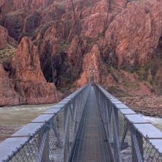
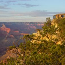
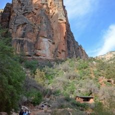
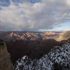
Tonto Trail is a hiking path that extends roughly 70 miles along the south side of the Grand Canyon, following the natural curves of the terrain. The route passes through layers of different rock formations and offers views of varied geological features and landscape zones.

Centuries ago, indigenous peoples created this pathway and used it as an important route for travel and trade across the Grand Canyon region. The path connects different points that were significant to these communities.

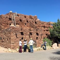
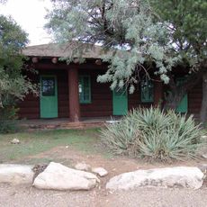
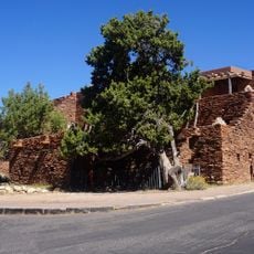
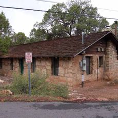
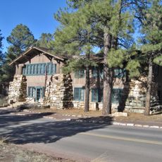
The trail passes through lands that hold meaning for several indigenous peoples, with archaeological sites and remains of ancient dwellings visible along the route. Visitors can observe how these communities shaped their presence in this landscape over time.

A permit is needed for overnight stays, and hikers must bring sufficient water as natural sources are limited and require treatment before drinking. It is wise to prepare for long hiking days and to watch weather conditions.

The path connects with several other trails such as South Bass and Boucher, allowing hikers to create different loop routes within the canyon system. Experienced hikers use these connections to plan longer and more varied journeys.

The community of curious travelers

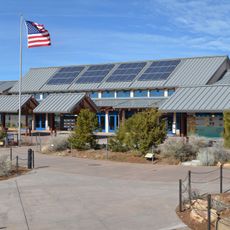
AroundUs brings together thousands of curated places, local tips, and hidden gems, enriched daily by 60,000 contributors worldwide.

Start exploring
Location
GPS coordinates
36.07640,-112.10700
Latest update
December 9, 2025 18:40
Around this place
Grand Canyon National Park
United States of America

Grand Canyon National Park

2.7 km
El Tovar Hotel
United States of America

El Tovar Hotel

3.4 km
South Kaibab Trail
United States of America

South Kaibab Trail

3.4 km
Bright Angel Lodge
United States of America

Bright Angel Lodge

3.7 km
Hopi House
United States of America

Hopi House

3.4 km
Kaibab Trail Suspension Bridge
United States of America

Kaibab Trail Suspension Bridge

3.2 km
Grand Canyon Depot
United States of America

Grand Canyon Depot

3.4 km
Grand Canyon Village Historic District
United States of America

Grand Canyon Village Historic District

3.7 km
Lookout Studio
United States of America

Lookout Studio

3.7 km
Buckey O'Neill Cabin
United States of America

Buckey O'Neill Cabin

3.7 km
River Trail
United States of America

River Trail

2.4 km
Plateau Point Trail
United States of America

Plateau Point Trail

1.9 km
Rim Trail
United States of America

Rim Trail

3.6 km
Mary Jane Colter buildings
United States of America

Mary Jane Colter buildings

3.7 km
Grand Canyon South Rim Ranger's Dormitory
United States of America

Grand Canyon South Rim Ranger's Dormitory

3.6 km
Plateau Point
United States of America

Plateau Point

2 km
Grand Canyon National Park Superintendent's Residence
United States of America

Grand Canyon National Park Superintendent's Residence

3.3 km
Grand Canyon Park Operations Building
United States of America

Grand Canyon Park Operations Building

3.6 km
Grand Canyon Visitor Center
United States of America

Grand Canyon Visitor Center

1.9 km
Yavapai Geology Museum
United States of America

Yavapai Geology Museum

1.5 km
Silver Bridge
United States of America

Silver Bridge

2.6 km
Yavapai Museum of Geology
United States of America

Yavapai Museum of Geology

1.5 km
Verkamp's Visitor Center
United States of America

Verkamp's Visitor Center

3.3 km
Horace M. Albright Training Center
United States of America

Horace M. Albright Training Center

3.7 km
Grand Canyon Visitor Center
United States of America

Grand Canyon Visitor Center

1.9 km
Trailer Village
United States of America

Trailer Village

2.7 km
Mile-and-a-Half Resthouse
United States of America

Mile-and-a-Half Resthouse

3.4 km
Bright Angel Canyon
United States of America

Bright Angel Canyon

2.9 km
Show the full map
Reviews
Share your experience

No review yet

Discussions
Start a discussion...

No discussion yet

« Tonto Trail - Hiking trail in Grand Canyon National Park, Arizona » is provided by Around Us (aroundus.com). Images and texts are derived from Wikimedia project under a Creative Commons license. You are allowed to copy, distribute, and modify copies of this page, under the conditions set by the license, as long as this note is clearly visible.

Discover hidden gems everywhere you go!

From secret cafés to breathtaking viewpoints, skip the crowded tourist spots and find places that match your style. Our app makes it easy with voice search, smart filtering, route optimization, and insider tips from travelers worldwide. Download now for the complete mobile experience.

Around Us App Screenshot

A unique approach to discovering new places

Le Figaro

All the places worth exploring

France Info

A tailor-made excursion in just a few clicks

20 Minutes

Around Us
Travel Guide & Maps
Download

Send to your phone

QR Code
1

Open the camera app on your mobile.

2

Point at the QR code with your camera. A notification will appear.

3

Tap the notification to open the link.