Enable Location

We need your location to show you interesting places around you

Discover nearby places

Find interesting locations and hidden gems around you

Precise directions

Get accurate directions and distances to places

Your location is never shared with other users. It's only used when you tap the location button.

Old Iron Town

Log in to your account

Start exploring — it's free

Trusted by 62,189 travelers worldwide

Continue with Google
Continue with Apple
or

We will send you a code to connect

By continuing, you accept our Terms and Conditions and our Privacy Policy

Check your inbox

We've sent a pincode in your inbox. Please enter the code below.

Old Iron Town, ghost town in Iron County, Utah, Unite States

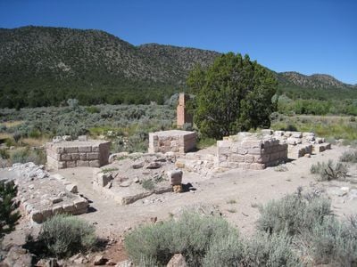
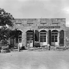
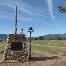
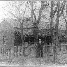
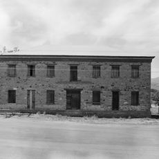
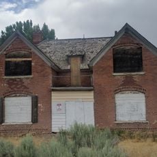
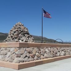
Old Iron Town is a ghost town in Iron County with visible ruins of buildings and industrial structures from the 1800s. The remains include a furnace, a kiln building, and foundations that show how iron production and daily life were organized in this remote settlement.

The settlement was established in 1868 after iron ore deposits were discovered nearby and briefly employed about 100 people. It was abandoned in 1876 when production and shipping costs became unsustainable, especially after economic pressures and shifts in the mining market.

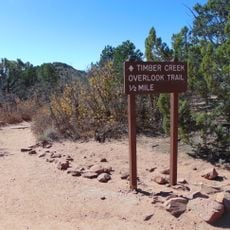
Wear comfortable walking shoes since the ground is uneven and the site is best explored on foot. There are no shops or guides on site, so it helps to read about the place before visiting and plan extra time to look around the ruins.

The site was one of the first attempts by Mormon settlers to produce iron locally and achieve economic self-sufficiency, showing their vision for a self-reliant community. Although the project ultimately failed, it reveals an important chapter of regional pioneer history that is often overlooked by visitors.

The community of curious travelers

AroundUs brings together thousands of curated places, local tips, and hidden gems, enriched daily by 60,000 contributors worldwide.

Start exploring
Location
Inception
1868
Elevation above the sea
1,782 m
GPS coordinates
37.60000,-113.45000
Latest update
February 7, 2026 11:40
Around this place
Righteous Branch of the Church of Jesus Christ of Latter-day Saints
United States of America

Righteous Branch of the Church of Jesus Christ of Latter-day Saints

34.5 km
Kolob Arch
United States of America

Kolob Arch

32.4 km
Santa Clara Volcano
United States of America

Santa Clara Volcano

41.3 km
Eccles Coliseum
United States of America

Eccles Coliseum

34 km
Mountain Meadows
United States of America

Mountain Meadows

22 km
Kolob Reservoir
United States of America

Kolob Reservoir

40.2 km
Horse Ranch Mountain
United States of America

Horse Ranch Mountain

29.1 km
Signal Peak
United States of America

Signal Peak

31.4 km
Pine Valley Chapel and Tithing Office
United States of America

Pine Valley Chapel and Tithing Office

23.9 km
Blackridge Wilderness
United States of America

Blackridge Wilderness

35.2 km
Iron Mountain
United States of America

Iron Mountain

8.3 km
Red Butte Wilderness
United States of America

Red Butte Wilderness

37.7 km
Wells Fargo and Company Express Building
United States of America

Wells Fargo and Company Express Building

39.3 km
Fort Harmony
United States of America

Fort Harmony

23.3 km
John Steele House
United States of America

John Steele House

41 km
Naegle Winery
United States of America

Naegle Winery

41.4 km
Frontier Homestead State Park Museum
United States of America

Frontier Homestead State Park Museum

35.5 km
Thomas Forsyth House
United States of America

Thomas Forsyth House

41.3 km
Daniel R. and Sophia G. Page House
United States of America

Daniel R. and Sophia G. Page House

4.5 km
Leeds Tithing Office
United States of America

Leeds Tithing Office

41.2 km
Southern Utah Museum of Art
United States of America

Southern Utah Museum of Art

34.9 km
Kanarra Creek Canyon
United States of America

Kanarra Creek Canyon

27.1 km
Timber Creek Overlook Trail
United States of America

Timber Creek Overlook Trail

28.6 km
Adams Memorial Shakespearean Theatre
United States of America

Adams Memorial Shakespearean Theatre

34.7 km
Mountain Meadows Massacre Site
United States of America

Mountain Meadows Massacre Site

22 km
Cedar Canyon
United States of America

Cedar Canyon

36.3 km
Kolob Canyons Visitor Center
United States of America

Kolob Canyons Visitor Center

25.7 km
Toquerville Hall
United States of America

Toquerville Hall

41.1 km
Show the full map
« Old Iron Town - ghost town in Iron County, Utah, Unite States » is provided by Around Us (aroundus.com). Images and texts are derived from Wikimedia project under a Creative Commons license. You are allowed to copy, distribute, and modify copies of this page, under the conditions set by the license, as long as this note is clearly visible.

Discover hidden gems everywhere you go!

From secret cafés to breathtaking viewpoints, skip the crowded tourist spots and find places that match your style. Our app makes it easy with voice search, smart filtering, route optimization, and insider tips from travelers worldwide. Download now for the complete mobile experience.

Around Us App Screenshot

A unique approach to discovering new places

Le Figaro

All the places worth exploring

France Info

A tailor-made excursion in just a few clicks

20 Minutes

Around Us
Travel Guide & Maps
Download

Send to your phone

QR Code
1

Open the camera app on your mobile.

2

Point at the QR code with your camera. A notification will appear.

3

Tap the notification to open the link.