Chest opened
+${chestReward.xp} XP
Explorer
NOUVEAU ×${chestReward.collectible.quantity}
tapez pour fermer
Chest locked

Open chests in the app

Around Us is built for your phone — chests unlock when you walk, explore and capture nearby places.

Enable Location

We need your location to show you interesting places around you

Discover nearby places

Find interesting locations and hidden gems around you

Precise directions

Get accurate directions and distances to places

Your location is never shared with other users. It's only used when you tap the location button.

Log in to your account

Start exploring — it's free

Trusted by 72,993 travelers worldwide

Continue with Google
Continue with Apple
or

We will send you a code to connect

By continuing, you accept our Terms and Conditions and our Privacy Policy

Check your inbox

We've sent a pincode in your inbox. Please enter the code below.

Discussion Reviews Photo
1.3k Popularity

Cedar City Historic District, Historic district in Cedar City, United States.

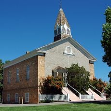
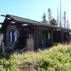
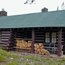
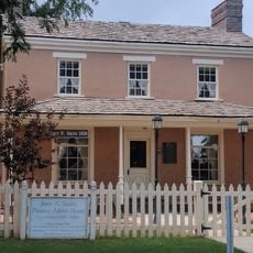
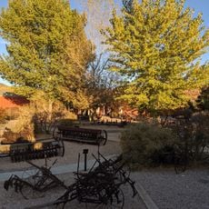
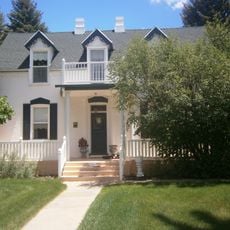
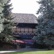
Cedar City Historic District is a registered heritage area containing around 172 buildings spread across several blocks from Shakespeare Lane to 200 South and between 100 West and 300 West. The collection includes residential and public buildings that preserve the town's appearance from the late 1800s onward.

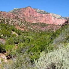
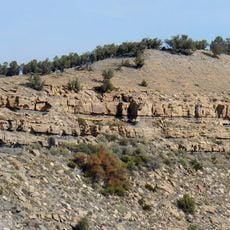
The town was founded in 1851 to mine iron ore, an ambitious project led by Mormon settlers under Brigham Young's direction. By the late 1800s, sheep ranching became the dominant economic activity, bringing prosperity and growth to the community.

The district displays a range of building styles from the late 1800s through early 1900s, including Tudor Revival, Bungalows, and American Craftsman homes. This architectural mix reflects different periods of community growth and changing tastes among residents.

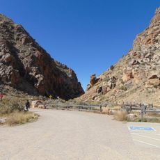
The area is best explored on foot, with visitors walking marked routes through the streets at their own pace. Most buildings are located close together, so a visit involves several hours of walking through well-kept residential blocks.

The area marks the location of the first iron mining operations west of the Mississippi River, a major milestone in early American industrial history. This mining venture was a bold experiment that transformed into a thriving town in the desert.

The community of curious travelers

AroundUs brings together thousands of curated places, local tips, and hidden gems, enriched daily by 60,000 contributors worldwide.

Start exploring
Location
GPS coordinates
37.67306,-113.06139
Latest update
December 14, 2025 17:43
Around this place
Kolob Arch
United States of America

Kolob Arch

29.1 km
Kolob Canyons
United States of America

Kolob Canyons

32.8 km
Navajo Lake
United States of America

Navajo Lake

30.7 km
Eccles Coliseum
United States of America

Eccles Coliseum

1.4 km
Kolob Reservoir
United States of America

Kolob Reservoir

26.9 km
Brian Head
United States of America

Brian Head

20.3 km
Ashdown Gorge Wilderness
United States of America

Ashdown Gorge Wilderness

15.5 km
Horse Ranch Mountain
United States of America

Horse Ranch Mountain

23.4 km
Iron Mountain
United States of America

Iron Mountain

27.7 km
Parowan Meetinghouse
United States of America

Parowan Meetinghouse

27.6 km
Naturita Formation
United States of America

Naturita Formation

16.4 km
Parowan Gap Petroglyphs

Parowan Gap Petroglyphs

27.2 km
Cedar Breaks National Monument Visitor Center
United States of America

Cedar Breaks National Monument Visitor Center

20.8 km
Fort Harmony
United States of America

Fort Harmony

26.4 km
Cedar Breaks National Monument Caretaker's Cabin
United States of America

Cedar Breaks National Monument Caretaker's Cabin

20.9 km
Jesse N. Smith House
United States of America

Jesse N. Smith House

27.7 km
Frontier Homestead State Park Museum
United States of America

Frontier Homestead State Park Museum

1.7 km
William and Julia Lyman House
United States of America

William and Julia Lyman House

27.8 km
Southern Utah Museum of Art
United States of America

Southern Utah Museum of Art

610 m
Kanarra Creek Canyon
United States of America

Kanarra Creek Canyon

17.1 km
Timber Creek Overlook Trail
United States of America

Timber Creek Overlook Trail

29.2 km
Adams Memorial Shakespearean Theatre
United States of America

Adams Memorial Shakespearean Theatre

682 m
Parowan Gap
United States of America

Parowan Gap

26.9 km
Alpine Pond Trail
United States of America

Alpine Pond Trail

21.3 km
Lava Point Campground
United States of America

Lava Point Campground

32.3 km
Arch Canyon
United States of America

Arch Canyon

19.4 km
Cedar Canyon
United States of America

Cedar Canyon

1.1 km
Kolob Canyons Visitor Center
United States of America

Kolob Canyons Visitor Center

28.4 km
Show the full map
Reviews
Share your experience

No review yet

Discussions
Start a discussion...

No discussion yet

« Cedar City Historic District - Historic district in Cedar City, United States » is provided by Around Us (aroundus.com). Images and texts are derived from Wikimedia project under a Creative Commons license. You are allowed to copy, distribute, and modify copies of this page, under the conditions set by the license, as long as this note is clearly visible.

Discover hidden gems everywhere you go!

From secret cafés to breathtaking viewpoints, skip the crowded tourist spots and find places that match your style. Our app makes it easy with voice search, smart filtering, route optimization, and insider tips from travelers worldwide. Download now for the complete mobile experience.

Around Us App Screenshot

A unique approach to discovering new places

Le Figaro

All the places worth exploring

France Info

A tailor-made excursion in just a few clicks

20 Minutes

Around Us
Travel Guide & Maps
Download

Send to your phone

QR Code
1

Open the camera app on your mobile.

2

Point at the QR code with your camera. A notification will appear.

3

Tap the notification to open the link.