Chest opened
+${chestReward.xp} XP
Explorer
NOUVEAU ×${chestReward.collectible.quantity}
tapez pour fermer
Chest locked

Open chests in the app

Around Us is built for your phone — chests unlock when you walk, explore and capture nearby places.

Enable Location

We need your location to show you interesting places around you

Discover nearby places

Find interesting locations and hidden gems around you

Precise directions

Get accurate directions and distances to places

Your location is never shared with other users. It's only used when you tap the location button.

Silver Springs

Log in to your account

Start exploring — it's free

Trusted by 72,888 travelers worldwide

Continue with Google
Continue with Apple
or

We will send you a code to connect

By continuing, you accept our Terms and Conditions and our Privacy Policy

Check your inbox

We've sent a pincode in your inbox. Please enter the code below.

Discussion Reviews 1 Photos
11.5k Popularity

Silver Springs, Census-designated place in Lyon County, Nevada, US

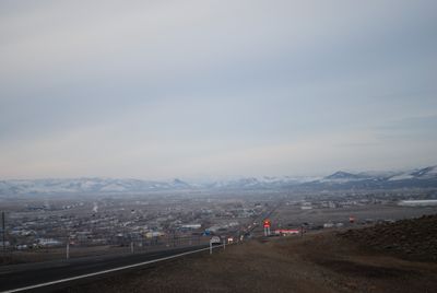
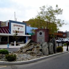
Silver Springs is a settlement in northern Nevada's desert landscape, located where two major highways intersect. The area spreads across open land with scattered buildings and local services spread throughout the region.

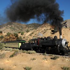
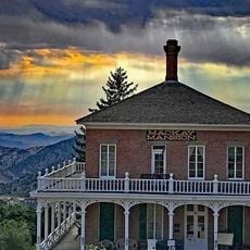
The settlement started as a railway station in the early 1900s at an important transportation crossing. It later developed as a residential area that connected surrounding regions through major roadways.

The population of 5,629 residents maintains regular community gatherings and events that strengthen local connections within Lyon County's rural environment.

An airport and two highways intersect here, making it easy to arrive and leave by different routes. Basic stores and services are spread throughout the area, though you'll need to travel between locations.

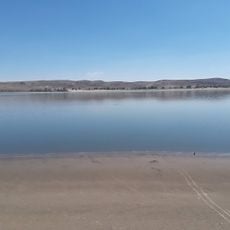
The Carson River forms natural boundaries to the south and east, flowing near a historic military fort. This waterway shapes the landscape and links the area to the broader region.

The community of curious travelers

AroundUs brings together thousands of curated places, local tips, and hidden gems, enriched daily by 60,000 contributors worldwide.

Start exploring
Location
Elevation above the sea
1,280 m
GPS coordinates
39.37060,-119.22100
Latest update
December 8, 2025 13:40
Around this place
Virginia and Truckee Railroad
United States of America

Virginia and Truckee Railroad

38.6 km
Old Washoe Club
United States of America

Old Washoe Club

37.6 km
Fort Churchill State Historic Park
United States of America

Fort Churchill State Historic Park

9.7 km
Virginia City Historic District
United States of America

Virginia City Historic District

37.4 km
Piper's Opera House
United States of America

Piper's Opera House

37.7 km
St. Mary's in the Mountains Catholic Church
United States of America

St. Mary's in the Mountains Catholic Church

37.4 km
International Hotel
United States of America

International Hotel

37.5 km
Fourth Ward School
United States of America

Fourth Ward School

37.9 km
Lahontan State Recreation Area
United States of America

Lahontan State Recreation Area

11.2 km
Lahontan Dam
United States of America

Lahontan Dam

16.9 km
Henry Piper House
United States of America

Henry Piper House

37.5 km
Knights of Pythias Building
United States of America

Knights of Pythias Building

37.5 km
St. Paul's Episcopal Church
United States of America

St. Paul's Episcopal Church

37.4 km
Chollar Mansion
United States of America

Chollar Mansion

37.8 km
Churchill County Jail
United States of America

Churchill County Jail

39.9 km
Churchill County Courthouse
United States of America

Churchill County Courthouse

39.6 km
Fallon City Hall
United States of America

Fallon City Hall

39.9 km
Wadsworth Union Church
United States of America

Wadsworth Union Church

29.9 km
Washoe Club Museum & Saloon
United States of America

Washoe Club Museum & Saloon

37.6 km
McCarthy House
United States of America

McCarthy House

37.5 km
C.J. Prescott House
United States of America

C.J. Prescott House

37.7 km
Parish House
United States of America

Parish House

37.3 km
Piper-Beebe House
United States of America

Piper-Beebe House

37.5 km
Maine Street Historic District
United States of America

Maine Street Historic District

39.8 km
Mackay Mansion & Museum
United States of America

Mackay Mansion & Museum

37.6 km
King-McBride Mansion
United States of America

King-McBride Mansion

37.6 km
Piper Opera House
United States of America

Piper Opera House

37.5 km
Silver Springs Beach
United States of America

Silver Springs Beach

2.8 km
Show the full map
Reviews
Share your experience

No review yet

Discussions
Start a discussion...

No discussion yet

« Silver Springs - Census-designated place in Lyon County, Nevada, US » is provided by Around Us (aroundus.com). Images and texts are derived from Wikimedia project under a Creative Commons license. You are allowed to copy, distribute, and modify copies of this page, under the conditions set by the license, as long as this note is clearly visible.

Discover hidden gems everywhere you go!

From secret cafés to breathtaking viewpoints, skip the crowded tourist spots and find places that match your style. Our app makes it easy with voice search, smart filtering, route optimization, and insider tips from travelers worldwide. Download now for the complete mobile experience.

Around Us App Screenshot

A unique approach to discovering new places

Le Figaro

All the places worth exploring

France Info

A tailor-made excursion in just a few clicks

20 Minutes

Around Us
Travel Guide & Maps
Download

Send to your phone

QR Code
1

Open the camera app on your mobile.

2

Point at the QR code with your camera. A notification will appear.

3

Tap the notification to open the link.