Chest opened
+${chestReward.xp} XP
Explorer
NOUVEAU ×${chestReward.collectible.quantity}
tapez pour fermer
Chest locked

Open chests in the app

Around Us is built for your phone — chests unlock when you walk, explore and capture nearby places.

Enable Location

We need your location to show you interesting places around you

Discover nearby places

Find interesting locations and hidden gems around you

Precise directions

Get accurate directions and distances to places

Your location is never shared with other users. It's only used when you tap the location button.

Log in to your account

Start exploring — it's free

Trusted by 72,891 travelers worldwide

Continue with Google
Continue with Apple
or

We will send you a code to connect

By continuing, you accept our Terms and Conditions and our Privacy Policy

Check your inbox

We've sent a pincode in your inbox. Please enter the code below.

Simpson Springs
Discussion Reviews Photo
4k Popularity

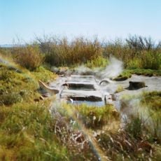
Simpson Springs, Natural spring in Tooele County, United States

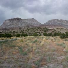
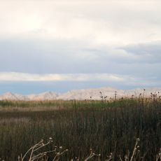
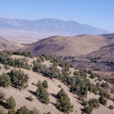
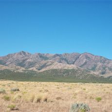
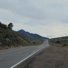
Simpson Springs is a natural water source in the Utah desert at about 5100 feet elevation. The spring sits in wide open landscape with sparse vegetation and clear views across the surrounding terrain.

The spring was named after Captain James H. Simpson in 1858 and served as vital water supply for the Pony Express mail service. This route connected Salt Lake City to California and was one of the fastest communication methods of its era.

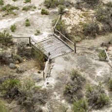
This spring was a crucial stopping point for travelers crossing the desert during the 1800s. Visitors can see traces of how people relied on this water source to continue their journeys through the arid landscape.

A nearby campground offers about 20 sites with tables, fire pits, and pit toilets for visitor use. Fresh water from the spring is available seasonally from March through November.

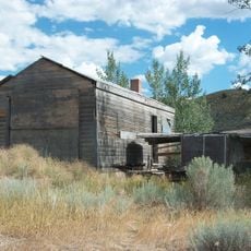
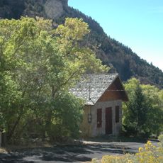
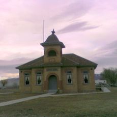
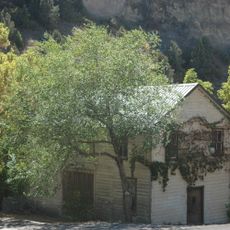
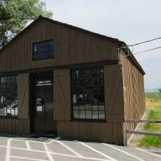
A reconstructed Pony Express station building from 1975 stands at the site, built by the Future Farmers of America organization. This reconstruction gives visitors a sense of what the original stations may have looked like.

The community of curious travelers

AroundUs brings together thousands of curated places, local tips, and hidden gems, enriched daily by 60,000 contributors worldwide.

Start exploring
Location
Location
GPS coordinates
40.03780,-112.78600
Latest update
December 11, 2025 18:02
Around this place
Topaz Mountain
United States of America

Topaz Mountain

45.5 km
Fish Springs National Wildlife Refuge
United States of America

Fish Springs National Wildlife Refuge

53.1 km
Little Sahara Recreation Area
United States of America

Little Sahara Recreation Area

53.6 km
Mammoth
United States of America

Mammoth

57.8 km
Deseret Peak
United States of America

Deseret Peak

48.9 km
Cedar Mountain Wilderness
United States of America

Cedar Mountain Wilderness

63.1 km
Deseret Peak Wilderness
United States of America

Deseret Peak Wilderness

48 km
Baker Hot Springs
United States of America

Baker Hot Springs

47.6 km
United States of America

Five Mile Pass

65 km
Fumarole Butte
United States of America

Fumarole Butte

47.6 km
Lincoln Highway Bridge
United States of America

Lincoln Highway Bridge

19.9 km
Thomas N. Taylor House
United States of America

Thomas N. Taylor House

25.4 km
Stockton Jail
United States of America

Stockton Jail

58.6 km
Harker Canyon (Tooele County, Utah)
United States of America

Harker Canyon (Tooele County, Utah)

27.3 km
Lawrence Brothers and Company Store
United States of America

Lawrence Brothers and Company Store

58.2 km
Eureka LDS Church Meetinghouse
United States of America

Eureka LDS Church Meetinghouse

57.7 km
John C. Sharp House
United States of America

John C. Sharp House

30.5 km
Knight Grain Elevator
United States of America

Knight Grain Elevator

51.6 km
Ophir Town Hall
United States of America

Ophir Town Hall

58.5 km
Fairfield District School
United States of America

Fairfield District School

64.3 km
Eureka Lilly Headframe
United States of America

Eureka Lilly Headframe

61.9 km
Cedar Fort School
United States of America

Cedar Fort School

66.2 km
David E. Davis House
United States of America

David E. Davis House

44.7 km
Reddick Hotel-Ophir LDS Meetinghouse
United States of America

Reddick Hotel-Ophir LDS Meetinghouse

58.3 km
Stockton School
United States of America

Stockton School

58.6 km
Camp Floyd Cemetery
United States of America

Camp Floyd Cemetery

63.2 km
Homansville Canyon
United States of America

Homansville Canyon

62 km
Camp Floyd
United States of America

Camp Floyd

63.1 km
Show the full map
Reviews
Share your experience

No review yet

Discussions
Start a discussion...

No discussion yet

« Simpson Springs - Natural spring in Tooele County, United States » is provided by Around Us (aroundus.com). Images and texts are derived from Wikimedia project under a Creative Commons license. You are allowed to copy, distribute, and modify copies of this page, under the conditions set by the license, as long as this note is clearly visible.

Discover hidden gems everywhere you go!

From secret cafés to breathtaking viewpoints, skip the crowded tourist spots and find places that match your style. Our app makes it easy with voice search, smart filtering, route optimization, and insider tips from travelers worldwide. Download now for the complete mobile experience.

Around Us App Screenshot

A unique approach to discovering new places

Le Figaro

All the places worth exploring

France Info

A tailor-made excursion in just a few clicks

20 Minutes

Around Us
Travel Guide & Maps
Download

Send to your phone

QR Code
1

Open the camera app on your mobile.

2

Point at the QR code with your camera. A notification will appear.

3

Tap the notification to open the link.