Enable Location

We need your location to show you interesting places around you

Discover nearby places

Find interesting locations and hidden gems around you

Precise directions

Get accurate directions and distances to places

Your location is never shared with other users. It's only used when you tap the location button.

Skull Valley

Log in to your account

Start exploring — it's free

Trusted by 67,533 travelers worldwide

Continue with Google
Continue with Apple
or

We will send you a code to connect

By continuing, you accept our Terms and Conditions and our Privacy Policy

Check your inbox

We've sent a pincode in your inbox. Please enter the code below.

Skull Valley
Discussion Reviews 1 Photos
9.1k Popularity

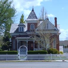
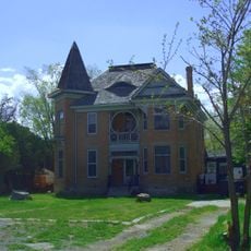
Skull Valley, Valley in Tooele County, United States.

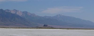
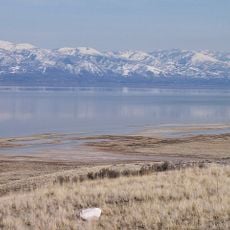
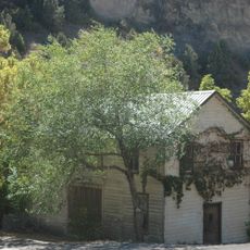
Skull Valley is a long valley that stretches between the Stansbury Mountains and Cedar Mountains in Tooele County. The landscape contains numerous springs and flood plains, particularly visible near the settlement of Iosepa.

The valley received its current name following the Donner Party's passage in 1846, changing from its earlier designation as Spring Valley. This renaming remains central to the area's identity.

The southern part of the valley is home to the Goshute Tribe, whose reservation sits at the base of the mountains. Their presence shapes how people understand and use the land today.

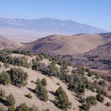
State Route 196 provides main road access through the valley and connects to nearby highways. White Rocks to the south offers several camping areas and serves as a good base for exploring the surrounding region.

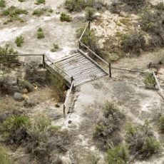
The flood plain near Iosepa spans several kilometers and displays distinctive depressions formed by seasonal water flows and mountain streams. These natural features shift the valley's character with the changing seasons and offer unusual opportunities for observation.

The community of curious travelers

AroundUs brings together thousands of curated places, local tips, and hidden gems, enriched daily by 60,000 contributors worldwide.

Start exploring
Location
Part of
Great Basin
GPS coordinates
40.53720,-112.74400
Latest update
December 10, 2025 15:59
Around this place
Bingham Canyon Mine
United States of America

Bingham Canyon Mine

50.3 km
Kennecott Smokestack
United States of America

Kennecott Smokestack

50.5 km
Farnsworth Peak
United States of America

Farnsworth Peak

47.8 km
Great Salt Lake State Park
United States of America

Great Salt Lake State Park

50.1 km
Deseret Peak
United States of America

Deseret Peak

13.2 km
United States of America

Black Rock

48.4 km
Cedar Mountain Wilderness
United States of America

Cedar Mountain Wilderness

18.4 km
Bingham Canyon Reclamation Project
United States of America

Bingham Canyon Reclamation Project

50.1 km
Deseret Peak Wilderness
United States of America

Deseret Peak Wilderness

7.9 km
Benson Grist Mill
United States of America

Benson Grist Mill

39.8 km
Lincoln Highway Bridge
United States of America

Lincoln Highway Bridge

42.3 km
Thomas N. Taylor House
United States of America

Thomas N. Taylor House

39.3 km
Stockton Jail
United States of America

Stockton Jail

33.6 km
Hilda Erickson House
United States of America

Hilda Erickson House

24.1 km
Tooele County Courthouse and City Hall
United States of America

Tooele County Courthouse and City Hall

37.8 km
Alex and Mary Alice Johnson House
United States of America

Alex and Mary Alice Johnson House

24.8 km
James and Penninah Wrathall House
United States of America

James and Penninah Wrathall House

24.3 km
Grantsville First Ward Meetinghouse
United States of America

Grantsville First Ward Meetinghouse

24 km
Grantsville School and Meetinghouse
United States of America

Grantsville School and Meetinghouse

24 km
John T. Rich House
United States of America

John T. Rich House

24.1 km
Tooele Carnegie Library
United States of America

Tooele Carnegie Library

37.8 km
Ophir Town Hall
United States of America

Ophir Town Hall

45.6 km
Johnson Hall-Deseret Mercantile Building
United States of America

Johnson Hall-Deseret Mercantile Building

24.7 km
David E. Davis House
United States of America

David E. Davis House

34.3 km
Reddick Hotel-Ophir LDS Meetinghouse
United States of America

Reddick Hotel-Ophir LDS Meetinghouse

45.4 km
Peter Clegg House
United States of America

Peter Clegg House

37.9 km
Stockton School
United States of America

Stockton School

33.9 km
Copperton Community Methodist Church
United States of America

Copperton Community Methodist Church

54.9 km
Show the full map
Reviews
Share your experience

No review yet

Discussions
Start a discussion...

No discussion yet

« Skull Valley - Valley in Tooele County, United States » is provided by Around Us (aroundus.com). Images and texts are derived from Wikimedia project under a Creative Commons license. You are allowed to copy, distribute, and modify copies of this page, under the conditions set by the license, as long as this note is clearly visible.

Discover hidden gems everywhere you go!

From secret cafés to breathtaking viewpoints, skip the crowded tourist spots and find places that match your style. Our app makes it easy with voice search, smart filtering, route optimization, and insider tips from travelers worldwide. Download now for the complete mobile experience.

Around Us App Screenshot

A unique approach to discovering new places

Le Figaro

All the places worth exploring

France Info

A tailor-made excursion in just a few clicks

20 Minutes

Around Us
Travel Guide & Maps
Download

Send to your phone

QR Code
1

Open the camera app on your mobile.

2

Point at the QR code with your camera. A notification will appear.

3

Tap the notification to open the link.