Bingham Canyon Mine

Log in to your account

AroundUs is a community-driven map of interesting places, built by curious explorers like you. It grows with every review, story, and photo you share.
Connect to save your favorite spots, contribute locations, and create personalized routes.
By continuing, you accept our Terms and Conditions and our Privacy Policy
Add to collection
Map
Suggest a change
Share

Bingham Canyon Mine, Copper mine in Salt Lake County, United States.

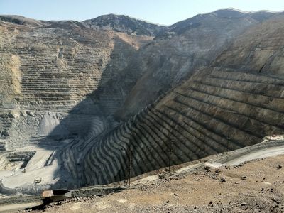
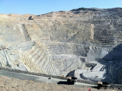
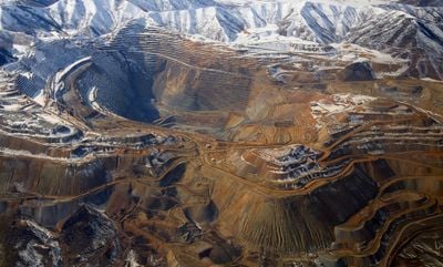
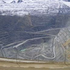
The Bingham Canyon Mine is an opencast copper mine in Salt Lake County, Utah, where concentric terraces spiral downward into the Oquirrh Mountains. Heavy machinery moves rock around the clock along roads that wind through the circular tiers, creating a bowl-shaped excavation visible from many miles away.

Prospectors searching for gold and silver began digging in the canyon in 1863, but copper soon became the main resource extracted from the rock. By the early 20th century, engineers introduced new methods for processing low-grade ore, turning the site into a model for large-scale mining worldwide.

The name Bingham comes from brothers Sanford and Thomas Bingham, who settled in the canyon in the 1840s before prospectors arrived decades later. Today visitors watch trucks smaller than toys from the rim, a perspective that shows how deeply the terraced walls descend into the earth.

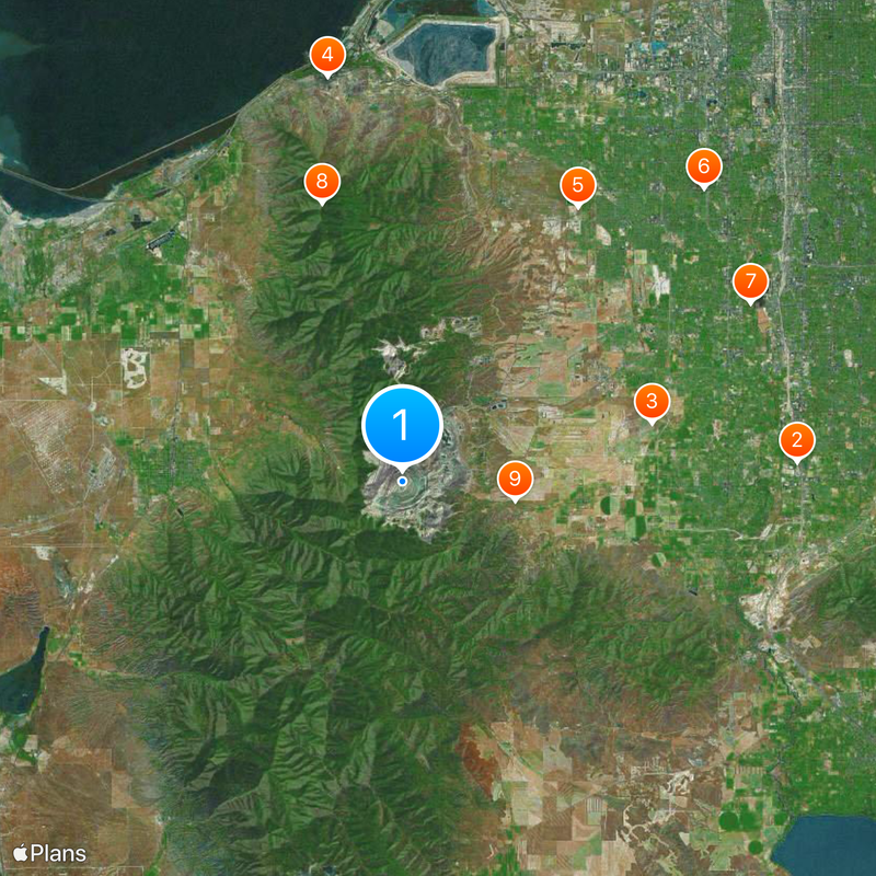
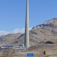
Viewing areas sit on elevated ground above the mine floor, accessible from spring through autumn when weather permits safe travel on mountain roads. Bring layers and sun protection, as wind and altitude make conditions cooler and more exposed than in nearby valleys.

Astronauts can see this excavation from space without instruments, making it one of the few human-made structures visible from orbit with the naked eye. A landslide in 2013 triggered a seismic event felt across much of Utah, moving enough rock to keep seismographs recording for several minutes.

Location: Salt Lake County

Inception: 1863

GPS coordinates: 40.52222,-112.14944

Latest update: December 12, 2025 17:27

Photos
Satellite images showing incredible locations seen from the sky

Satellite imagery has transformed how we view remote locations on Earth, offering perspectives on places that are often invisible or difficult to reach from ground level. This collection presents natural formations, artificial structures and historical sites from an aerial vantage point. From...

Around this place
The Living Planet Aquarium
United States of America

The Living Planet Aquarium

21.7 km
Oquirrh Mountain Utah Temple
United States of America

Oquirrh Mountain Utah Temple

14.1 km
Kennecott Smokestack
United States of America

Kennecott Smokestack

22.6 km
USANA Amphitheatre
United States of America

USANA Amphitheatre

17.9 km
Taylorsville Utah Temple
United States of America

Taylorsville Utah Temple

23.1 km
Gardner Village
United States of America

Gardner Village

21.4 km
Farnsworth Peak
United States of America

Farnsworth Peak

15.9 km
Butterfield Canyon
United States of America

Butterfield Canyon

6.3 km
Bingham Canyon Reclamation Project
United States of America

Bingham Canyon Reclamation Project

218 m
Benson Grist Mill
United States of America

Benson Grist Mill

18.9 km
Cowabunga Bay Water Park
United States of America

Cowabunga Bay Water Park

22 km
Conservation Garden Park
United States of America

Conservation Garden Park

20.8 km
Waterfall Splash Pad
United States of America

Waterfall Splash Pad

16.4 km
Gardner Mill
United States of America

Gardner Mill

21.5 km
Empress Theatre
United States of America

Empress Theatre

21.3 km
Stockton Jail
United States of America

Stockton Jail

19.6 km
Riverton Elementary School
United States of America

Riverton Elementary School

17.8 km
Draper-Steadman House
United States of America

Draper-Steadman House

18 km
Tooele County Courthouse and City Hall
United States of America

Tooele County Courthouse and City Hall

12.5 km
West Jordan Ward Meetinghouse
United States of America

West Jordan Ward Meetinghouse

21.3 km
Tooele Carnegie Library
United States of America

Tooele Carnegie Library

12.5 km
Ophir Town Hall
United States of America

Ophir Town Hall

19.1 km
Reddick Hotel-Ophir LDS Meetinghouse
United States of America

Reddick Hotel-Ophir LDS Meetinghouse

19.2 km
Peter Clegg House
United States of America

Peter Clegg House

12.4 km
Stockton School
United States of America

Stockton School

19.5 km
Copperton Community Methodist Church
United States of America

Copperton Community Methodist Church

6.4 km
Utah Bit and Mine
United States of America

Utah Bit and Mine

22.5 km
Utah Veterans Cemetery and Memorial Park
United States of America

Utah Veterans Cemetery and Memorial Park

20.6 km
Show the full map
Reviews

Visited this place? Tap the stars to rate it and share your experience / photos with the community! Try now! You can cancel it anytime.

« Bingham Canyon Mine - Copper mine in Salt Lake County, United States » is provided by Around Us (aroundus.com). Images and texts are derived from Wikimedia project under a Creative Commons license. You are allowed to copy, distribute, and modify copies of this page, under the conditions set by the license, as long as this note is clearly visible.

Discover hidden gems everywhere you go!

From secret cafés to breathtaking viewpoints, skip the crowded tourist spots and find places that match your style. Our app makes it easy with voice search, smart filtering, route optimization, and insider tips from travelers worldwide. Download now for the complete mobile experience.

Around Us App Screenshot

A unique approach to discovering new places

Le Figaro

All the places worth exploring

France Info

A tailor-made excursion in just a few clicks

20 Minutes