Enable Location

We need your location to show you interesting places around you

Discover nearby places

Find interesting locations and hidden gems around you

Precise directions

Get accurate directions and distances to places

Your location is never shared with other users. It's only used when you tap the location button.

Chaudière-Appalaches

Log in to your account

Start exploring — it's free

Trusted by 62,789 travelers worldwide

Continue with Google
Continue with Apple
or

We will send you a code to connect

By continuing, you accept our Terms and Conditions and our Privacy Policy

Check your inbox

We've sent a pincode in your inbox. Please enter the code below.

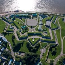
Chaudière-Appalaches, Administrative region in Quebec, Canada

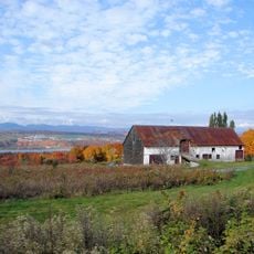
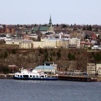
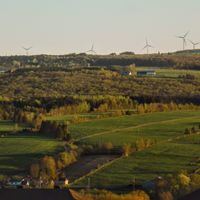
Chaudière-Appalaches is an administrative region in southeastern Quebec that stretches along the south shore of the Saint Lawrence River. The territory includes several county divisions with agricultural landscapes, river valleys, and small urban centers.

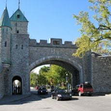
The region grew from French colonial settlements of the 17th century that spread along the Chaudière River and surrounding areas. Fur trading and later agriculture became the foundation for development across these lands over the following centuries.

The communities here maintain strong ties to farming through local markets and food producers that shape daily life. You can see this connection everywhere, from the fields to the shops selling fresh regional products.

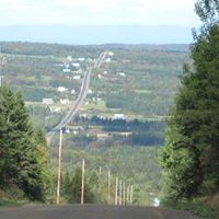
You can reach the region easily from Quebec City using the Pierre-Laporte and Quebec Bridges that cross to the south shore. Main roads connect the various communities well throughout the territory.

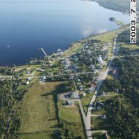
The region contains over 100 municipalities, each with its own local government and distinct character. This patchwork of communities creates a varied landscape where each place has developed its own identity.

The community of curious travelers

AroundUs brings together thousands of curated places, local tips, and hidden gems, enriched daily by 60,000 contributors worldwide.

Start exploring
Location
Shares border with
Centre-du-Québec, Bas-Saint-Laurent, Estrie, Capitale-Nationale
GPS coordinates
46.48330,-70.61670
Latest update
December 17, 2025 11:13
« Chaudière-Appalaches - Administrative region in Quebec, Canada » is provided by Around Us (aroundus.com). Images and texts are derived from Wikimedia project under a Creative Commons license. You are allowed to copy, distribute, and modify copies of this page, under the conditions set by the license, as long as this note is clearly visible.

Discover hidden gems everywhere you go!

From secret cafés to breathtaking viewpoints, skip the crowded tourist spots and find places that match your style. Our app makes it easy with voice search, smart filtering, route optimization, and insider tips from travelers worldwide. Download now for the complete mobile experience.

Around Us App Screenshot

A unique approach to discovering new places

Le Figaro

All the places worth exploring

France Info

A tailor-made excursion in just a few clicks

20 Minutes

Around Us
Travel Guide & Maps
Download

Send to your phone

QR Code
1

Open the camera app on your mobile.

2

Point at the QR code with your camera. A notification will appear.

3

Tap the notification to open the link.